Whittier Ridge Trail and Lakes Trail
Gifford Pinchot National Forest · Skamania County, Washington
24.8 km
~1 day 2 hrs
1408 m
“Embark on the Whittier Ridge Trail and Lakes Trail for a scenic, moderately challenging 25-kilometer adventure.”
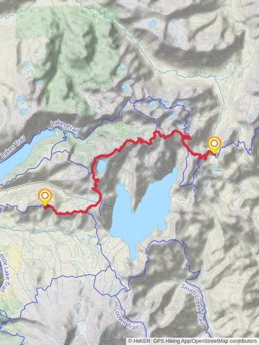
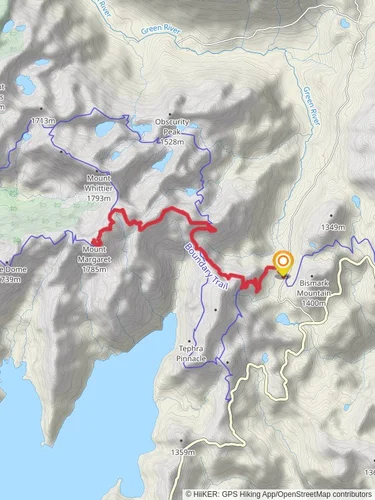
Starting your adventure near Skamania County, Washington, the Whittier Ridge Trail and Lakes Trail is a captivating loop that spans approximately 25 kilometers (15.5 miles) with an elevation gain of around 1400 meters (4600 feet). This trail is rated as medium difficulty, making it suitable for hikers with some experience and a good level of fitness.
### Getting There To reach the trailhead, you can drive to the nearest significant landmark, which is the town of Cougar, Washington. From Cougar, head east on Lewis River Road (Forest Road 90) until you reach Forest Road 25. Continue on Forest Road 25 until you reach the trailhead parking area. Public transport options are limited, so driving is the most reliable way to get there.
### Trail Overview The trail begins with a steady ascent through dense forest, offering a mix of Douglas fir, western hemlock, and cedar trees. As you climb, you'll encounter a series of switchbacks that gradually lead you to higher elevations. The first significant landmark is the junction with the Lakes Trail, approximately 5 kilometers (3.1 miles) from the trailhead. Here, you can take a short detour to visit the serene Blue Lake, a perfect spot for a quick rest and some photos.
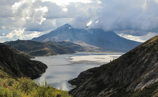
### Whittier Ridge Continuing on the main trail, you'll soon reach Whittier Ridge. This section is known for its narrow, rocky path and steep drop-offs, so proceed with caution. The ridge offers breathtaking panoramic views of Mount St. Helens, Mount Adams, and the surrounding valleys. This is a great spot to take a break and soak in the scenery. The ridge section is about 8 kilometers (5 miles) into the hike and involves a significant portion of the elevation gain.
### Flora and Fauna As you traverse the ridge, keep an eye out for the diverse flora and fauna. The area is home to black-tailed deer, black bears, and a variety of bird species, including the elusive northern spotted owl. Wildflowers such as lupine, Indian paintbrush, and beargrass add splashes of color to the landscape, especially in late spring and early summer.
### Descending to the Lakes After navigating Whittier Ridge, the trail descends towards the lakes. This section is less strenuous but still requires careful footing due to loose rocks and occasional muddy patches. You'll pass by several small alpine lakes, each offering unique views and opportunities for reflection. The largest of these, Bear Lake, is about 15 kilometers (9.3 miles) from the trailhead and provides an excellent spot for lunch or a longer rest.
### Historical Significance The region around Whittier Ridge and the lakes has a rich history. Native American tribes, including the Cowlitz and Klickitat, have long used these lands for hunting and gathering. In more recent history, the area was affected by the 1980 eruption of Mount St. Helens, which reshaped the landscape and created new ecological niches.
### Final Stretch The final stretch of the trail loops back towards the trailhead, gradually descending through lush forest and crossing several small streams. This section is relatively easy, allowing you to enjoy the tranquility of the forest and reflect on the journey. The entire loop brings you back to the starting point, completing a rewarding and scenic hike.
### Navigation For navigation, it's highly recommended to use the HiiKER app, which provides detailed maps and real-time updates to ensure you stay on the right path. The app is particularly useful for this trail, given its challenging sections and multiple junctions.
Prepare well, bring plenty of water, snacks, and appropriate gear, and you'll have an unforgettable experience on the Whittier Ridge Trail and Lakes Trail.
Reviews
User comments, reviews and discussions about the Whittier Ridge Trail and Lakes Trail, Washington.
5.0
average rating out of 5
16 rating(s)


