Download
3D Flyover
Add to list
More
4802.4 km
~183 days
81168 m
Multi-Day
“Embark on the epic Continental Divide Trail, a scenic, rugged odyssey steeped in American heritage.”
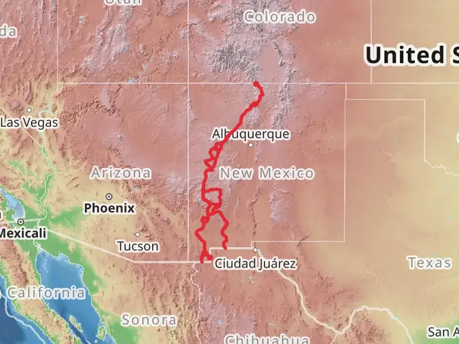
Spanning approximately 4802 kilometers (around 2985 miles) and with an elevation gain of around 81,100 meters (approximately 266,000 feet), the Continental Divide Trail (CDT) is one of the most significant long-distance hiking experiences in North America. This point-to-point trail traverses five U.S. states: New Mexico, Colorado, Wyoming, Idaho, and Montana, culminating at the Canadian border.
Getting to the Trailhead
The southern terminus of the CDT is located near Hidalgo County, New Mexico, close to the Crazy Cook Monument. To reach the starting point, hikers often drive or arrange a shuttle from Lordsburg, New Mexico, which is accessible by Greyhound bus or via a regional airport in Silver City. The nearest significant landmark to the southern terminus is the Antelope Wells Port of Entry, a border crossing point between the United States and Mexico.
New Mexico
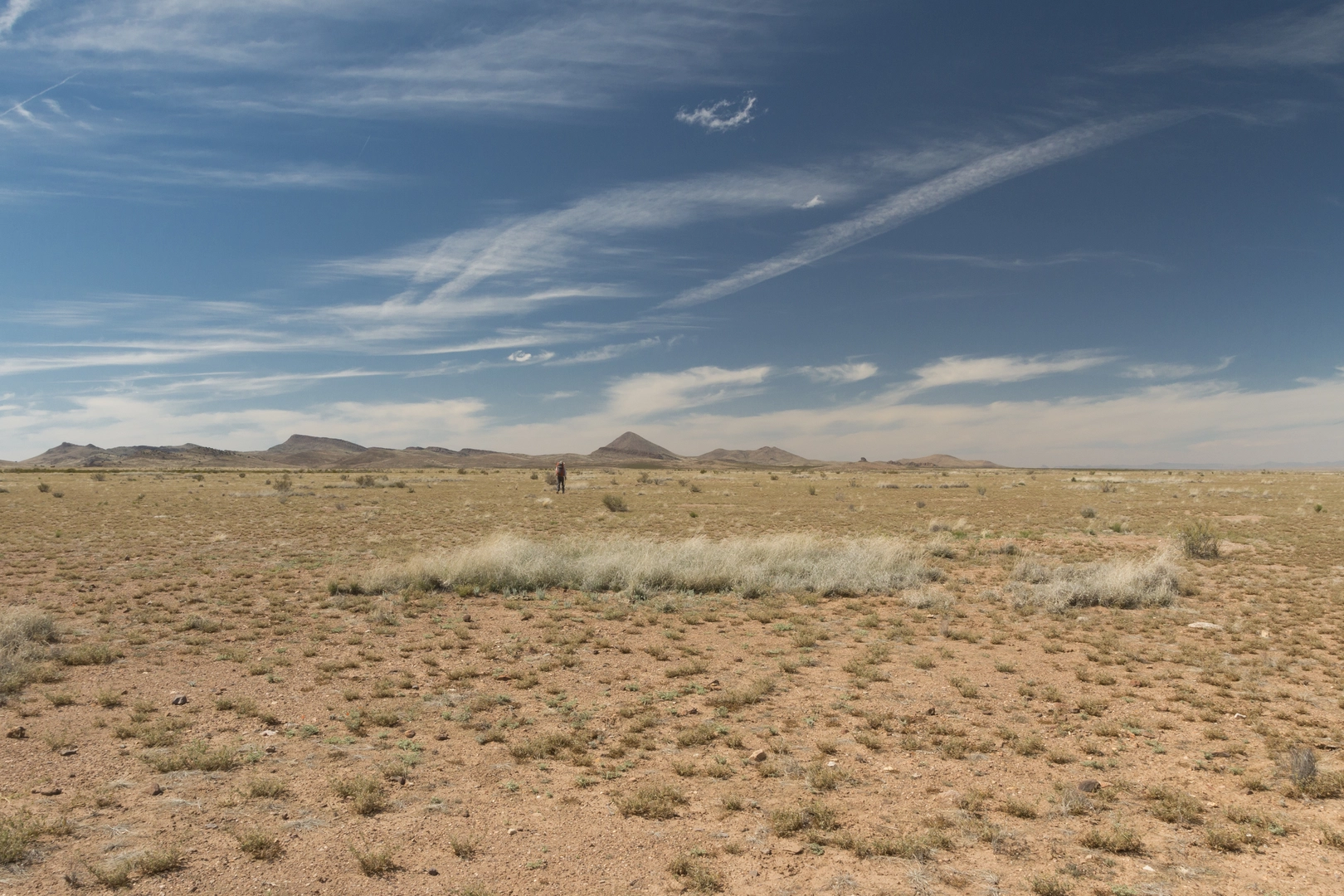
The journey begins in the Chihuahuan Desert, where hikers navigate through rugged terrain with sparse water sources. The trail meanders through the Gila National Forest, home to the Gila Cliff Dwellings National Monument, which offers a glimpse into the lives of the Mogollon people who inhabited the area over 700 years ago.
Colorado
As the trail enters Colorado, the landscape transforms dramatically. The San Juan Mountains present a challenging but rewarding section with high alpine passes and stunning vistas. The CDT reaches its highest point at Grays Peak, standing at 4,350 meters (14,278 feet). Colorado's section is also known for its wildflower displays and the historic mining towns of Leadville and Silverton.
Wyoming
Wyoming's section includes the vast, windswept expanses of the Great Divide Basin, where the trail neither drains to the Atlantic nor Pacific oceans. The trail then enters the Bridger-Teton National Forest, leading to the iconic Yellowstone National Park. Here, hikers can witness geothermal features, such as Old Faithful, and an abundance of wildlife, including bison, elk, and possibly grizzly bears.
Idaho and Montana
The CDT crosses the Idaho-Montana border several times, offering a mix of forested trails and high mountain ridges. The trail passes through the Salmon-Challis National Forest, known for its remote wilderness and the historic Lewis and Clark Expedition route. As hikers approach the Canadian border, they traverse the rugged, glacier-carved landscapes of Glacier National Park, with its pristine lakes and the chance to spot mountain goats and other alpine species.
Trail Navigation and Planning
Due to the trail's length and complexity, thorough planning is essential. Hikers should use the HiiKER app for up-to-date trail information, navigation, and to locate essential waypoints such as water sources, campsites, and resupply points. Given the trail's difficulty rating and the variety of terrain, it is recommended that hikers have significant backpacking experience and be prepared for self-sufficiency in remote and challenging conditions.
Weather and Seasonal Considerations
The CDT is typically hiked from April to October to avoid the most extreme winter conditions. However, weather in the mountains can be unpredictable, and snow can linger in the higher elevations well into the summer months. Hikers should be prepared for a wide range of temperatures and weather events, including thunderstorms and sudden snowfalls.
Wildlife and Safety
The trail traverses habitats for diverse wildlife, including black bears, grizzly bears, mountain lions, and rattlesnakes. Proper food storage and awareness of wildlife are crucial for safety. Hikers should also be prepared for the physical demands of the trail and the potential for altitude sickness in the higher elevations.
Cultural and Historical Significance
The CDT is not only a physical journey but also a passage through diverse cultural and historical landscapes. From Native American heritage sites to remnants of the Old West and the pioneering spirit of America's expansion, the trail offers a living history lesson and a deeper understanding of the varied regions it crosses.
Conclusion
The Continental Divide Trail is a monumental trek that challenges and rewards those who undertake its journey. With careful preparation, respect for the natural environment, and a sense of adventure, hikers can embark on a transformative experience that embodies the spirit of the American wilderness.

Comments and Reviews
User comments, reviews and discussions about the Continental Divide Trail, New Mexico.
4.78
average rating out of 5
9 rating(s)