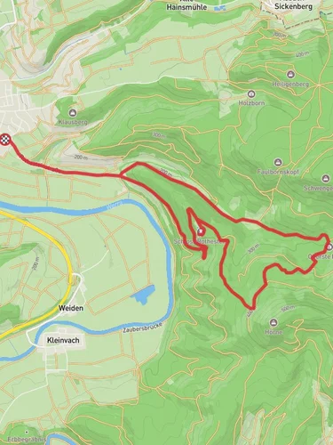
Bad Sooden Allendorf to Homburgslinde via Saelzerweg 3
9.9 km
~2 hrs 45 min
473 m
“Discover lush landscapes, historic ruins, and rich wildlife on Germany's scenic Saelzerweg 3 hiking trail.”
Starting near the picturesque town of Bad Sooden-Allendorf in the Werra-Meißner-Kreis region of Germany, this trail offers a delightful mix of natural beauty and historical intrigue. The trailhead is easily accessible by public transport, with regular trains and buses connecting Bad Sooden-Allendorf to larger cities like Kassel and Göttingen. If you're driving, there are parking facilities available in the town, making it convenient to leave your car and start your hike.
Trail Overview
The trail spans approximately 10 km (6.2 miles) and features an elevation gain of around 400 meters (1,312 feet). This point-to-point hike is rated as medium difficulty, making it suitable for moderately experienced hikers. The route follows the Saelzerweg 3, a historic salt route that has been used for centuries.
Natural Beauty and Wildlife
As you begin your hike, you'll be greeted by the lush greenery of the Werra Valley. The trail meanders through dense forests, open meadows, and along the serene Werra River. Keep an eye out for local wildlife, including deer, foxes, and a variety of bird species. The flora is equally impressive, with wildflowers dotting the landscape, especially in the spring and summer months.
Historical Significance
The Saelzerweg 3 is steeped in history. This ancient salt route was once a vital trade path, used to transport salt from the mines in Bad Sooden-Allendorf to other parts of Germany. Along the way, you'll encounter remnants of this historical trade, including old milestones and markers that date back several centuries. The trail also passes by several old farmhouses and barns, offering a glimpse into the rural life of the past.
Key Landmarks
Around the 3 km (1.9 miles) mark, you'll come across the ruins of an old watchtower, which once served as a lookout point for traders and travelers. This spot offers a fantastic panoramic view of the surrounding valley and is a great place to take a break and soak in the scenery.
At approximately 7 km (4.3 miles), you'll reach the highlight of the trail: the Homburg Castle ruins. Perched atop a hill, these ruins offer a fascinating look into medieval architecture. The castle dates back to the 12th century and was once a formidable fortress. Today, it provides a perfect spot for a picnic and some exploration.
Navigation and Safety
To ensure you stay on track, it's highly recommended to use the HiiKER app, which provides detailed maps and real-time navigation. The trail is well-marked, but having a reliable navigation tool can help you avoid any wrong turns.
Final Stretch
The final stretch of the hike takes you through a beautiful beech forest before descending towards Homburgslinde. This section is relatively easy, allowing you to enjoy the tranquil surroundings as you make your way to the endpoint.
Getting Back
Once you reach Homburgslinde, you can either arrange for a pickup or take public transport back to Bad Sooden-Allendorf. Buses run regularly, and the nearest bus stop is just a short walk from the trail's end.
This hike offers a perfect blend of natural beauty, historical landmarks, and moderate physical challenge, making it a rewarding experience for any outdoor enthusiast.
Reviews
User comments, reviews and discussions about the Bad Sooden Allendorf to Homburgslinde via Saelzerweg 3, Germany.
0.0
average rating out of 5
0 rating(s)


