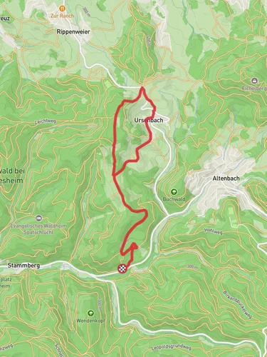
10.8 km
~2 hrs 50 min
408 m
“Embark on the scenic Rundwanderweg Wilhelmsfeld - Dollenschlag Weg loop trail for a moderately challenging 11 km adventure.”
Starting near the picturesque town of Wilhelmsfeld in the Rhein-Neckar-Kreis region of Germany, this 11 km (approximately 6.8 miles) loop trail offers a moderate challenge with an elevation gain of around 400 meters (about 1,312 feet). The trailhead is conveniently accessible by both car and public transport. If you're driving, you can park near the town center of Wilhelmsfeld. For those using public transport, take a bus or train to Heidelberg and then a local bus to Wilhelmsfeld.
### Trail Overview
The Rundwanderweg Wilhelmsfeld - Dollenschlag Weg is a well-marked loop trail that takes you through a variety of landscapes, including dense forests, open meadows, and charming rural areas. The trail is suitable for hikers with a moderate level of fitness and offers a mix of gentle slopes and steeper sections.
### Key Landmarks and Points of Interest
Wilhelmsfeld Town Center: Starting from the town center, you'll immediately notice the quaint charm of Wilhelmsfeld, with its traditional German architecture and friendly locals. This is a great place to grab any last-minute supplies or enjoy a coffee before you set off.
Dollenschlag Meadow: About 3 km (1.9 miles) into the hike, you'll reach the Dollenschlag Meadow. This open area offers stunning views of the surrounding hills and is a perfect spot for a short break. The meadow is also a great place to observe local wildlife, including deer and various bird species.
Historical Significance: The region around Wilhelmsfeld has a rich history dating back to the Roman era. As you hike, you'll come across several informational plaques detailing the historical significance of the area, including ancient trade routes and historical settlements.
### Flora and Fauna
The trail takes you through a diverse range of ecosystems. In the forested sections, you'll find a mix of deciduous and coniferous trees, including oak, beech, and pine. The underbrush is home to a variety of smaller plants and fungi, making it a great spot for nature enthusiasts. Keep an eye out for local wildlife such as foxes, badgers, and a variety of bird species.
### Navigation and Safety
The trail is well-marked with signs and markers, but it's always a good idea to have a reliable navigation tool. The HiiKER app is highly recommended for this trail, as it provides detailed maps and real-time updates. Make sure to wear sturdy hiking boots, as some sections can be rocky and uneven.
### Getting There
By Car: If you're driving, set your GPS to Wilhelmsfeld town center. There are several parking options available, and the trailhead is just a short walk from the main parking areas.
By Public Transport: From Heidelberg, take a local bus to Wilhelmsfeld. The bus ride offers scenic views and takes about 30 minutes. Once you arrive in Wilhelmsfeld, the trailhead is easily accessible from the bus stop.
### Final Tips
- Weather: Check the weather forecast before you go. The trail can be slippery after rain, so appropriate footwear is essential. - Supplies: Bring enough water and snacks, as there are limited facilities along the trail. - Respect Nature: Follow Leave No Trace principles to keep the trail beautiful for future hikers.
Enjoy your hike on the Rundwanderweg Wilhelmsfeld - Dollenschlag Weg, and take in the natural beauty and historical richness of this unique region.
Reviews
User comments, reviews and discussions about the Rundwanderweg Wilhelmsfeld - Dollenschlag Weg, Germany.
5.0
average rating out of 5
3 rating(s)


