12.4 km
~2 hrs 50 min
224 m
“Explore a 12 km scenic loop near Oberbergischer Kreis, brimming with nature, wildlife, and historical landmarks.”
Starting near Oberbergischer Kreis, Germany, this 12 km (7.5 miles) loop trail offers a delightful mix of natural beauty and historical significance. With an elevation gain of around 200 meters (656 feet), it is rated as a medium difficulty hike, making it suitable for moderately experienced hikers.
### Getting There
To reach the trailhead, you can drive or use public transport. If driving, set your GPS to the nearest known address: Oberbergischer Kreis, Germany. For those using public transport, take a train to Gummersbach station and then a local bus to the nearest stop at Marienheide. From there, it's a short walk to the trailhead.
### Trail Overview
The trail begins near the picturesque village of Oberbergischer Kreis, winding through dense forests and open meadows. The first section of the trail, Heimatweg, is well-marked and takes you through a serene forested area. This part of the trail is relatively flat, making it a good warm-up for the more challenging sections ahead.
### Significant Landmarks
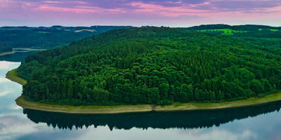
Around the 3 km (1.9 miles) mark, you'll encounter the first significant landmark: the Neyetalsperre dam. This dam, constructed in the early 20th century, is a marvel of engineering and offers stunning views of the reservoir. Take a moment to appreciate the historical significance of this structure, which has played a crucial role in water management for the region.
### Wildlife and Nature
As you continue along the trail, keep an eye out for local wildlife. The area is home to a variety of bird species, including woodpeckers and owls. You might also spot deer and foxes if you're lucky. The trail meanders through mixed forests of beech and oak, providing ample shade and a rich tapestry of flora.
### Elevation and Terrain
The trail starts to gain elevation after the Neyetalsperre dam. Over the next 4 km (2.5 miles), you'll ascend approximately 150 meters (492 feet). This section can be a bit strenuous, with some steep inclines and rocky terrain. Good hiking boots are recommended for this part of the trail.
### Navigation
For navigation, it's advisable to use the HiiKER app, which provides detailed maps and real-time updates. The trail is well-marked, but having a reliable navigation tool can help you stay on track, especially in the more remote sections.
### Final Stretch
The final 5 km (3.1 miles) of the trail take you back down towards the starting point. This section is mostly downhill, offering a gentle descent through more open landscapes. You'll pass through a few small villages, where you can stop for a rest or a snack.
### Historical Significance
The region around Oberbergischer Kreis has a rich history, dating back to medieval times. The trail itself passes by several old farmhouses and mills, some of which date back to the 17th century. These historical landmarks offer a glimpse into the rural life of the past and add an extra layer of interest to your hike.
### Practical Tips
- Water and Snacks: There are no facilities along the trail, so bring enough water and snacks. - Weather: The weather can be unpredictable, so check the forecast and dress in layers. - Safety: Always let someone know your hiking plans and estimated return time.
This 12 km loop trail offers a perfect blend of natural beauty, wildlife, and historical landmarks, making it a rewarding experience for any hiker.
Reviews
User comments, reviews and discussions about the Neye via Heimatweg and Neyetalsperre, Germany.
0.0
average rating out of 5
0 rating(s)


