Wipperfürth to Roderwiese via Rund um Thier
11.9 km
~2 hrs 47 min
241 m
“Explore lush forests, historic landmarks, and rolling hills on the Wipperfürth to Roderwiese medium-difficulty trail.”
Starting near Oberbergischer Kreis, Germany, the Wipperfürth to Roderwiese via Rund um Thier trail spans approximately 12 kilometers (7.5 miles) with an elevation gain of around 200 meters (656 feet). This point-to-point trail is rated as medium difficulty, making it suitable for moderately experienced hikers.
### Getting There To reach the trailhead, you can either drive or use public transport. If driving, set your GPS to Wipperfürth, a charming town in the Oberbergischer Kreis region. There are several parking options available in the town center. For those using public transport, take a train to Wipperfürth station. From there, local buses can take you closer to the trailhead, or you can opt for a short taxi ride.
### Trail Overview The trail begins in the picturesque town of Wipperfürth, known for its medieval architecture and historical significance. As you start your hike, you'll pass through cobblestone streets and traditional German houses, offering a glimpse into the region's rich history.
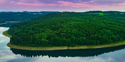
### Nature and Wildlife As you leave the town, the trail meanders through lush forests and open meadows. The area is home to a variety of wildlife, including deer, foxes, and numerous bird species. Keep an eye out for the European robin and the great spotted woodpecker, both commonly seen along this route.
### Significant Landmarks Around the 4-kilometer (2.5-mile) mark, you'll come across the historic Thier Chapel, a small but significant religious site dating back to the 17th century. This is a great spot to take a break and soak in the serene surroundings.
### Elevation and Terrain The trail features a mix of flat sections and gentle inclines, with the most significant elevation gain occurring between the 6th and 8th kilometers (3.7 to 5 miles). The terrain is varied, ranging from well-maintained paths to more rugged, forested sections. Good hiking boots are recommended to navigate the occasional rocky patches.
### Navigation For navigation, it's advisable to use the HiiKER app, which provides detailed maps and real-time updates. The trail is well-marked, but having a reliable navigation tool will ensure you stay on track.
### Final Stretch As you approach Roderwiese, the landscape opens up to rolling hills and expansive views of the surrounding countryside. The final stretch is relatively flat, allowing for a leisurely end to your hike. Roderwiese itself is a quaint village, perfect for a post-hike meal or a relaxing stroll.
### Historical Significance The region around Oberbergischer Kreis has a rich history, with settlements dating back to the Roman era. Wipperfürth, in particular, is one of the oldest towns in the area, with records dating back to the 9th century. The trail offers a unique blend of natural beauty and historical landmarks, making it a rewarding experience for both nature lovers and history enthusiasts.
Whether you're looking to explore the natural beauty of the German countryside or delve into the region's historical roots, the Wipperfürth to Roderwiese via Rund um Thier trail offers a fulfilling and memorable hiking experience.
Reviews
User comments, reviews and discussions about the Wipperfürth to Roderwiese via Rund um Thier, Germany.
5.0
average rating out of 5
1 rating(s)


