12.3 km
~2 hrs 53 min
258 m
“Explore a scenic 12 km loop with reservoirs, diverse landscapes, and historical landmarks near Oberbergischer Kreis.”
Starting near Oberbergischer Kreis, Germany, the Bevertalsperre via Rundwanderweh Neyetalsperre is a picturesque loop trail that spans approximately 12 kilometers (7.5 miles) with an elevation gain of around 200 meters (656 feet). This medium-difficulty trail offers a blend of natural beauty, historical significance, and a variety of landscapes that make it a rewarding experience for hikers.
### Getting There To reach the trailhead, you can drive or use public transport. If driving, set your GPS to the nearest known address: Bevertalsperre, 42499 Hückeswagen, Germany. For those using public transport, take a train to Wipperfürth and then a local bus to Hückeswagen. From there, it's a short walk to the trailhead.
### Trail Overview The trail begins near the Bevertalsperre, a large reservoir that serves as a focal point for the hike. As you start, you'll be greeted by serene water views and lush greenery. The path is well-marked and maintained, making navigation straightforward. However, it's always a good idea to have the HiiKER app handy for real-time navigation and updates.
### Key Landmarks and Sections
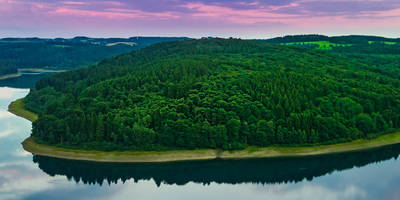
#### Bevertalsperre The Bevertalsperre reservoir is not just a beautiful sight but also a significant historical landmark. Constructed in the early 20th century, it was initially built for flood control and water supply. Today, it serves as a recreational area for boating, fishing, and swimming. The trail offers several vantage points where you can take in panoramic views of the reservoir.
#### Neyetalsperre About halfway through the loop, you'll encounter the Neyetalsperre, another reservoir that adds to the trail's scenic diversity. This area is less frequented, offering a more tranquil experience. The Neyetalsperre was built around the same time as Bevertalsperre and serves similar purposes. The trail around this reservoir is slightly more rugged, so be prepared for a bit of a challenge.
### Flora and Fauna The trail is rich in biodiversity. You'll walk through dense forests of beech and oak, interspersed with open meadows. Keep an eye out for local wildlife such as deer, foxes, and a variety of bird species. The reservoirs attract waterfowl, so birdwatchers should bring binoculars.
### Elevation and Terrain The elevation gain of 200 meters (656 feet) is spread out over the 12 kilometers (7.5 miles), making the climbs manageable for most hikers. The terrain varies from paved paths near the reservoirs to dirt trails through the forest. Some sections can be muddy, especially after rain, so waterproof hiking boots are recommended.
### Historical Significance The region around Oberbergischer Kreis has a rich history dating back to medieval times. The reservoirs themselves are engineering marvels from the early 20th century, reflecting the industrial advancements of that era. Along the trail, you'll find informational plaques that provide insights into the area's history and the construction of the reservoirs.
### Practical Tips - Water and Snacks: There are no facilities along the trail, so bring enough water and snacks. - Weather: The weather can be unpredictable, so check the forecast and dress in layers. - Safety: While the trail is generally safe, always let someone know your hiking plans and expected return time.
This trail offers a perfect blend of natural beauty, moderate physical challenge, and historical intrigue, making it a must-visit for any hiking enthusiast.
Reviews
User comments, reviews and discussions about the Bevertalsperre via Rundwanderweh Neyetalsperre, Germany.
0.0
average rating out of 5
0 rating(s)


