6.5 km
~1 hrs 35 min
184 m
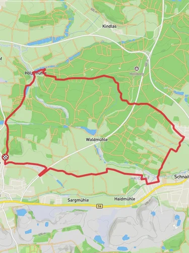
“Explore Hölzlmühl Weg: a 6 km loop blending lush landscapes, historic mills, and moderate hiking challenges.”
Starting near the picturesque town of Amberg-Sulzbach in Germany, this 6 km (approximately 3.7 miles) loop trail offers a delightful mix of natural beauty and historical intrigue. With an elevation gain of around 100 meters (328 feet), the Hölzlmühl Weg is rated as medium difficulty, making it accessible for most hikers with a moderate level of fitness.
### Getting There To reach the trailhead, you can either drive or use public transport. If driving, set your GPS to Amberg-Sulzbach, and you will find ample parking near the starting point. For those using public transport, take a train to Amberg station, which is well-connected to major cities like Nuremberg and Regensburg. From Amberg station, local buses or a short taxi ride will get you to the trailhead.
### Trail Highlights As you embark on the Hölzlmühl Weg, you'll be greeted by a lush, forested landscape that is characteristic of the Upper Palatinate region. The trail meanders through dense woods, open meadows, and along serene streams, offering a variety of scenery to enjoy.
#### Historical Significance One of the most intriguing aspects of this trail is its historical significance. The region around Amberg-Sulzbach has a rich history dating back to the medieval period. As you hike, you'll come across remnants of old mills and historical buildings that tell the story of the area's industrial past. The Hölzlmühl itself, an old mill, is a notable landmark that gives the trail its name. This mill was once a vital part of the local economy, grinding grain for the surrounding communities.
### Nature and Wildlife The trail is a haven for nature enthusiasts. Keep an eye out for a variety of bird species, including woodpeckers and songbirds, which are abundant in the area. The forested sections are home to deer and other small mammals, so tread quietly if you wish to catch a glimpse of these elusive creatures. In the spring and summer months, the meadows burst into a riot of colors with wildflowers, making it a perfect spot for photography.
### Navigation and Safety Navigating the Hölzlmühl Weg is straightforward, but it's always wise to have a reliable navigation tool. The HiiKER app is highly recommended for this purpose, as it provides detailed maps and real-time updates. The trail is well-marked with signs, but having HiiKER ensures you stay on track, especially at junctions where multiple paths converge.
### Points of Interest - Hölzlmühl Mill: Approximately 2 km (1.2 miles) into the hike, you'll reach the old mill. Take a moment to explore the area and imagine the bustling activity that once took place here. - Scenic Overlook: Around the 4 km (2.5 miles) mark, there's a scenic overlook that offers panoramic views of the surrounding countryside. It's a great spot to take a break and enjoy a snack. - Stream Crossings: The trail features several charming stream crossings. These are generally easy to navigate but can be slippery after rain, so watch your footing.
### Final Stretch As you loop back towards the starting point, the trail descends gently, offering a relaxing end to your hike. The final kilometer takes you through a beautiful stretch of mixed forest, where the dappled sunlight creates a serene atmosphere.
Whether you're a history buff, a nature lover, or simply looking for a pleasant day hike, the Hölzlmühl Weg offers something for everyone.
Reviews
User comments, reviews and discussions about the Hölzlmühl Weg, Germany.
4.0
average rating out of 5
4 rating(s)


