10.8 km
~2 hrs 18 min
90 m
“Explore an 11 km loop of lush forests, historical mining sites, and serene ponds around Amberg-Sulzbach.”
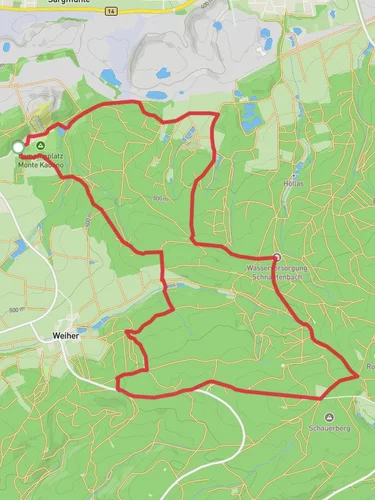
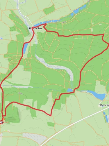
Starting near Amberg-Sulzbach in Germany, this 11 km (approximately 6.8 miles) loop trail offers a delightful mix of natural beauty and historical intrigue. With no significant elevation gain, it is accessible to a wide range of hikers, though it is rated as medium difficulty due to its length and varied terrain.
### Getting There To reach the trailhead, you can drive or use public transport. If driving, set your GPS to the vicinity of Amberg-Sulzbach. For those using public transport, the nearest significant landmark is the Amberg train station. From there, local buses or a short taxi ride can take you to the trailhead.
### Trail Navigation For navigation, the HiiKER app is highly recommended. It provides detailed maps and real-time updates to ensure you stay on track.
### Trail Highlights The trail meanders through a picturesque landscape characterized by lush forests, serene ponds, and open meadows. Early on, you will encounter the Rohrweiher, a tranquil pond that is perfect for a short break and some bird-watching. This area is known for its diverse avian population, so keep your binoculars handy.
### Historical Significance As you continue, you will pass through areas steeped in history. The region around Amberg-Sulzbach has a rich mining heritage, and remnants of old mining operations can still be seen along the trail. Informational plaques provide insights into the historical significance of these sites, making it a fascinating journey through time.
### Flora and Fauna The trail is a haven for nature enthusiasts. Depending on the season, you might see a variety of wildflowers, including orchids and lilies. The forested sections are home to deer, foxes, and a variety of bird species. In the spring and summer, the meadows burst into a riot of colors, making it a photographer's dream.
### Practical Tips - Footwear: Given the varied terrain, sturdy hiking boots are recommended. - Weather: Check the weather forecast before heading out, as the trail can become muddy after rain. - Supplies: Carry enough water and snacks, as there are no facilities along the trail. - Safety: While the trail is well-marked, always have a map on HiiKER for added security.
### Points of Interest - Rohrweiher Pond: Approximately 2 km (1.2 miles) into the hike, this is a great spot for a rest. - Historical Mining Sites: Around the 5 km (3.1 miles) mark, you will encounter several old mining sites with informational plaques. - Scenic Meadows: At about 8 km (5 miles), the trail opens up into expansive meadows, offering stunning views and excellent photo opportunities.
This trail offers a balanced mix of natural beauty and historical context, making it a rewarding experience for both novice and seasoned hikers.
Reviews
User comments, reviews and discussions about the Rohrweiherweg, Germany.
0.0
average rating out of 5
0 rating(s)


