Download
3D Flyover
Add to list
More
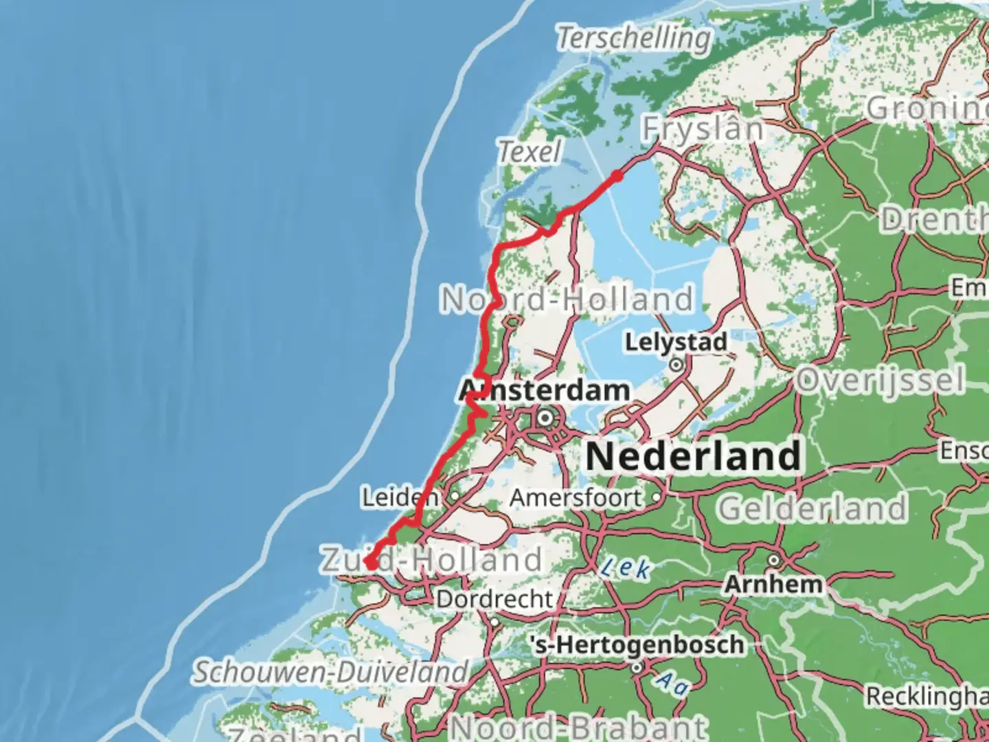
247.8 km
~9 days
531 m
Multi-Day
“Discover the picturesque Dutch coastline on the Nederlands Kustpad 2, a serene hike steeped in nature and history.”
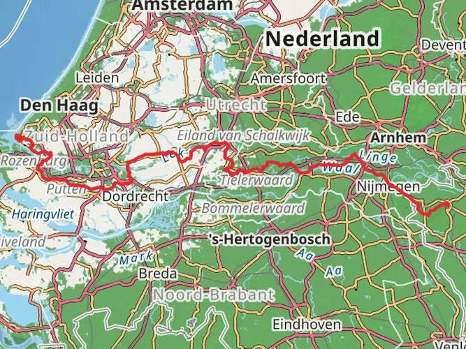
The Nederlands Kustpad 2 is a captivating long-distance trail that stretches approximately 248 kilometers (about 154 miles) along the scenic coastline of the Netherlands. With an elevation gain of around 500 meters (approximately 1640 feet), it offers hikers a relatively flat terrain, making it accessible to those with a moderate level of fitness.
Getting to the Trailhead
The trailhead is conveniently located near the vibrant city of Rotterdam, a hub of culture and architecture. For those opting for public transport, Rotterdam is well-served by trains and buses from various parts of the country. Upon arrival in Rotterdam, local buses or a short taxi ride can take you to the starting point of the trail. If driving, there are parking facilities near the trailhead where you can leave your car.
Navigating the Trail
As you embark on your journey, the HiiKER app will be an invaluable tool for navigation, providing detailed maps and waypoints to ensure you stay on the right path. The trail is well-marked, with signage guiding you along the coastal route.
Landmarks and Scenery
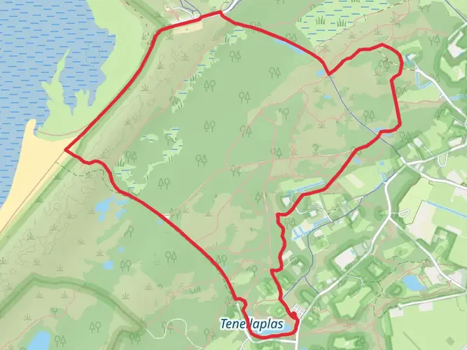
The trail meanders through a diverse array of landscapes, from sandy beaches and dune systems to quaint coastal towns and lush polder landscapes. You'll encounter the iconic Dutch windmills, historical fishing villages, and the occasional tulip field, particularly enchanting in the spring.
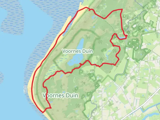
One of the early highlights is the Westduinpark, a dynamic dune landscape near The Hague. As you continue, you'll pass through the seaside resort of Scheveningen, a perfect spot to enjoy fresh seafood and watch the bustling harbor activity.
Wildlife and Nature
Birdwatchers will delight in the variety of species that can be observed along the route, especially in the dune areas which serve as important breeding grounds. The trail also crosses several nature reserves, such as the Zwanenwater, a haven for migratory birds and home to two large dune lakes.
Historical Significance
The trail offers a glimpse into the Netherlands' maritime history, with landmarks such as the Bunker Museum in IJmuiden, which showcases remnants of the Atlantic Wall from World War II. The path also takes you through historic towns like Haarlem and Alkmaar, each with their own rich heritage and well-preserved medieval architecture.
Preparation and Planning
Given the trail's length, it's advisable to plan for multiple days of hiking, with accommodations ranging from campgrounds to comfortable guesthouses. The flat terrain may not be strenuous, but the coastal winds can be challenging, so proper gear is essential. Layered clothing, a windbreaker, and sun protection are recommended, as well as sturdy walking shoes.
Conclusion
The Nederlands Kustpad 2 is a journey through the heart of Dutch coastal life, offering a unique blend of natural beauty, wildlife, and historical intrigue. Whether you're a seasoned hiker or looking for a leisurely long-distance walk, this trail promises an unforgettable experience along the shores of the Netherlands.

Frequently asked questions
Where does the Nederlands Kustpad 2 - Hoek van Holland Haven to Breezanddijk start?
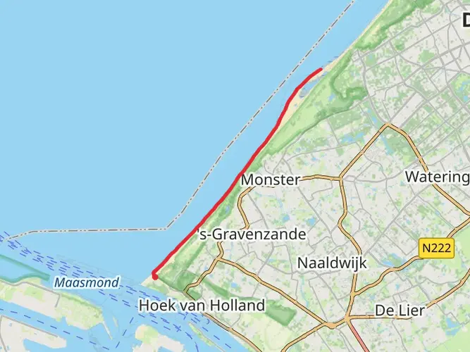
The route starts at Hoek van Holland Haven, on the Rotterdam side of the Dutch coast. The first official day stage of Nederlands Kustpad 2 begins in Hoek van Holland and runs 19.3 km to Ockenburgh, making Hoek van Holland Haven the practical starting point for this section.
How long is the Nederlands Kustpad 2 - Hoek van Holland Haven to Breezanddijk hike?
Nederlands Kustpad 2 - Hoek van Holland Haven to Breezanddijk is 247.81 km long, or about 154 miles. It is a multi-day coastal route, so most hikers break it into a series of day stages rather than attempting it in one push.
How hard is the Nederlands Kustpad 2 - Hoek van Holland Haven to Breezanddijk?
This route is rated easy overall, with 531 m of total elevation gain spread across nearly 248 km. That low climbing total means the challenge is usually the distance and number of walking days, not steep ascents or mountain terrain.
How many stages does the Nederlands Kustpad 2 - Hoek van Holland Haven to Breezanddijk have?
The official Nederlands Kustpad Deel 2 is commonly described as 16 day walks from Hoek van Holland toward Den Helder, while the broader line from Hoek van Holland to Den Oever is listed at 233 km. This HiiKER route to Breezanddijk is longer at 247.81 km, so stage counts can vary depending on the exact endpoint and how each itinerary is split.
Is there a Nederlands Kustpad route in Hoek van Holland on the Nederlands Kustpad 2 - Hoek van Holland Haven to Breezanddijk?
Yes. Hoek van Holland is a recognized start area for Nederlands Kustpad Deel 2, and Wandelnet lists an opening stage from Hoek van Holland to Ockenburgh. There is also a shorter signed walk around Hoek van Holland Haven that connects with the Nederlands Kustpad, confirming the trail is established there.
What kind of scenery is on the Nederlands Kustpad 2 - Hoek van Holland Haven to Breezanddijk?
The route follows the Dutch coast through a mix of dunes, beaches, boulevards, polder country, and coastal towns. Official descriptions highlight places such as Hoek van Holland, Den Haag, Katwijk, Egmond, Haarlem, Den Oever, and the Afsluitdijk area, with the sea usually staying within easy reach.
Comments and Reviews
User comments, reviews and discussions about the Nederlands Kustpad 2 - Hoek van Holland Haven to Breezanddijk, Netherlands.
4.2
average rating out of 5
5 rating(s)