Download
3D Flyover
Add to list
More
159.8 km
~6 days
323 m
Multi-Day
“Embark on the Friese Woudenpad, a scenic trek through Friesland's rich history and vibrant landscapes.”
Spanning approximately 160 kilometers (about 100 miles) with an elevation gain of around 300 meters (roughly 980 feet), the Friese Woudenpad is a captivating point-to-point trail that weaves through the diverse landscapes of the Friesland province in the Netherlands. This medium-difficulty trek is a journey through history, nature, and the unique cultural heritage of the region.
Getting to the Trailhead
The trailhead, located near Het Hogeland, is accessible by both public transport and car. For those opting for public transportation, buses frequently run from the nearest major cities and towns to Het Hogeland. If driving, there are parking options available near the starting point of the trail. It's advisable to use the HiiKER app to navigate to the exact starting location and to plan your journey accordingly.
Navigating the Friese Woudenpad
The Friese Woudenpad offers a well-marked route that takes hikers through a variety of terrains including woodlands, heathlands, and picturesque Dutch farmlands. The trail is divided into several stages, allowing for manageable day hikes or a continuous multi-day adventure. Hikers can rely on the HiiKER app for detailed maps and GPS navigation to ensure they stay on the correct path.
Landmarks and Natural Beauty
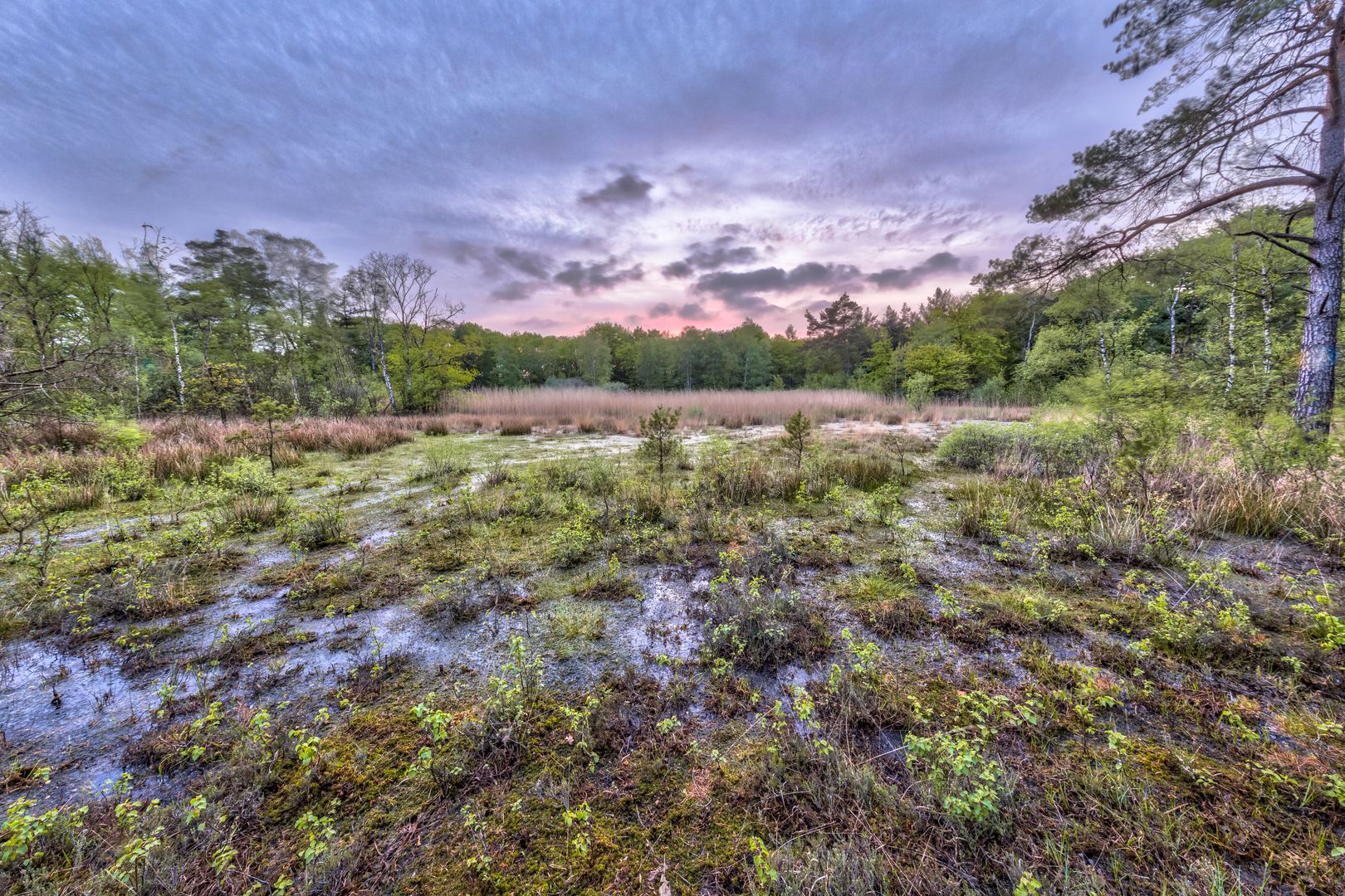
As you embark on the Friese Woudenpad, expect to encounter a tapestry of landscapes that include the serene Frisian forests, known locally as 'wouden', which are interspersed with small streams and meadows. The trail also passes through charming villages where traditional Dutch architecture is on full display.
One of the significant landmarks along the route is the historic Slachtedijk, an ancient dike that dates back to medieval times. This dike is not only a testament to the region's history of land reclamation and water management but also offers panoramic views of the surrounding countryside.
Wildlife and Flora
The diverse habitats along the Friese Woudenpad support a rich array of wildlife. Birdwatchers will be delighted by the opportunity to spot species such as the Eurasian blackcap and the common redstart. The trail's varied ecosystems also provide a home for butterflies, dragonflies, and a multitude of plant species, including the rare sundew, which can be found in the boggy areas.
Historical Significance
The Friesland region is steeped in history, and the Friese Woudenpad allows hikers to delve into this past. The area was once the domain of powerful Frisian kings, and throughout the hike, one can find remnants of ancient settlements, burial mounds, and historical battlefields. The trail also offers insights into the traditional Frisian way of life, which has been preserved over the centuries.
Preparation and Planning
Before setting out on the Friese Woudenpad, hikers should prepare for variable weather conditions and pack accordingly. The trail can be hiked year-round, but the best time to visit is from spring to autumn when the weather is milder and the days are longer. Ensure you have adequate water, food supplies, and a first-aid kit. It's also wise to carry a multi-tool and a portable charger for your electronic devices.
For accommodation, there are various options along the trail, including campsites, B&Bs, and small hotels. Planning your stops in advance is recommended, especially during the peak hiking season.
Conclusion
The Friese Woudenpad is a journey through the heart of Friesland, offering a blend of natural beauty, wildlife, and a deep sense of history. With careful planning and a spirit of adventure, hikers will find this trail to be a rewarding Dutch experience.

Frequently asked questions
How long is the Friese Woudenpad and how many days does the full hike take?
The Friese Woudenpad is about 159.83 km long, so it is usually treated as a multi-day walk rather than a single outing. The official route is commonly divided into 11 day stages, which puts most days in the roughly 11 to 17 km range depending on the section and any chosen variants.
How many stages does the Friese Woudenpad have?
The main Friese Woudenpad route is divided into 11 day stages. There are also extra variants on the wider route network, so the exact total distance can increase beyond the main line, but the core long-distance walk is generally planned around those 11 stages.
Where does the Friese Woudenpad start and finish?
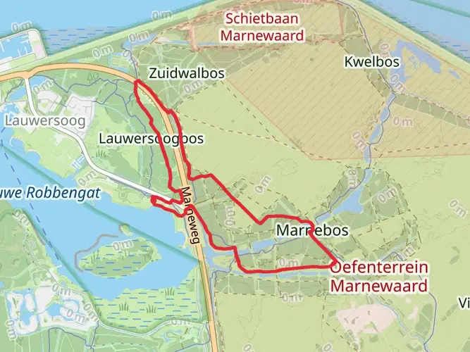
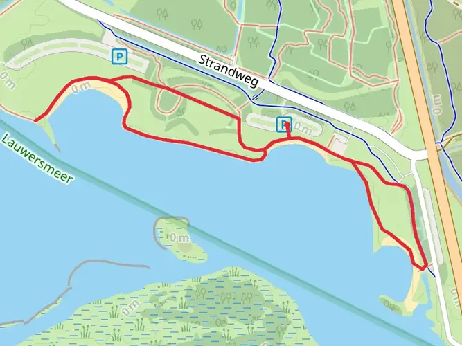
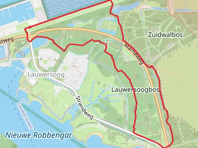
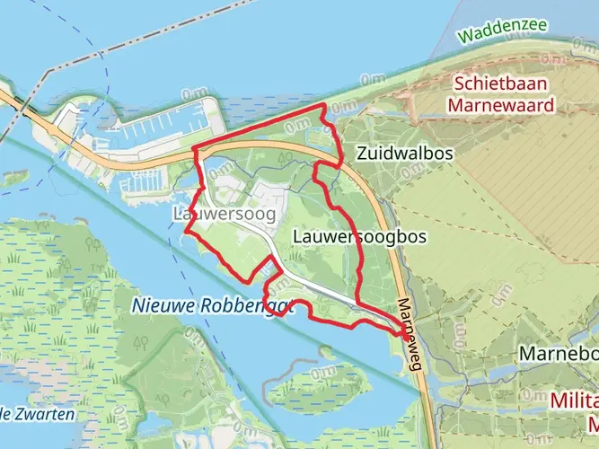
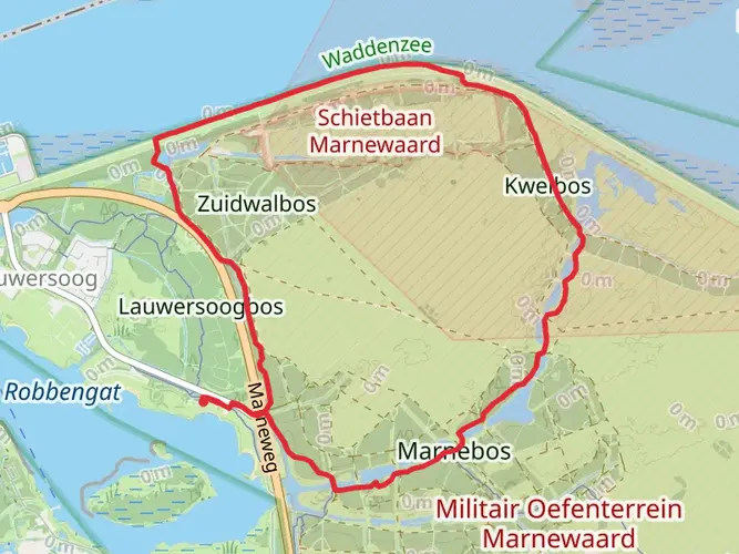
The Friese Woudenpad runs between Lauwersoog on the Dutch coast and Steenwijk farther south. Walking north to south links open coastal country, Dokkum, the Friese Wouden, the Drents-Friese Wold area, and the approach to the Weerribben before reaching Steenwijk.
Is the Friese Woudenpad difficult?
The Friese Woudenpad is generally considered an easy long-distance trail. Over nearly 160 km it gains only about 323 meters of elevation, so the challenge comes more from the length and number of walking days than from steep climbing.
What kind of scenery does the Friese Woudenpad pass through?
The Friese Woudenpad crosses a wide mix of northern Dutch landscapes, including open sea-clay country near Lauwersoog, the historic town of Dokkum, the hedged and narrow-field landscapes of the Dokkumer Wâlden, and the sandy ridges and stream valleys of the Friese Wouden. Farther south it connects areas around Lauwersmeer, Drents-Friese Wold, and the Weerribben.
What is Friese Woudenpad stage 1 like?
Stage 1 of the Friese Woudenpad runs from Lauwersoog to Iezumasyl and is about 14.1 km long. It is known for broad, open views, the R.J. Cleveringsluizen, the Bantswei, and the Bantpolder, where winter birdlife can be a highlight.
What is Friese Woudenpad stage 7 known for?
Stage 7 of the Friese Woudenpad is one of the more scenic inland sections, with estate landscapes, heath, and fens in the Friesland interior. Around this part of the route, the Weinterper Schar area and nearby heathland sections are often singled out as some of the most attractive walking on the trail.
Does the Friese Woudenpad have a guidebook?
Yes. The Friese Woudenpad has a printed walking guide, and the known edition has 140 pages. Even so, route updates have been made in recent years, so current stage-by-stage route changes matter because some sections were improved and adjusted after the guide was published.
Comments and Reviews
User comments, reviews and discussions about the Friese Woudenpad, Netherlands.
4.71
average rating out of 5
7 rating(s)