Download
3D Flyover
Add to list
More
6.0 km
~1 hrs 11 min
0 m
Loop
“Under vast Dutch skies, this tranquil loop weaves through wild meadows, marshes, and a tapestry of birdlife.”
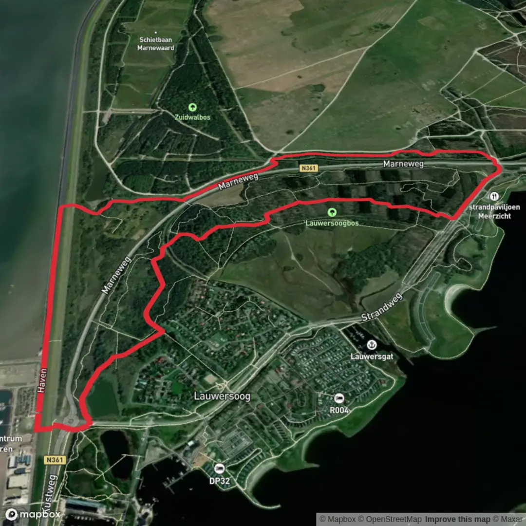
Starting from the edge of Lauwersoog, a small harbor village in the northern Netherlands, this gentle 6 km (about 3.7 miles) loop offers a flat, easy-going route with virtually no elevation gain, making it accessible for hikers of all abilities. The trailhead is conveniently located near the Lauwersoog Haven, a recognizable spot adjacent to the ferry terminal and the bustling marina, which serves as a gateway to the Wadden Sea and Schiermonnikoog Island.
Getting There
Lauwersoog is well-connected by public transport. Buses run regularly from Groningen and Leeuwarden, stopping at Lauwersoog Haven, just steps from the trail’s starting point. For those arriving by car, ample parking is available at the marina, with clear signage directing visitors to the walking paths and nature reserves.
Trail Experience and Navigation
The loop follows the Marne Weg, a quiet country road that quickly transitions into a network of dikes, grassy embankments, and wide-open fields. The landscape is quintessentially Dutch—expansive skies, wind-blown reeds, and the distant calls of waterfowl. Navigation is straightforward, with well-marked paths and signposts at key junctions. For precise route guidance and real-time updates, HiiKER is the recommended navigation tool.
Nature and Wildlife
This region is part of the Lauwersmeer National Park, a haven for birdlife and a designated Dark Sky Park. Expect to see flocks of geese, spoonbills, and, in spring and autumn, migratory birds resting in the wetlands. The area’s brackish marshes and meadows are home to wild orchids, sea lavender, and grazing Highland cattle, which help maintain the open landscape.
Landmarks and Points of Interest
About 2 km (1.2 miles) into the hike, the route skirts the edge of the Robbenoort forest, a young woodland planted after the Lauwerszee was closed off from the Wadden Sea in 1969. This engineering feat transformed the region from a tidal bay into a freshwater lake, protecting inland villages from flooding and creating new habitats for wildlife. Interpretive panels along the way explain the history of the dike system and the ongoing efforts to balance nature conservation with water management.
Midway through the loop, panoramic views open up across the Lauwersmeer, with the silhouette of the old sea dike visible on the horizon. On clear days, the distant outline of Schiermonnikoog Island can be seen. Benches and bird hides are strategically placed for rest and wildlife observation.
Practical Tips
The entire loop is flat, with a total elevation gain of less than 1 metre (3 feet), and the surface alternates between paved paths and grassy tracks. Waterproof footwear is advisable after rain, as some sections can be muddy. The open terrain offers little shelter from wind or sun, so bring appropriate clothing and sun protection. Facilities, including toilets and a café, are available at the marina near the start and end of the hike.
This route is ideal for families, birdwatchers, and anyone seeking a peaceful walk through one of the Netherlands’ most unique landscapes.

Surfaces
Concrete
Unknown
Asphalt
Grass
Paved
Comments and Reviews
User comments, reviews and discussions about the Robbenoort via Marne Weg, Netherlands.
average rating out of 5
0 rating(s)