Download
3D Flyover
Add to list
More
283.5 km
~10 days
1511 m
Multi-Day
“Embark on a scenic trek through the Veluwe's heart, rich in history and natural splendors.”
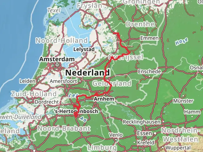
Embarking on the Veluwe Zwerfpad, hikers will traverse approximately 283 kilometers (about 176 miles) of diverse landscapes, with an elevation gain of around 1500 meters (nearly 4921 feet). This loop trail, which begins near Arnhem in the Netherlands, offers a medium difficulty rating and is a testament to the natural beauty and historical richness of the region.
Getting to the Trailhead The starting point of the Veluwe Zwerfpad is accessible from Arnhem, which is well-connected by public transport. Hikers can take a train to Arnhem Central Station and then a bus to the vicinity of the trailhead. For those driving, parking is available near the trail's starting point.
Navigating the Trail As you set out, the HiiKER app will be an invaluable tool for navigation, providing detailed maps and waypoints to ensure you stay on the right path. The trail is marked, but having a digital companion like HiiKER can enhance the experience and provide peace of mind.
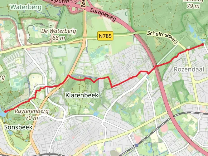
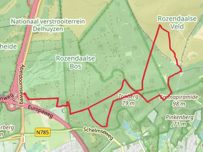
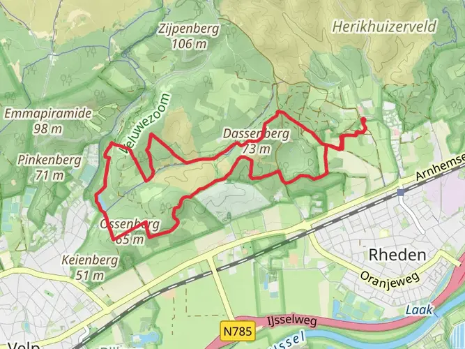
Landmarks and Nature The Veluwe Zwerfpad takes you through the heart of the Veluwe, a region known for its expansive heathlands, dense forests, and shifting sand dunes. The trail meanders through the Hoge Veluwe National Park, where you can visit the Kröller-Müller Museum, home to the second-largest collection of Van Gogh paintings in the world.
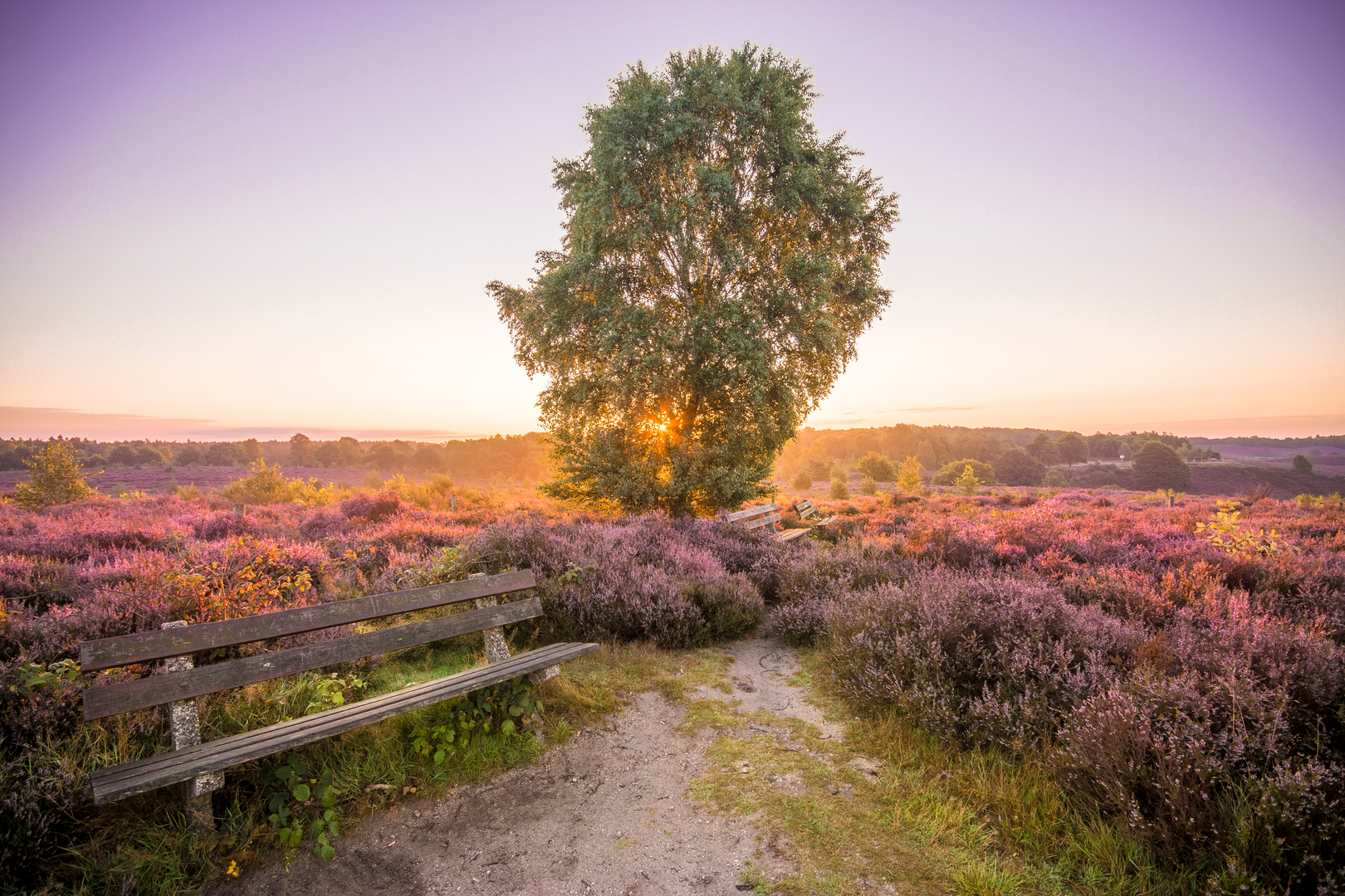
As you hike, you'll encounter the picturesque Posbank, a large heathland area known for its rolling hills and stunning purple heather, which blooms vibrantly in late summer. The trail also leads through the historic village of Otterlo and past the Ginkelse Heide, where airborne landings took place during Operation Market Garden in World War II.
Wildlife Encounters The Veluwe is a sanctuary for wildlife, and hikers may spot red deer, roe deer, wild boar, and a variety of bird species. The trail's diverse habitats support a rich biodiversity, making it a haven for nature enthusiasts.
Historical Significance The region is steeped in history, with remnants of ancient Celtic fields and burial mounds dotting the landscape. The trail also passes through areas that played significant roles during World War II, offering a somber reflection on the past.
Preparation and Planning Before setting out, ensure you have adequate supplies, as the trail can take several days to complete. There are opportunities to restock in the towns and villages along the route, but carrying enough water and food for the day's hike is essential. The trail offers a mix of terrains, so sturdy hiking boots are recommended.
Seasonal Considerations The Veluwe Zwerfpad can be hiked year-round, but each season offers a unique experience. Spring brings blossoming flora, while autumn is a spectacle of changing leaves. Winter hikes can be serene with frost-covered landscapes, though some facilities may be closed. Summer provides long daylight hours, but be prepared for warmer temperatures and busier trails.
By preparing adequately and respecting the natural and historical significance of the Veluwe, hikers can fully immerse themselves in the beauty and tranquility of the Veluwe Zwerfpad.

Frequently asked questions
What is the route of the Veluwe Zwerfpad and where does the Veluwe Zwerfpad start and finish?
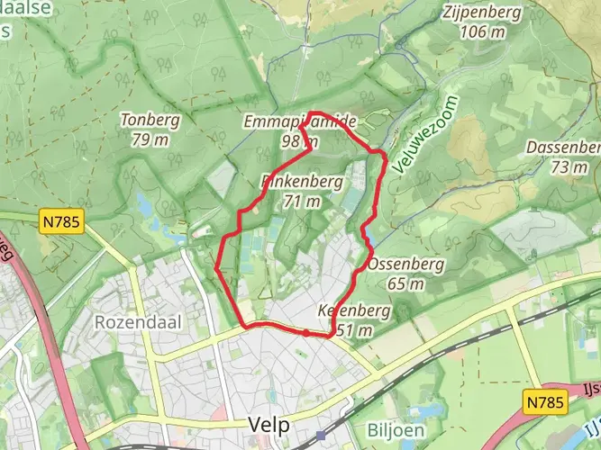
The Veluwe Zwerfpad is a 283.46 km multi-day walking route in the Veluwe region, starting and finishing in Arnhem. It is laid out as a long circuit rather than a single out-and-back, with 25 stages linking places such as Wolfheze, Lunteren, Otterlo, Garderen, Putten, Elspeet, Hoog Soeren, Kootwijk, Loenen, Dieren, Rheden, Velp, and Arnhem Centraal.
How many stages does the Veluwe Zwerfpad have, and are there official Veluwe Zwerfpad stages?
The Veluwe Zwerfpad is divided into 25 official stages, which makes it easier to plan as a long-distance walk. Published stage points include Wolfheze to Planken Wambuis, Station Lunteren to Otterlo, Garderen to Putten, Loenen to Dieren, Dieren to Rheden, Rheden to Kasteel Rosendael in Velp, and a final approach back to Arnhem Centraal.
Does the Veluwe Zwerfpad go through Posbank and De Hoge Veluwe?
Yes. The route crosses some of the best-known landscapes on the Veluwe, including the Posbank area near Rheden and parts of De Hoge Veluwe. Along the way it passes heath, forest, and sandy terrain, and notable places tied to the route include Posbank, Kasteel Rosendael near Velp, and the park area between Arnhem, Ede, and Apeldoorn.
Is the Veluwe Zwerfpad easy, and how much climbing is on the Veluwe Zwerfpad?
The Veluwe Zwerfpad is rated easy overall, but it is still a substantial long-distance hike. The full route covers 283.46 km with 1,511 m of total elevation gain, so the climbing is spread out over many days rather than concentrated in one mountain section. That makes it more about endurance and daily stage planning than steep technical terrain.
Can the Veluwe Zwerfpad be reached by public transport from Arnhem?
Yes. Arnhem is a practical access point for the Veluwe Zwerfpad because the route starts and finishes in the city, and Arnhem Centraal is one of the named route points on the trail. The wider Veluwe and De Hoge Veluwe area are also well connected by public transport, with park access from the Arnhem side via Schaarsbergen and other entrances near Otterlo and Hoenderloo.
Is the Veluwe Zwerfpad suitable for kids, or is the Veluwe Zwerfpad too long for families?
The full Veluwe Zwerfpad is too long for most families to tackle in one trip at 283.46 km, but individual stages can work well for stronger young walkers. Because the route is split into 25 stages and has an easy overall rating, families usually treat it as selected day walks around places like Arnhem, Rheden, Velp, or Otterlo rather than a complete through-hike.
Are dogs allowed on the Veluwe Zwerfpad?
Dogs may be possible on some parts of the Veluwe Zwerfpad, but rules vary by land manager and section. That matters because the route passes through De Hoge Veluwe, where dogs are allowed only if physically leashed, and they are not allowed inside park buildings except in limited designated cases. For a full end-to-end walk, dog access needs to be checked stage by stage.
Comments and Reviews
User comments, reviews and discussions about the Veluwe Zwerfpad, Netherlands.
4.71
average rating out of 5
7 rating(s)