Download
3D Flyover
Add to list
More
380.6 km
~13 days
1163 m
Multi-Day
“Embark on the Maarten Van Rossumpad for a historical and scenic Dutch hiking adventure.”
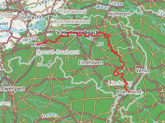
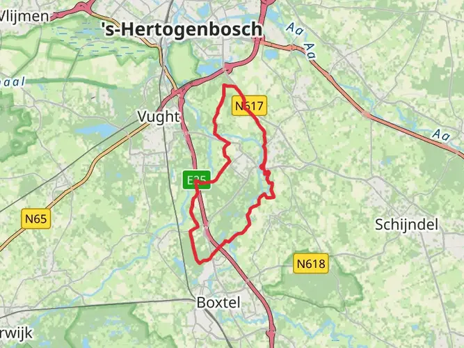
Spanning approximately 381 kilometers (237 miles) and with an elevation gain of around 1100 meters (3609 feet), the Maarten Van Rossumpad offers a medium-difficulty trek through the heart of the Netherlands. This point-to-point trail begins near the historic city of 's-Hertogenbosch, often referred to as Den Bosch, and weaves its way through the picturesque Dutch countryside, ending in the small town of Steenwijk.
Getting to the Trailhead
To reach the starting point of the Maarten Van Rossumpad, hikers can utilize the Netherlands' efficient public transportation system. From the 's-Hertogenbosch railway station, the trailhead is easily accessible by a short bus ride or taxi. For those driving, parking is available in the area, but it's advisable to check for the most current parking options and restrictions.
Navigating the Trail
Hikers can rely on the HiiKER app for up-to-date navigation and trail information. The app provides detailed maps and waypoints, ensuring that even though the trail is well-marked with the characteristic red and white signage, you have a digital companion for additional security.
Historical Significance and Landmarks
The trail is named after Maarten van Rossum, a Dutch military tactician from the 16th century, and it passes through regions rich in history. As you traverse the varied landscapes, you'll encounter castles, estates, and ancient towns that tell the story of the Netherlands' past. Notable historical landmarks include the medieval castle of Doorwerth, the fortified city of Buren, and the Hanseatic town of Zutphen.
Natural Beauty and Wildlife
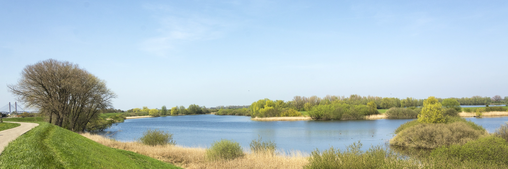
The Maarten Van Rossumpad crosses diverse ecosystems, from dense woodlands to open heathlands, river landscapes, and traditional polder areas. This variety of habitats supports an abundance of wildlife, including various bird species, deer, and smaller mammals. The trail also offers the chance to see the unique Dutch fen and bog landscapes, particularly in the Weerribben-Wieden National Park, which is a highlight towards the end of the trail.
Trail Experience
The journey begins in the southern part of the Netherlands, gradually moving northwards. The elevation gain is modest, with the trail remaining relatively flat, as is typical for the region. However, the distance itself presents the primary challenge, making it suitable for hikers with a moderate level of fitness.
The trail can be broken down into manageable sections, with the first notable area being the Veluwe, a region known for its expansive heathlands and forests. Here, the trail reaches some of its highest points, offering gentle climbs and scenic vistas.
As you progress, the trail passes through the IJssel valley, characterized by its river landscapes and fertile soils. This area is particularly rich in birdlife, so keep your binoculars handy.
Accommodations and Resupply Points
Throughout the Maarten Van Rossumpad, there are numerous towns and villages where hikers can find accommodations ranging from campsites to bed and breakfasts. Resupply points for food and water are also well distributed along the route, ensuring that hikers can replenish their provisions regularly.
Seasonal Considerations
The trail is accessible year-round, but the best time to hike is from late spring to early autumn when the weather is mild, and the natural landscapes are at their most vibrant. Hikers should be prepared for the changeable Dutch weather and pack accordingly.
Conclusion
By following the Maarten Van Rossumpad, hikers will not only experience the natural beauty of the Netherlands but also immerse themselves in the rich tapestry of Dutch history and culture. With careful planning and a spirit of adventure, this trail promises a memorable and rewarding journey through one of Europe's most charming countries.

Frequently asked questions
How long does the Maarten Van Rossumpad take to walk from 's-Hertogenbosch to Steenwijk?
The Maarten Van Rossumpad is about 380.59 km long, so most hikers treat it as a multi-day route rather than a single through-hike push. At a typical long-distance pace, it is usually split into roughly 18 walking days, with individual stages ranging from short sections around 6 km to long days of more than 30 km between places such as 's-Hertogenbosch, Doorwerth, Ommen, and Steenwijk.
What is the route of the Maarten Van Rossumpad and where does it start and finish?
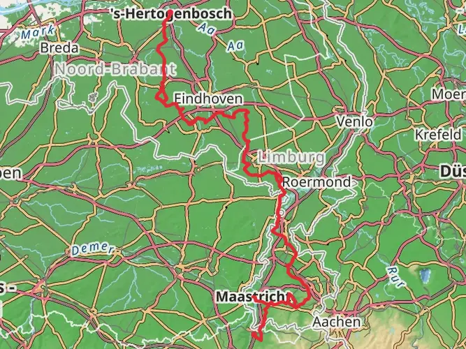
The Maarten Van Rossumpad runs point to point across the Netherlands from 's-Hertogenbosch in North Brabant to Steenwijk in Overijssel. The route passes through the river landscapes of the Betuwe, then continues across the Veluwe, Salland, the Vecht valley, and on toward the peatland and village landscapes near the finish at Steenwijk.
How difficult is the Maarten Van Rossumpad and does it have much climbing?
The Maarten Van Rossumpad is generally rated easy, with a total elevation gain of about 1,163 meters spread over the full 380.59 km route. That means the climbing is modest by long-distance standards, although some stages are hillier than others, especially around the Veluwe between places like Doorwerth, Oosterbeek, Velp, Loenen, and Vaassen.
How many stages does the Maarten Van Rossumpad have, and how long are they?
The Maarten Van Rossumpad is commonly divided into about 18 main stages. The shortest listed stage is around 6.3 km near the start from 's-Hertogenbosch to Oud-Empel, while one of the longest is about 33.1 km between the Loenen and Vaassen area, so the route can be planned as either short day walks or longer backpacking days.
What is stage 1 of the Maarten Van Rossumpad like?
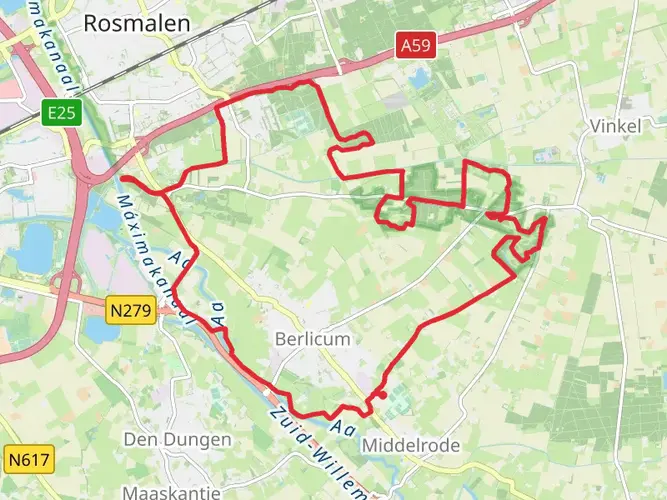
Stage 1 of the Maarten Van Rossumpad starts in 's-Hertogenbosch and runs to Oud-Empel for about 6.3 km, with roughly 32 meters of ascent. It is one of the shortest sections on the whole trail, making it a practical first day for walkers arriving by train into Den Bosch and wanting an easy opening stage before continuing deeper into the route.
Can I get a GPX or map for the Maarten Van Rossumpad?
Yes. The Maarten Van Rossumpad is a waymarked long-distance trail, and digital mapping and GPX-style route support are available on HiiKER for both the full route and individual stages. That is especially useful on a 380.59 km trail with multiple stage breaks, including sections through places such as Buren, Doorwerth, Oosterbeek, Ommen, Staphorst, and Havelte.
Comments and Reviews
User comments, reviews and discussions about the Maarten Van Rossumpad, Netherlands.
4.33
average rating out of 5
3 rating(s)