Download
3D Flyover
Add to list
More
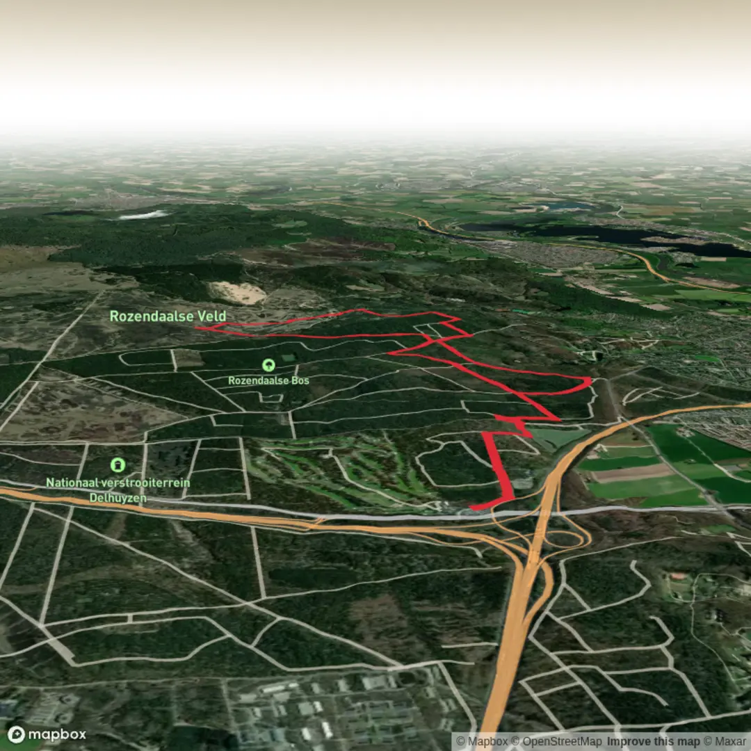
12.4 km
~2 hrs 35 min
68 m
Loop
“From castle reflections to purple heath, this scenic loop blends history, wildlife, and sweeping woodland views.”
Nestled just east of Arnhem, the trailhead for this 12 km (7.5 mile) loop is conveniently located near the entrance to the Rozendaalse Bos, close to the well-known Kasteel Rosendael. This area is easily accessible by public transport: take a train to Arnhem Centraal, then transfer to a local bus heading towards Rozendaal, alighting at the “Rozendaal, Kerk” stop. From there, it’s a short walk to the castle grounds, where parking is also available for those arriving by car.
Woodland Paths and Open Heath
The route begins with gentle woodland paths winding through the Rozendaalse Bos, a forested area known for its tall beech and oak trees. The terrain here is mostly flat, with a gradual elevation gain of about 100 metres (330 feet) spread across the entire loop, making it suitable for hikers of all abilities. Early in the hike, you’ll pass the historic Kasteel Rosendael, a moated castle dating back to the 14th century, famous for its shell gallery and landscaped park. The castle grounds are open to visitors, and the gardens are especially beautiful in spring and summer.
After leaving the castle area, the trail transitions into the Rozendaalsche Veld, a vast expanse of heathland. This open landscape is dotted with juniper bushes and offers wide views, especially striking in late summer when the heather blooms purple. The sandy soil and sparse tree cover create a unique habitat for wildlife; keep an eye out for roe deer, foxes, and a variety of birds, including woodpeckers and buzzards. The heath is also home to several rare plant species, so tread lightly and stick to marked paths.
Vossenberg and Historical Features
Midway through the loop, you’ll reach the Vossenberg, a modest hill that provides one of the highest vantage points in the area. At approximately 6 km (3.7 miles) into the hike, the elevation here offers sweeping views over the heath and forest. The Vossenberg area has historical significance: during World War II, it was used as a lookout and defensive position. Remnants of wartime bunkers and trenches can still be found, partially hidden by undergrowth. Interpretive signs along the route provide context about the area’s role in the conflict and its recovery in the decades since.
Navigation and Trail Conditions
The entire loop is well-marked, but the open heath sections can be disorienting in foggy or low-light conditions. For reliable navigation, use HiiKER, which provides up-to-date trail maps and GPS guidance. The paths are mostly sandy or packed earth, with occasional muddy patches after rain. Sturdy walking shoes are recommended, but the gentle gradients mean hiking poles are optional.
Return to Rozendaal
The final stretch of the loop leads back into the forest, passing several small ponds and streams that attract frogs and dragonflies in warmer months. The route circles back to the starting point near Kasteel Rosendael, where you can relax in the castle café or explore the gardens further before heading home. Public transport connections from Rozendaal are frequent, making it easy to return to Arnhem or other nearby cities.

Surfaces
Dirt
Ground
Unknown
Gravel
Concrete
Asphalt
Sand
Comments and Reviews
User comments, reviews and discussions about the Vossenberg and Rozendaalsche Veld Loop, Netherlands.
average rating out of 5
0 rating(s)