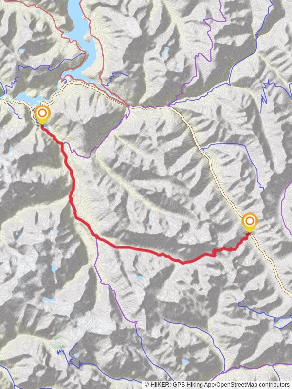
Easy Pass, Thunder Creek and Diablo Lake Trail
36.5 km
~1 day 4 hrs
1463 m
“Explore stunning landscapes and rich history on the 37 km Easy Pass, Thunder Creek, and Diablo Lake Trail!”
Starting near Skagit County, Washington, the Easy Pass, Thunder Creek, and Diablo Lake Trail is a point-to-point adventure spanning approximately 37 kilometers (23 miles) with an elevation gain of around 1400 meters (4600 feet). This trail is rated as medium difficulty, making it suitable for moderately experienced hikers.
### Getting There To reach the trailhead, you can drive or use public transport. If driving, head towards the North Cascades National Park. The nearest significant landmark is the Ross Dam Trailhead, accessible via State Route 20. For those using public transport, the nearest major city is Seattle. From Seattle, you can take a bus to Marblemount, and then arrange for a local shuttle or taxi to the trailhead.
### Trail Overview The trail begins with a steady ascent towards Easy Pass, which sits at an elevation of approximately 2080 meters (6825 feet). This initial section is about 6 kilometers (3.7 miles) long and gains around 900 meters (2950 feet) in elevation. The climb is challenging but rewarding, offering panoramic views of the surrounding peaks and valleys.
### Easy Pass to Thunder Creek After reaching Easy Pass, the trail descends into the Thunder Creek Valley. This section is about 10 kilometers (6.2 miles) long with a descent of approximately 600 meters (1970 feet). The descent can be steep in places, so trekking poles are recommended. Thunder Creek is known for its lush, old-growth forests and vibrant wildflower meadows, especially in late spring and early summer.
### Thunder Creek to Diablo Lake Continuing along Thunder Creek, the trail gradually ascends again towards Diablo Lake. This section is roughly 21 kilometers (13 miles) long with an elevation gain of about 500 meters (1640 feet). The trail meanders through dense forests and along the creek, offering numerous opportunities to spot wildlife such as black bears, deer, and various bird species. Keep an eye out for the historic Thunder Creek Shelter, built in the 1930s by the Civilian Conservation Corps.
### Diablo Lake As you approach Diablo Lake, the trail offers stunning views of the turquoise waters, a result of glacial flour suspended in the water. The lake is a popular spot for kayaking and fishing. The trail ends near the Diablo Lake Trailhead, where you can arrange for a pickup or shuttle back to your starting point.
### Navigation and Safety Given the trail's length and varying terrain, it's crucial to have a reliable navigation tool. HiiKER is recommended for detailed maps and real-time updates. Always check weather conditions before setting out, as the area can experience sudden changes. Carry sufficient water, food, and emergency supplies, and be prepared for encounters with wildlife.
### Historical Significance The region around the trail has a rich history. The North Cascades were originally inhabited by Native American tribes such as the Skagit and Nooksack, who used the valleys and passes for trade and travel. The area later saw an influx of miners and loggers in the late 19th and early 20th centuries. The construction of the North Cascades Highway in the 1960s opened up the area to recreational activities, leading to the establishment of the North Cascades National Park in 1968.
This trail offers a blend of natural beauty, challenging terrain, and historical significance, making it a memorable experience for any hiker.
Easy Pass, Thunder Creek and Diablo Lake Trail passes through these parks:
Reviews
User comments, reviews and discussions about the Easy Pass, Thunder Creek and Diablo Lake Trail, Washington.
4.0
average rating out of 5
13 rating(s)


