Download
3D Flyover
Add to list
More
4277.9 km
~166 days
80962 m
Multi-Day
“Embark on the epic Ultra Pedestrian North Loop to discover the Pacific Northwest's wild heart.”
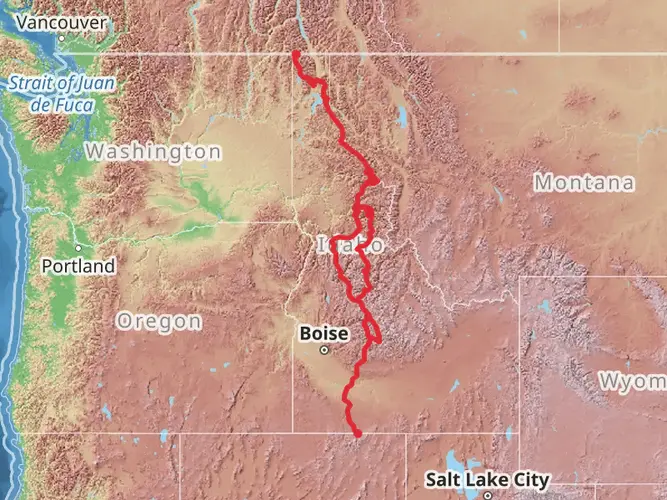
Spanning approximately 4278 kilometers (2658 miles) with an elevation gain of around 80,900 meters (265,420 feet), the Ultra Pedestrian North Loop is a monumental trail that encircles some of the most scenic and rugged landscapes in the Pacific Northwest. Starting near Bonner County, Idaho, this loop trail offers a diverse array of environments, from dense forests and alpine meadows to rocky ridges and serene lakes.
Getting to the Trailhead
The trailhead is accessible by car, located near Bonner County in Idaho. For those relying on public transportation, the nearest significant city with bus and train services is Spokane, Washington. From Spokane, you can rent a car or find local shuttle services that will take you to the trailhead.
Trail Overview
As you embark on this journey, you'll traverse through multiple national forests, including the Colville, Okanogan, and Wenatchee, each offering unique landscapes and challenges. The trail is marked by changes in terrain and climate, which hikers should prepare for. The loop is estimated to have a medium difficulty rating, but due to its length, it requires thorough preparation and endurance.
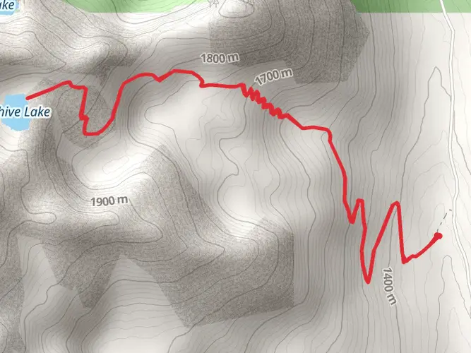
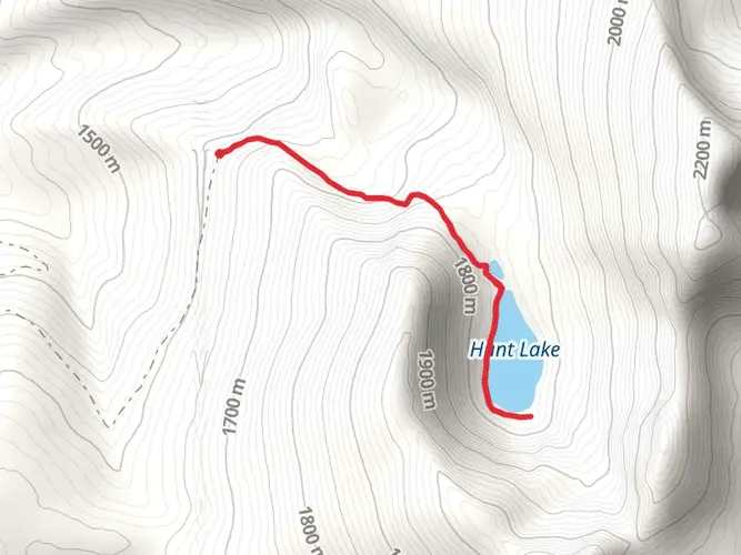
Significant Landmarks and Nature
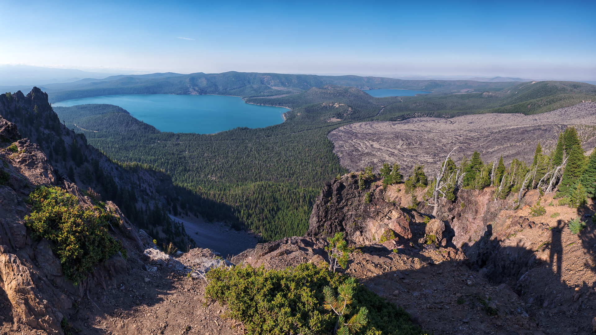
One of the early highlights of the trail is the Selkirk Mountain Range, where you'll encounter a mix of dense forest and high peaks. As you progress, you'll reach the Pasayten Wilderness, an area known for its remote beauty and wildlife, including lynx, wolves, and grizzly bears. The North Cascades present a dramatic backdrop with jagged peaks and glaciers, while the Columbia River Gorge offers a contrast with its lush, water-carved landscapes.
Wildlife and Flora
The trail is home to a rich variety of wildlife. Hikers may spot elk, mountain goats, and black bears, among other species. Birdwatchers will appreciate the diversity of avian life, including eagles and ospreys. The flora changes with the elevation and the seasons, from wildflowers in the spring to larches turning golden in the fall.
Historical Significance
The region is steeped in history, with the trail passing through areas that were once the hunting and fishing grounds of Native American tribes. The trail also winds near historical sites from the early European settlers and fur traders who explored these lands.
Navigation and Preparation
Given the trail's length and remote sections, it is crucial to plan resupply points and be prepared for self-sufficiency. Hikers should use navigation tools like HiiKER to track their progress and stay on the correct path. It's also important to be aware of the weather patterns and prepare for sudden changes, especially in the higher elevations.
Elevation and Distance
The trail's elevation gain is significant, with some sections having steep ascents and descents. Hikers should be prepared for the physical demands of the trail, which will test their endurance over the course of several weeks or even months.
Conclusion
The Ultra Pedestrian North Loop is a trail of epic proportions, offering an immersive experience into the wilderness of the Pacific Northwest. It is a journey that requires careful planning, respect for nature, and a spirit of adventure.

What to expect?
Activity types
Frequently asked questions
How long does it take to hike the Ultra Pedestrian North Loop?
The Ultra Pedestrian North Loop is about 4,277.93 km, or 2,658 miles, so it is a true multi-month expedition rather than a standard backpacking trip. HiiKER lists an estimate of about 248 days, and the route created by UltraPedestrian is described as a 2,634-mile Inland Northwest loop, which aligns with a long thru-hike timeframe.
How difficult is the Ultra Pedestrian North Loop in Idaho?
The Ultra Pedestrian North Loop is rated Extra Difficult and includes roughly 80,962 m of total elevation gain, or about 265,420 feet. That combination of extreme distance and sustained climbing puts it well beyond a typical long weekend or section hike and into expedition-level territory.
Where does the Ultra Pedestrian North Loop go after starting near Bonner County?
The Ultra Pedestrian North Loop is an Inland Northwest loop that links major long-distance corridors across Idaho, Washington, and Oregon. UltraPedestrian describes it as connecting parts of the Idaho Centennial Trail, Oregon Desert Trail, Pacific Crest Trail, and Pacific Northwest Trail into one continuous circuit, so the route crosses multiple mountain and forest regions rather than staying in Bonner County.
What major wilderness areas and mountain ranges are on the Ultra Pedestrian North Loop?
The route passes through some of the biggest backcountry landscapes in the region, including the Selkirk Mountains and Washington’s Pasayten Wilderness. Forest Service information for the Pacific Northwest Trail and Pasayten Wilderness confirms that the route reaches the eastern Pasayten near Horseshoe Basin and travels through remote north-central Washington terrain.
Is the Ultra Pedestrian North Loop a loop trail or an out-and-back route?
The Ultra Pedestrian North Loop is a loop trail, not an out-and-back. It is designed as a continuous circuit of roughly 4,278 km that returns to its broader starting region after linking long sections of the Idaho Centennial Trail, Pacific Crest Trail, Pacific Northwest Trail, and Oregon Desert Trail.
What states does the Ultra Pedestrian North Loop pass through?
The Ultra Pedestrian North Loop crosses Idaho, Washington, and Oregon. UltraPedestrian describes the route as an Inland Northwest loop built from long-distance trail segments in those three states, which is one reason the total distance reaches about 2,658 miles.
Comments and Reviews
User comments, reviews and discussions about the Ultra Pedestrian North Loop, Idaho.
4.46
average rating out of 5
24 rating(s)