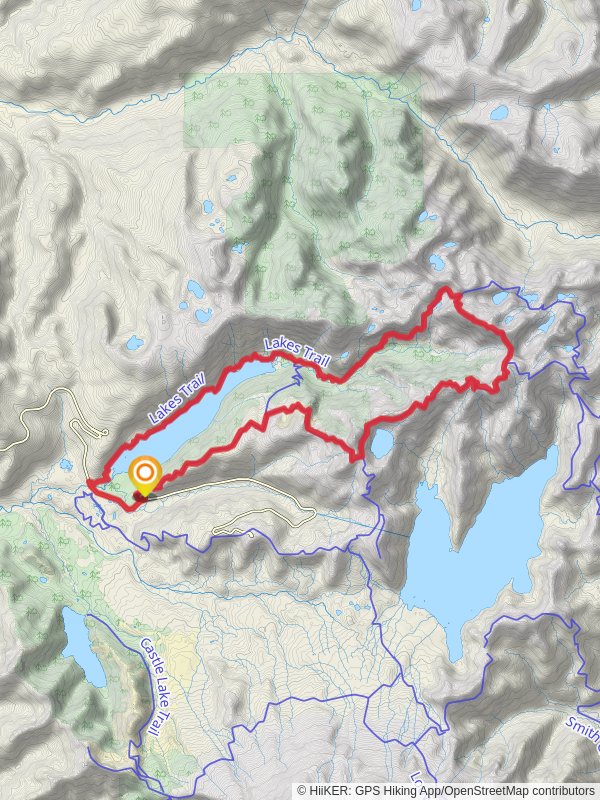
Lakes Trail and Boundary Trail
Gifford Pinchot National Forest · Cowlitz County, Washington
35.6 km
~2 day
1774 m
“Explore diverse landscapes and historical landmarks on the 36 km Lakes Trail and Boundary Trail loop.”
Starting near Cowlitz County, Washington, the Lakes Trail and Boundary Trail loop spans approximately 36 kilometers (22 miles) with an elevation gain of around 1700 meters (5577 feet). This medium-difficulty trail offers a diverse range of landscapes, historical landmarks, and abundant wildlife, making it a rewarding experience for hikers.
### Getting There To reach the trailhead, you can drive or use public transport. If driving, head towards the nearest significant landmark, which is the town of Randle, WA. From Randle, take Forest Road 25 south for about 20 miles until you reach the trailhead parking area. For those using public transport, the nearest bus stop is in Randle, WA. From there, you may need to arrange a taxi or rideshare to the trailhead.
### Trail Overview The trail begins with a gentle ascent through dense forest, offering a cool and shaded start. As you progress, the trail becomes steeper, leading you to the first significant landmark, Blue Lake, approximately 8 kilometers (5 miles) in. This serene lake is an excellent spot for a short break and some photography.
### Key Landmarks and Sections #### Blue Lake to Boundary Trail Junction Continuing from Blue Lake, the trail ascends more steeply, gaining about 300 meters (984 feet) in elevation over the next 4 kilometers (2.5 miles). This section is characterized by switchbacks and offers occasional views of the surrounding valleys. Keep an eye out for deer and various bird species that frequent this area.
#### Boundary Trail Junction to Twin Lakes At the junction with the Boundary Trail, turn left to continue the loop. This section is relatively flat for the next 6 kilometers (3.7 miles), passing through alpine meadows filled with wildflowers in the summer months. Twin Lakes, located at this junction, are another highlight, offering crystal-clear waters and a peaceful setting for a longer rest.
### Historical Significance The Boundary Trail has historical significance as it was used by Native American tribes for trade and travel long before European settlers arrived. Interpretive signs along the trail provide insights into the rich cultural history of the region.
### Wildlife and Flora The trail is home to a variety of wildlife, including black bears, elk, and mountain goats. It's essential to carry bear spray and know how to use it. The flora varies from dense coniferous forests at lower elevations to alpine meadows at higher altitudes, offering a diverse range of plant species.
### Final Stretch: Twin Lakes to Trailhead The final section of the trail descends gradually over 10 kilometers (6.2 miles), passing through mixed forests and offering occasional views of Mount St. Helens in the distance. This part of the trail is less strenuous, allowing you to enjoy the final leg of your hike at a more relaxed pace.
### Navigation For navigation, it's highly recommended to use the HiiKER app, which provides detailed maps and real-time GPS tracking to ensure you stay on the correct path.
### Preparation Tips Given the elevation gain and distance, it's crucial to be well-prepared. Carry sufficient water, high-energy snacks, and appropriate clothing for changing weather conditions. Trekking poles can be beneficial for the steeper sections of the trail.
By following these guidelines and being well-prepared, you'll be able to fully enjoy the natural beauty and historical richness of the Lakes Trail and Boundary Trail loop.
Reviews
User comments, reviews and discussions about the Lakes Trail and Boundary Trail, Washington.
5.0
average rating out of 5
9 rating(s)


