19.1 km
~4 hrs 50 min
608 m
“Embark on a 19-kilometer adventure through rugged terrain, stunning vistas, and rich historical landmarks in Utah.”
Starting near Grand County, Utah, the Pritchett Canyon Trail and Hunter Rim Trail form a loop that spans approximately 19 kilometers (around 12 miles) with an elevation gain of about 600 meters (approximately 1,970 feet). This medium-difficulty trail offers a mix of rugged terrain, stunning vistas, and rich historical context, making it a rewarding adventure for prepared hikers.
### Getting There
To reach the trailhead, you can drive or use public transportation. If driving, head towards Moab, Utah, which is the nearest significant town. From Moab, take Kane Creek Boulevard southwest for about 6 miles until you reach the Pritchett Canyon Trailhead. For those relying on public transport, Moab is accessible via shuttle services from larger cities like Salt Lake City. From Moab, you may need to arrange a taxi or rideshare to the trailhead.
### Trail Overview
The trail begins with a challenging ascent through Pritchett Canyon, characterized by rocky paths and occasional scrambling sections. The first 3 kilometers (about 1.9 miles) will see you gaining approximately 200 meters (around 650 feet) in elevation. This part of the trail is known for its dramatic rock formations and narrow canyon walls, which are a testament to the area's geological history.
### Significant Landmarks
As you progress, you'll encounter several notable landmarks. Around the 5-kilometer (3.1-mile) mark, you'll come across the Pritchett Arch, a natural rock arch that offers a perfect spot for a short break and some photography. Continuing on, the trail opens up to expansive views of the surrounding mesas and valleys, providing a stark contrast to the enclosed canyon you just traversed.
### Flora and Fauna
The trail is home to a variety of plant and animal life. Keep an eye out for desert flora such as yucca, sagebrush, and various cacti. Wildlife sightings may include mule deer, desert bighorn sheep, and a variety of bird species like the golden eagle and peregrine falcon. The best times for wildlife observation are early morning and late afternoon.
### Historical Significance
This region holds significant historical value, particularly for its Native American heritage. Petroglyphs and pictographs can be found along the trail, especially near the Hunter Rim section. These ancient rock carvings and paintings offer a glimpse into the lives of the indigenous peoples who once inhabited this area. Please remember to respect these sites and leave them undisturbed.
### Navigation and Safety
Given the rugged nature of the trail, it's crucial to be well-prepared. Download the trail map from HiiKER before you set out, as cell service can be unreliable in this remote area. The trail is well-marked, but having a reliable navigation tool will ensure you stay on course.
### Final Stretch
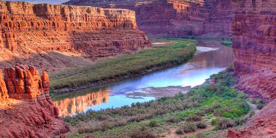
The final section of the trail takes you along the Hunter Rim, offering panoramic views of the La Sal Mountains and the Colorado River. This part of the trail is less strenuous, allowing you to enjoy the scenery as you descend back towards the trailhead. The last 4 kilometers (about 2.5 miles) are relatively flat, making for a pleasant end to your hike.
### Preparation Tips
Ensure you carry plenty of water, as the desert environment can be extremely dry and hot, especially in the summer months. Wear sturdy hiking boots with good ankle support, and consider using trekking poles for added stability. Sunscreen, a hat, and sunglasses are also essential to protect against the intense sun.
By following these guidelines and being well-prepared, you'll be able to fully enjoy the diverse landscapes and rich history that the Pritchett Canyon Trail and Hunter Rim Trail have to offer.
Reviews
User comments, reviews and discussions about the Pritchett Canyon Trail and Hunter Rim Trail, Utah.
0.0
average rating out of 5
0 rating(s)


