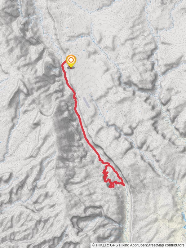
37.8 km
~1 day 4 hrs
1194 m
“Embark on the Halls Creek Loop for a moderately challenging hike through Capitol Reef's stunning, historic landscapes.”
Starting near Garfield County, Utah, the Halls Creek Loop is a captivating 38 km (24 miles) journey through the heart of Capitol Reef National Park. With an elevation gain of approximately 1100 meters (3600 feet), this loop trail offers a moderately challenging experience for hikers, blending stunning landscapes with rich historical significance.
### Getting There To reach the trailhead, you can drive to the Capitol Reef National Park Visitor Center, located at 52 Scenic Drive, Torrey, UT 84775. From there, head south on the Notom-Bullfrog Road for about 42 miles (68 km) until you reach the trailhead. Public transport options are limited, so driving is the most practical way to get there. Ensure your vehicle is suitable for dirt roads, especially if recent weather conditions have been unfavorable.
### Trail Overview The Halls Creek Loop takes you through a variety of terrains, including desert landscapes, narrow canyons, and expansive plateaus. The trail is well-marked, but carrying a reliable navigation tool like HiiKER is highly recommended for real-time guidance.
### Key Sections and Landmarks
#### Lower Muley Twist Canyon Approximately 8 km (5 miles) into the hike, you'll encounter the Lower Muley Twist Canyon. This section is renowned for its towering sandstone walls and narrow passages. The canyon's unique geological formations are a testament to millions of years of erosion and sedimentation.
#### Halls Creek Narrows Around the 16 km (10 miles) mark, you'll reach the Halls Creek Narrows. This segment is particularly striking, with its deep, winding canyon walls that rise dramatically on either side. Be cautious of flash floods in this area, especially during the rainy season. The narrows are a haven for photographers and nature enthusiasts alike.
#### Historical Significance Capitol Reef National Park is steeped in history, with evidence of ancient Native American cultures, including the Fremont people, who inhabited the region over a thousand years ago. Petroglyphs and other archaeological sites can be found along the trail, offering a glimpse into the lives of these early inhabitants.
### Flora and Fauna The trail is home to a diverse range of plant and animal life. Keep an eye out for desert flora such as sagebrush, juniper, and various cacti species. Wildlife sightings may include mule deer, bighorn sheep, and a variety of bird species. Always maintain a respectful distance from wildlife and follow Leave No Trace principles to preserve the natural beauty of the area.
### Elevation and Terrain The trail's elevation gain of 1100 meters (3600 feet) is spread out over the 38 km (24 miles), making it a steady but manageable climb. The highest points offer panoramic views of the surrounding desert and canyon landscapes, rewarding your efforts with breathtaking vistas.
### Preparation and Safety Given the trail's remote location, it's crucial to be well-prepared. Carry sufficient water, as sources can be scarce, especially during the hotter months. A water filtration system is advisable if you plan to use natural water sources. Weather conditions can vary, so pack layers to accommodate temperature changes. A detailed map and a navigation tool like HiiKER are essential for staying on course.
Embarking on the Halls Creek Loop is a journey through some of Utah's most stunning and historically rich landscapes. With proper preparation and respect for the natural environment, this trail offers an unforgettable hiking experience.
Reviews
User comments, reviews and discussions about the Halls Creek Loop, Utah.
0.0
average rating out of 5
0 rating(s)


