Download
3D Flyover
Add to list
More
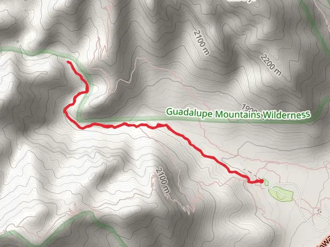
29.1 km
~2 days
1048 m
Multi-Day
“Embark on a scenic but strenuous journey through diverse landscapes and rich history on the Pine Springs to McKittrick Canyon trail.”
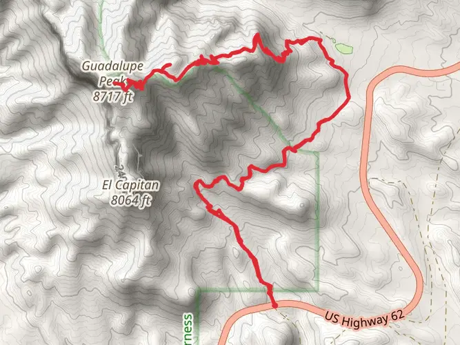
Embarking on the Pine Springs to McKittrick Canyon trail, hikers will traverse a challenging and rewarding journey through the Guadalupe Mountains National Park. This point-to-point trail spans approximately 29 kilometers (18 miles) and involves an elevation gain of around 1000 meters (3280 feet), offering a strenuous trek that is best suited for experienced hikers.
Getting to the Trailhead
The trailhead is located near Culberson County, Texas. For those driving, the closest significant landmark is the Pine Springs Visitor Center, which is accessible via U.S. Highway 62/180. Parking is available at the visitor center, and from there, the trailhead is clearly marked. For those relying on public transportation, options are limited, and it's advisable to rent a car from the nearest major city, such as El Paso, which is about a two-hour drive away.
The Journey Begins
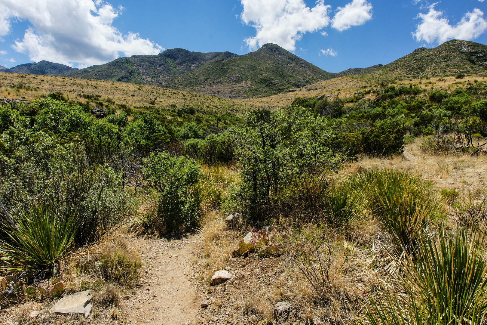
Starting from the Pine Springs trailhead, hikers will immediately be greeted by the arid landscape typical of West Texas. The initial ascent is steep and rocky, with switchbacks that offer stunning views of the surrounding desert and the distant Sierra Diablo Mountains. As you climb, the vegetation transitions from desert scrub to a more diverse array of flora, including pinyon pine and juniper trees.
Landmarks and Natural Beauty
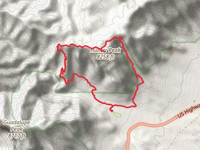
One of the most significant landmarks along the route is Guadalupe Peak, the highest point in Texas, which can be seen from various points along the trail. Although this hike does not summit the peak, the trail provides plenty of panoramic vistas where hikers can appreciate the peak's majesty.
As you continue, the trail will lead you through Manzanita Spring, a lush area where water is typically available, but it's essential to treat any water before drinking. This is also a great spot to observe local wildlife, such as mule deer and the occasional mountain lion, from a safe distance.
Historical Significance
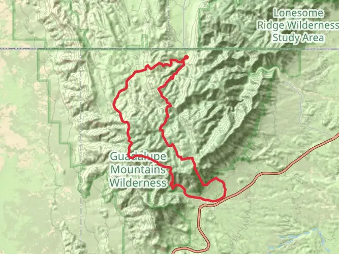
The region is rich in history, with the Guadalupe Mountains being part of an ancient marine fossil reef dating back to the Permian era. The trail itself may not have significant historical structures, but the land tells a story of geological processes and ancient habitats that existed long before humans walked these paths.
Navigating the Trail
For navigation, hikers should use the HiiKER app to track their progress and ensure they stay on the correct path. The app provides detailed maps and trail information that can be invaluable in the remote and sometimes complex terrain of the Guadalupe Mountains.
Final Ascent and Descent into McKittrick Canyon
The final section of the trail involves a descent into McKittrick Canyon, renowned for its stunning fall foliage and a diverse ecosystem that contrasts sharply with the arid surroundings. The canyon is home to a variety of trees, including maples, oaks, and pines, creating a colorful and serene environment.
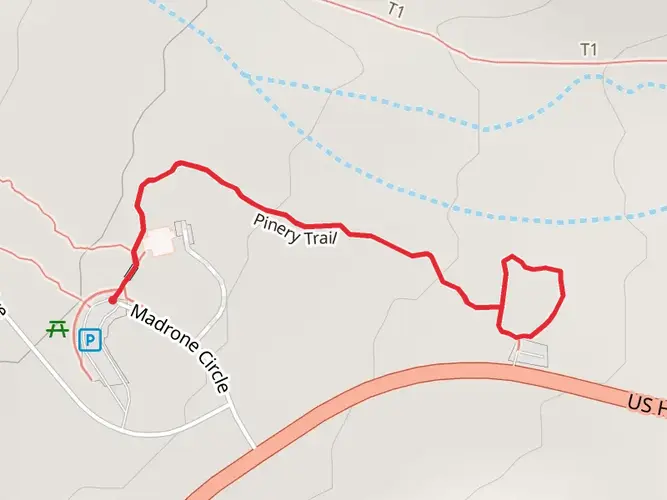
Upon reaching McKittrick Canyon, hikers will find themselves at the end of the trail, where they can arrange for pickup or shuttle back to their starting point. The McKittrick Canyon Visitor Center is the nearest landmark, providing information and resources for the end of the journey.
Preparation and Safety
Due to the trail's difficulty and remote nature, hikers should be well-prepared with adequate water, food, and gear for changing weather conditions. It's also wise to inform someone of your hiking plans and expected return time. Cell service can be spotty, so plan accordingly.
Remember, this trail is not a loop, so transportation arrangements must be made for the return trip from McKittrick Canyon to Pine Springs.

What to expect?
Activity types
Comments and Reviews
User comments, reviews and discussions about the Pine Springs to McKittrick Canyon, Texas.
4.67
average rating out of 5
6 rating(s)