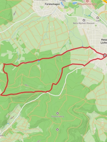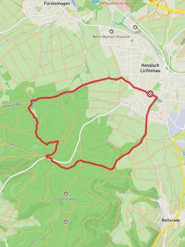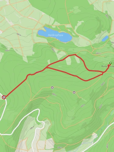
10.9 km
~2 hrs 34 min
239 m
“Experience lush forests, panoramic views, and historical ruins on this 11 km moderately challenging loop trail.”
Starting near Werra-Meißner-Kreis in Germany, this 11 km (approximately 6.8 miles) loop trail offers a medium difficulty hike with an elevation gain of around 200 meters (656 feet). The trailhead is conveniently accessible by both car and public transport. If you're driving, you can park near the town of Bad Sooden-Allendorf. For those using public transport, take a train to Bad Sooden-Allendorf station, which is well-connected to major cities in the region. From the station, it's a short walk to the trailhead.
### Initial Ascent and Scenic Views The hike begins with a gentle ascent through lush forested areas, providing a serene start to your journey. As you climb, you'll notice the dense canopy of deciduous trees, which offers ample shade and a cool environment, especially during the warmer months. After about 2 km (1.2 miles), the trail opens up to offer panoramic views of the surrounding Werra Valley. This is an excellent spot for a short break and some photography.
### Grimmsteig Section Continuing along the Grimmsteig section, the trail becomes a bit steeper but remains manageable for most hikers. This part of the trail is named after the famous Brothers Grimm, who collected many of their fairy tales in this region. Keep an eye out for informational plaques that provide insights into the local folklore and the Brothers Grimm's connection to the area. The trail here is well-marked, but it's always a good idea to have the HiiKER app for navigation.
### Schlossberg Summit At around the 5 km (3.1 miles) mark, you'll reach the summit of Schlossberg. The elevation here is approximately 200 meters (656 feet) higher than your starting point. The summit offers breathtaking views of the Werra-Meißner-Kreis region and is a perfect spot for a picnic. There are also remnants of historical fortifications, giving you a glimpse into the area's medieval past. The ruins are well-preserved and provide a fascinating look into the region's history.
### Descent and Return Loop The descent begins gradually, winding through more forested areas and eventually leading you to open meadows. This part of the trail is particularly beautiful in the spring and summer when wildflowers are in full bloom. After about 8 km (5 miles), you'll start to loop back towards the starting point. The trail here is relatively flat, making for an easy and relaxing end to your hike.
### Flora and Fauna Throughout the hike, you'll encounter a variety of flora and fauna. The forested sections are home to deer, foxes, and a variety of bird species. In the meadows, you might spot rabbits and an array of butterflies. The diverse plant life includes oak, beech, and pine trees, as well as numerous wildflowers and shrubs.
### Practical Information Make sure to wear sturdy hiking boots, as some sections can be rocky and uneven. Bring plenty of water and snacks, especially if you plan to picnic at the summit. The trail is well-marked, but having the HiiKER app will ensure you stay on track. Weather can be unpredictable, so check the forecast and dress in layers.
This trail offers a perfect blend of natural beauty, historical significance, and moderate physical challenge, making it an ideal choice for a day hike in the Werra-Meißner-Kreis region.
Reviews
User comments, reviews and discussions about the Schlossberg via Grimmsteig, Germany.
0.0
average rating out of 5
0 rating(s)


