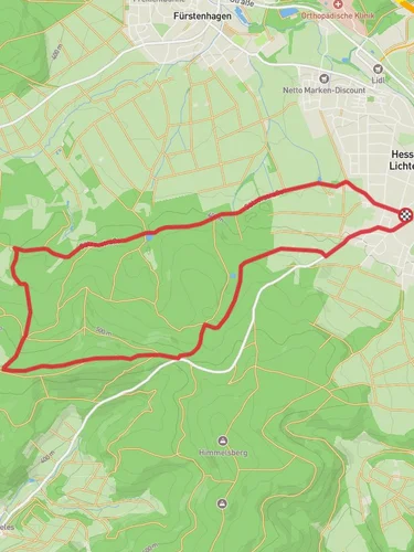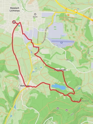
11.2 km
~2 hrs 43 min
287 m
“The Günsteroder Rundweg trail offers scenic views, historical sites, and moderate hiking challenges for nature enthusiasts.”
Starting near Schwalm-Eder-Kreis, Germany, the Günsteroder Rundweg is a scenic loop trail that spans approximately 11 km (6.8 miles) with an elevation gain of around 200 meters (656 feet). This trail is rated as medium difficulty, making it suitable for moderately experienced hikers.
### Getting There To reach the trailhead, you can either drive or use public transport. If driving, set your GPS to Schwalm-Eder-Kreis, and look for parking options near the village of Günsterode. For those using public transport, take a train to the nearest major station in Melsungen and then a local bus to Günsterode. The trailhead is conveniently located near the village, making it easily accessible.
### Trail Navigation For navigation, it is highly recommended to use the HiiKER app, which provides detailed maps and real-time updates to ensure you stay on the right path.
### Trail Highlights The trail begins with a gentle ascent through mixed forests, offering a serene environment filled with the sounds of local birdlife. After about 2 km (1.2 miles), you will come across the first significant landmark, the Günsteroder Teich, a picturesque pond that is perfect for a short break and some photography.
### Historical Significance As you continue, the trail takes you through areas rich in history. Around the 5 km (3.1 miles) mark, you will encounter remnants of old stone walls and foundations, believed to be part of medieval settlements. This region has a deep historical significance, with evidence of human habitation dating back to the Middle Ages.
### Flora and Fauna The trail is abundant with diverse flora and fauna. Depending on the season, you may see wildflowers such as bluebells and foxgloves. The forested sections are home to deer, foxes, and a variety of bird species, making it a delightful experience for nature enthusiasts.
### Midpoint and Elevation At approximately 6 km (3.7 miles), you will reach the highest point of the trail, offering panoramic views of the surrounding countryside. This is an excellent spot for a longer rest and to take in the scenery. The elevation gain here is about 200 meters (656 feet), providing a moderate challenge without being overly strenuous.
### Return Loop The descent begins gradually, leading you through open meadows and farmlands. Around the 8 km (5 miles) mark, you will pass by traditional German farmhouses, giving you a glimpse into the rural lifestyle of the region. The final stretch of the trail loops back into the forest, eventually bringing you back to the starting point near Günsterode.
### Practical Tips - Wear sturdy hiking boots as the terrain can be uneven in places. - Carry enough water and snacks, especially if you plan to take extended breaks. - Check the weather forecast before heading out, as conditions can change rapidly. - Use the HiiKER app for real-time navigation and updates.
This trail offers a balanced mix of natural beauty, historical intrigue, and moderate physical challenge, making it a rewarding experience for those who undertake it.
Reviews
User comments, reviews and discussions about the Günsteroder Rundweg, Germany.
0.0
average rating out of 5
0 rating(s)


