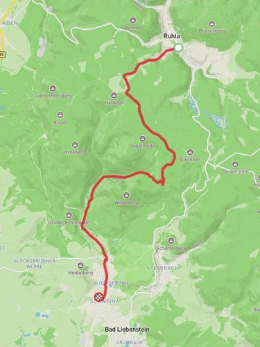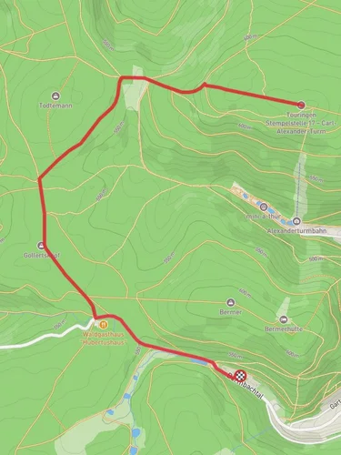
2.9 km
~49 min
155 m
“Discover the Schoßberg Loop - Thal: a 3 km trail blending natural beauty and historical intrigue.”
Starting near Wartburgkreis, Germany, the Schoßberg Loop - Thal is a delightful 3 km (1.86 miles) loop trail with an elevation gain of around 100 meters (328 feet). This medium-difficulty trail offers a blend of natural beauty and historical significance, making it a rewarding experience for hikers of various skill levels.
### Getting There To reach the trailhead, you can drive or use public transport. If driving, set your GPS to Wartburgkreis, Germany, and look for parking near the start of the trail. For those using public transport, the nearest significant landmark is the town of Eisenach, which is well-connected by train. From Eisenach, you can take a local bus or taxi to the trailhead.
### Trail Overview The trail begins with a gentle ascent through a mixed forest, where you'll be greeted by the sounds of birds and the rustling of leaves. The initial 0.5 km (0.31 miles) is relatively easy, allowing you to warm up as you gradually climb. Keep an eye out for the diverse flora, including oak and beech trees, which are particularly stunning in the autumn months.
### Historical Significance As you continue, you'll come across remnants of historical significance. The region around Wartburgkreis is steeped in history, with the Wartburg Castle being a notable landmark. Although not directly on the trail, the castle's influence permeates the area. Built in the Middle Ages, Wartburg Castle is a UNESCO World Heritage site and was a refuge for Martin Luther during the Reformation.
### Mid-Trail Highlights Around the 1.5 km (0.93 miles) mark, the trail reaches its highest point. Here, you'll find a small clearing that offers panoramic views of the surrounding Thuringian Forest. This is an excellent spot to take a break, hydrate, and enjoy the scenery. The elevation gain to this point is approximately 50 meters (164 feet), making it a moderate climb.
### Wildlife and Nature Descending from the high point, the trail meanders through a denser section of forest. This area is rich in wildlife; you might spot deer, foxes, and a variety of bird species. The forest floor is often carpeted with wildflowers in the spring, adding a splash of color to your hike.
### Final Stretch The last 1 km (0.62 miles) of the trail is a gentle descent back to the trailhead. This section is relatively easy and allows you to cool down as you complete the loop. The total elevation gain for the entire trail is around 100 meters (328 feet), making it a manageable hike for those with a moderate level of fitness.
### Navigation For navigation, it's highly recommended to use the HiiKER app, which provides detailed maps and real-time updates to ensure you stay on track. The trail is well-marked, but having a reliable navigation tool can enhance your hiking experience.
### Practical Tips - Wear sturdy hiking boots, as the trail can be uneven in places. - Bring water and snacks, especially if you plan to take breaks and enjoy the scenery. - Check the weather forecast before heading out, as conditions can change rapidly in the forested areas.
This trail offers a perfect blend of natural beauty, historical context, and moderate physical challenge, making it an excellent choice for a day hike.
Reviews
User comments, reviews and discussions about the Schoßberg Loop - Thal, Germany.
5.0
average rating out of 5
1 rating(s)


