6.9 km
~1 hrs 33 min
108 m
“The Ringberg Walk offers 7 km of lush forests, wildlife, and historical views near Wartburg Castle.”
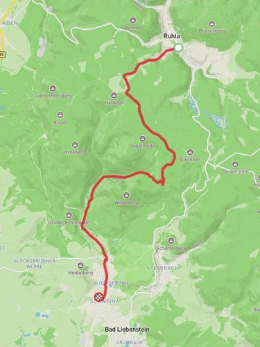
Starting near Wartburgkreis, Germany, the Ringberg Walk is an engaging out-and-back trail that spans approximately 7 kilometers (4.35 miles) with an elevation gain of around 100 meters (328 feet). This medium-difficulty hike offers a blend of natural beauty and historical intrigue, making it a rewarding experience for those who embark on it.
### Getting There To reach the trailhead, you can either drive or use public transport. If you're driving, set your GPS to the vicinity of Wartburgkreis, specifically near the town of Eisenach, which is well-known for its historical significance. For those using public transport, Eisenach is accessible by train, and from there, local buses or taxis can take you closer to the trailhead.
### Trail Overview The trail begins near the base of the Ringberg, a modest yet picturesque hill. As you start your hike, you'll find yourself surrounded by dense forests, primarily composed of beech and oak trees. The initial part of the trail is relatively flat, making it an excellent warm-up for the more challenging sections ahead.
### Flora and Fauna As you progress, keep an eye out for the diverse flora and fauna. The forest is home to various bird species, including woodpeckers and songbirds. If you're lucky, you might even spot a deer or a fox. The underbrush is rich with ferns and wildflowers, particularly in the spring and summer months.
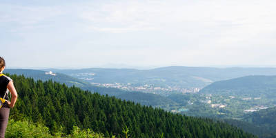
### Historical Significance Around the 2-kilometer (1.24-mile) mark, you'll come across a clearing that offers a panoramic view of the surrounding landscape. This area is historically significant as it was once a lookout point during medieval times. The Wartburg Castle, a UNESCO World Heritage Site, is visible in the distance. This castle is famous for its association with Martin Luther, who translated the New Testament into German while in hiding there.
### Mid-Trail Landmarks Continuing on, the trail begins to ascend more steeply. At approximately 3.5 kilometers (2.17 miles), you'll reach the highest point of the hike. Here, you'll find a small wooden bench where you can take a break and enjoy the view. The elevation gain of around 100 meters (328 feet) is most noticeable in this section, so take your time and stay hydrated.
### Navigation For navigation, it's highly recommended to use the HiiKER app, which provides detailed maps and real-time updates. The trail is well-marked, but having a reliable navigation tool can enhance your hiking experience and ensure you stay on the right path.
### Return Journey The return journey follows the same path, allowing you to revisit the scenic spots and perhaps notice details you missed on the way up. The descent is generally easier, but still, watch your footing, especially if the trail is wet or muddy.
### Practical Tips - Wear sturdy hiking boots, as the trail can be uneven in places. - Bring enough water and snacks, especially if you plan to take your time exploring. - Check the weather forecast before you go; the trail can be slippery after rain. - If you're hiking in the fall, be prepared for cooler temperatures and shorter daylight hours.
This hike offers a perfect blend of natural beauty, wildlife, and historical significance, making it a must-do for anyone visiting the Wartburgkreis region.
Reviews
User comments, reviews and discussions about the Ringberg Walk, Germany.
0.0
average rating out of 5
0 rating(s)


