9.5 km
~3 hrs 27 min
939 m
“Experience the 9 km Salz Alpen Steig and Staudach Loop for stunning Alpine views and rich history.”
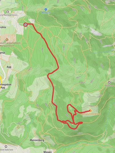
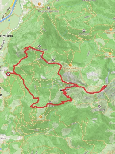
Starting near the charming town of Traunstein in Germany, this loop trail spans approximately 9 km (5.6 miles) with an elevation gain of around 900 meters (2,950 feet). The trailhead is conveniently located near Traunstein, making it accessible for both locals and visitors.
### Getting There To reach the trailhead, you can either drive or use public transportation. If you're driving, head towards Traunstein and look for parking options near the trailhead. For those using public transport, Traunstein is well-connected by train. From the Traunstein train station, you can take a local bus or taxi to the starting point of the trail.
### Trail Overview The Salz Alpen Steig and Staudach Loop is a medium-difficulty trail that offers a mix of natural beauty and historical significance. The trail is well-marked, but it's always a good idea to have a reliable navigation tool like HiiKER to ensure you stay on track.
### Key Landmarks and Sections
#### Initial Ascent The trail begins with a steady ascent through dense forests, offering a serene environment filled with the sounds of nature. As you climb, you'll gain approximately 300 meters (985 feet) in the first 2 km (1.2 miles). The forest is home to a variety of wildlife, including deer and numerous bird species, so keep your eyes peeled.
#### Midway Point: Scenic Views Around the 4 km (2.5 miles) mark, the trail opens up to a series of clearings that provide breathtaking views of the surrounding Alps. This is a great spot to take a break and soak in the panoramic vistas. The elevation gain at this point is about 600 meters (1,970 feet).
#### Historical Significance As you continue, you'll come across remnants of old salt mines, which are a testament to the region's historical significance in salt production. These mines date back to the medieval period and played a crucial role in the local economy. Informational plaques along the trail provide insights into the history and importance of these mines.
#### Final Descent The last section of the trail involves a descent back towards the trailhead. This part of the trail is less steep but requires careful footing, especially if the ground is wet. The descent covers the remaining 300 meters (985 feet) of elevation loss over the final 3 km (1.9 miles).
### Flora and Fauna The trail is rich in biodiversity. In the spring and summer months, you'll find a variety of wildflowers, including alpine roses and edelweiss. The forested areas are home to animals like foxes and badgers, and you might even spot a golden eagle soaring above the alpine meadows.
### Preparation Tips Given the elevation gain and the varied terrain, it's essential to wear sturdy hiking boots and bring trekking poles if you have them. Weather in the Alps can be unpredictable, so pack layers and a waterproof jacket. Ensure you have enough water and snacks, as there are no facilities along the trail.
### Navigation While the trail is well-marked, using a navigation tool like HiiKER can provide additional peace of mind. The app offers detailed maps and real-time tracking, which can be particularly useful in the more remote sections of the trail.
This loop trail offers a rewarding hike with a mix of natural beauty, historical landmarks, and challenging terrain, making it a must-visit for any hiking enthusiast exploring the Traunstein region.
Reviews
User comments, reviews and discussions about the Salz Alpen Steig and Staudach Loop, Germany.
0.0
average rating out of 5
0 rating(s)


