7.7 km
~2 hrs 37 min
650 m
“The Schnappenkirche Walk is an 8 km trail offering stunning views, rich history, and a rewarding challenge.”
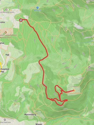
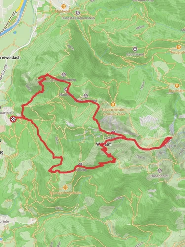
Starting near Traunstein, Germany, the Schnappenkirche Walk via Salzalpensteig is an 8 km (5 miles) out-and-back trail with an elevation gain of approximately 600 meters (1,968 feet). This medium-difficulty hike offers a blend of natural beauty, historical landmarks, and panoramic views, making it a rewarding experience for hikers.
### Getting There To reach the trailhead, you can either drive or use public transport. If driving, head towards Traunstein and look for parking options near the trailhead. For those using public transport, Traunstein is well-connected by train. From the Traunstein train station, you can take a local bus or taxi to the trailhead.
### Trail Overview The trail begins near Traunstein and quickly immerses you in the lush Bavarian landscape. The initial section is relatively gentle, allowing you to warm up as you walk through dense forests and meadows. As you progress, the trail becomes steeper, with switchbacks that help manage the elevation gain.
### Significant Landmarks - Salzalpensteig: This historic salt trail is a significant part of the route. Used for centuries to transport salt, the Salzalpensteig offers a glimpse into the region's rich history. Keep an eye out for old markers and remnants of the salt trade. - Schnappenkirche: The highlight of the hike is the Schnappenkirche, a small chapel perched on a hill. This chapel dates back to the 17th century and offers stunning views of the surrounding landscape. It's a perfect spot to take a break and soak in the scenery.
### Nature and Wildlife The trail is home to a variety of flora and fauna. In the spring and summer, wildflowers bloom along the path, adding vibrant colors to your hike. You might also spot deer, foxes, and a variety of bird species. The dense forest sections provide a cool, shaded respite, especially during the warmer months.
### Navigation For navigation, it's recommended to use HiiKER, which provides detailed maps and real-time updates. The trail is well-marked, but having a reliable navigation tool ensures you stay on track and can explore any interesting detours.
### Elevation and Terrain The total elevation gain of 600 meters (1,968 feet) is spread over the 8 km (5 miles) distance, making the ascent manageable for most hikers. The terrain varies from forest paths to rocky sections, so sturdy hiking boots are advisable. Trekking poles can also be helpful, especially on the steeper sections.
### Historical Significance The region around Traunstein has a rich history, particularly related to the salt trade. The Salzalpensteig was a crucial route for transporting salt from the Alps to other parts of Europe. Walking this trail, you are literally following in the footsteps of traders from centuries past.
### Final Stretch As you approach the Schnappenkirche, the trail levels out, offering a more relaxed walk to the chapel. The panoramic views from the top are breathtaking, providing a perfect reward for your efforts. After spending some time at the chapel, you can retrace your steps back to the trailhead, enjoying the downhill journey and the changing perspectives of the landscape.
This hike offers a perfect blend of natural beauty, historical intrigue, and physical challenge, making it a must-do for anyone visiting the Traunstein area.
Reviews
User comments, reviews and discussions about the Schnappenkirche Walk via Salzalpensteig, Germany.
0.0
average rating out of 5
0 rating(s)


