8.5 km
~2 hrs 6 min
237 m
“Explore the Gruensteroder Rundweg's 9 km of stunning nature, historic sites, and diverse wildlife.”
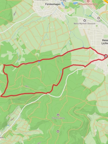
Starting near Schwalm-Eder-Kreis in Germany, the Gruensteroder Rundweg is a scenic loop trail that spans approximately 9 km (5.6 miles) with an elevation gain of around 200 meters (656 feet). This medium-difficulty trail offers a delightful mix of natural beauty, historical landmarks, and opportunities for wildlife observation.
### Getting There To reach the trailhead, you can either drive or use public transport. If driving, set your GPS to the vicinity of Schwalm-Eder-Kreis, specifically near the village of Gruensterode. For those using public transport, the nearest significant landmark is the town of Homberg (Efze). From Homberg, you can take a local bus or taxi to Gruensterode, which is a short distance away.
### Trail Navigation For navigation, it is highly recommended to use the HiiKER app, which provides detailed maps and real-time updates. The trail is well-marked, but having a reliable navigation tool will enhance your hiking experience.
### Trail Highlights #### Nature and Wildlife The trail meanders through a variety of landscapes, including dense forests, open meadows, and rolling hills. Keep an eye out for local wildlife such as deer, foxes, and a variety of bird species. The flora is equally diverse, with seasonal wildflowers adding splashes of color to the scenery.
#### Historical Significance One of the notable historical landmarks along the trail is the ancient watchtower ruins, located approximately 4 km (2.5 miles) into the hike. This tower dates back to the medieval period and offers a glimpse into the region's past. Another point of interest is the old mill near the 6 km (3.7 miles) mark, which has been partially restored and provides a picturesque spot for a rest.
### Elevation and Terrain The trail features a moderate elevation gain of around 200 meters (656 feet), making it accessible for most hikers with a reasonable level of fitness. The terrain varies from well-trodden paths to more rugged sections, so sturdy hiking boots are recommended. There are a few steep inclines, particularly around the 3 km (1.9 miles) and 7 km (4.3 miles) marks, but these are manageable with regular breaks.
### Points of Interest - Forest Canopy Walk: Around the 2 km (1.2 miles) mark, the trail passes through a dense forest where the canopy creates a natural tunnel. This section is particularly enchanting in the early morning when the sunlight filters through the leaves. - Panoramic Viewpoint: At approximately 5 km (3.1 miles), there is a clearing that offers panoramic views of the surrounding countryside. This is an ideal spot for a picnic or a photo opportunity. - Stream Crossings: The trail crosses several small streams, especially near the 8 km (5 miles) mark. These crossings are generally easy but can be slippery after rain, so caution is advised.
### Practical Tips - Water and Snacks: There are no facilities along the trail, so bring sufficient water and snacks. - Weather: Check the weather forecast before heading out, as conditions can change rapidly. - Leave No Trace: Ensure you carry out all trash and respect the natural environment.
By following these guidelines and using the HiiKER app for navigation, you can fully enjoy the beauty and history of the Gruensteroder Rundweg.
Reviews
User comments, reviews and discussions about the Gruensteroder Rundweg, Germany.
0.0
average rating out of 5
0 rating(s)


