10.1 km
~2 hrs 29 min
281 m
“Explore lush forests, panoramic views, and historical landmarks on Germany's scenic Höffe Rundweg A1 trail.”
Starting near the picturesque region of Rheinisch-Bergischer Kreis in Germany, this 10 km (approximately 6.2 miles) loop trail offers a delightful mix of natural beauty and moderate challenge, making it a perfect day hike for those looking to explore the German countryside. With an elevation gain of around 200 meters (656 feet), the Höffe Rundweg A1 provides a balanced workout without being overly strenuous.
### Getting There To reach the trailhead, you can either drive or use public transport. If driving, set your GPS to the nearest significant landmark, which is the town of Odenthal. There is ample parking available near the trailhead. For those using public transport, take a train to Bergisch Gladbach and then a bus to Odenthal. From there, it's a short walk to the starting point of the trail.
### Trail Navigation For navigation, it's highly recommended to use the HiiKER app, which provides detailed maps and real-time updates to ensure you stay on track. The trail is well-marked, but having a reliable navigation tool can enhance your hiking experience.
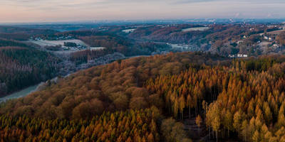
### Trail Highlights As you embark on the Höffe Rundweg A1, you'll be greeted by a lush landscape that changes with the seasons. The trail meanders through dense forests, open meadows, and along serene streams, offering a variety of scenery to enjoy.
#### Flora and Fauna The region is rich in biodiversity. Keep an eye out for native wildlife such as deer, foxes, and a variety of bird species. The flora is equally impressive, with oak, beech, and pine trees dominating the landscape. In spring and summer, the meadows burst into color with wildflowers, making it a photographer's paradise.
#### Historical Significance The Rheinisch-Bergischer Kreis area is steeped in history. Along the trail, you'll come across several historical landmarks, including remnants of old mills and traditional German farmhouses. These structures offer a glimpse into the region's past and its agricultural heritage.
### Key Sections of the Trail - First 2 km (1.2 miles): The initial stretch is relatively flat and takes you through a dense forest. This section is perfect for warming up and getting into the rhythm of the hike. - 2 km to 5 km (1.2 to 3.1 miles): The trail begins to ascend gradually, offering panoramic views of the surrounding countryside. This is where you'll gain most of the elevation, so take your time and enjoy the vistas. - 5 km to 8 km (3.1 to 5 miles): After reaching the highest point, the trail levels out and takes you through open meadows. This section is ideal for a picnic or a short rest. - Last 2 km (1.2 miles): The final stretch descends back into the forest, leading you back to the trailhead. This part of the trail is shaded and offers a cool, refreshing end to your hike.
### Practical Tips - Footwear: Given the mixed terrain, sturdy hiking boots are recommended. - Weather: Check the weather forecast before you go. The trail can be muddy after rain, so waterproof gear might be necessary. - Supplies: Bring enough water and snacks. There are no facilities along the trail, so be prepared. - Safety: Always let someone know your hiking plans and estimated return time.
The Höffe Rundweg A1 is a delightful trail that offers a bit of everything—natural beauty, historical landmarks, and a moderate challenge. Whether you're a seasoned hiker or a casual walker, this trail promises a rewarding experience.
Reviews
User comments, reviews and discussions about the Höffe Rundweg A1, Germany.
0.0
average rating out of 5
0 rating(s)


