Much to Hillesheim Loop via Kuttensiefen and Herrenteich
11.9 km
~2 hrs 42 min
201 m
“The Much to Hillesheim Loop is a scenic, medium-difficulty hike rich in natural beauty and history.”
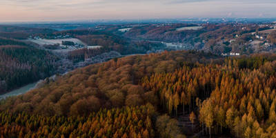
Starting near Rhein-Sieg-Kreis, Germany, the Much to Hillesheim Loop via Kuttensiefen and Herrenteich is a scenic 12 km (7.5 miles) loop trail with an elevation gain of approximately 200 meters (656 feet). This medium-difficulty trail offers a blend of natural beauty, historical landmarks, and diverse wildlife, making it a rewarding experience for hikers.
### Getting There To reach the trailhead, you can either drive or use public transport. If driving, set your GPS to Much, a town in the Rhein-Sieg-Kreis district. There are parking facilities available near the town center. For those using public transport, take a train to Siegburg/Bonn station and then a bus to Much. The bus services are frequent and reliable, making it convenient for hikers without a car.
### Trail Navigation For navigation, it is highly recommended to use the HiiKER app, which provides detailed maps and real-time updates. This will help you stay on track and ensure you don't miss any key points of interest.
### Key Sections and Landmarks
#### Kuttensiefen Starting from Much, the trail initially takes you through the picturesque village of Kuttensiefen. This area is known for its traditional half-timbered houses and serene countryside views. As you walk through, take a moment to appreciate the local architecture and the peaceful ambiance.
#### Herrenteich Continuing on, you'll reach Herrenteich, a small but beautiful pond surrounded by lush greenery. This is a great spot for a short break, where you can enjoy the tranquil water and perhaps spot some local wildlife, such as ducks and herons. The elevation gain here is gradual, making it a comfortable section of the hike.
#### Hillesheim The trail then leads you towards Hillesheim, a village with historical significance. Hillesheim is home to several old churches and buildings that date back to the medieval period. The village offers a glimpse into the region's rich history and cultural heritage. The elevation gain becomes more noticeable here, but the well-maintained paths make it manageable.
### Flora and Fauna The Much to Hillesheim Loop is rich in biodiversity. The trail passes through mixed forests, open meadows, and along small streams. Depending on the season, you might encounter a variety of wildflowers, including bluebells and daisies. Wildlife is abundant, with chances to see deer, foxes, and a variety of bird species.
### Historical Significance The region around Much and Hillesheim has a deep historical background. The area was once part of the Roman Empire, and remnants of Roman roads and settlements can still be found. During the medieval period, the region was a hub of activity, with many of the villages serving as important trade centers. The architecture and layout of these villages reflect their historical importance.
### Final Stretch As you loop back towards Much, the trail offers panoramic views of the surrounding countryside. The final stretch is relatively easy, with a gentle descent back into the town. This section is perfect for reflecting on the hike and enjoying the last bits of natural beauty the trail has to offer.
### Preparation Tips - Wear sturdy hiking boots, as some sections can be uneven. - Bring plenty of water and snacks, especially if hiking in warmer months. - Check the weather forecast and dress in layers. - Use the HiiKER app for navigation and updates on trail conditions.
This trail offers a perfect blend of natural beauty, historical landmarks, and a moderate challenge, making it an excellent choice for a day hike.
Reviews
User comments, reviews and discussions about the Much to Hillesheim Loop via Kuttensiefen and Herrenteich, Germany.
5.0
average rating out of 5
3 rating(s)


