9.9 km
~2 hrs 59 min
607 m
“The Fallmühle-Schwarzwandweg Loop offers a 10 km hike of scenic beauty, moderate challenge, and historical intrigue.”
Starting near Ostallgäu, Germany, the Fallmühle-Schwarzwandweg Loop is a captivating 10 km (6.2 miles) trail with an elevation gain of approximately 600 meters (1,968 feet). This loop trail is rated as medium difficulty, making it suitable for moderately experienced hikers.
### Getting There To reach the trailhead, you can drive or use public transportation. If driving, set your GPS to Fallmühle, a small settlement near Ostallgäu. For those using public transport, take a train to Füssen, the nearest major town, and then a local bus to Fallmühle. The bus ride offers scenic views of the Bavarian countryside, setting the stage for your hike.
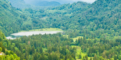
### Trail Overview The trail begins at Fallmühle, a picturesque area known for its traditional Bavarian architecture and serene landscapes. As you start your hike, you'll be greeted by lush meadows and dense forests, typical of the Allgäu region. The initial part of the trail is relatively flat, allowing you to warm up before the ascent begins.
### Ascent to Schwarzwand About 2 km (1.2 miles) into the hike, the trail starts to ascend more steeply. This section is characterized by a series of switchbacks that make the climb manageable. Keep an eye out for the diverse flora, including wildflowers and various species of ferns. The forest here is home to deer and a variety of bird species, so a pair of binoculars might come in handy.
### Midpoint: Schwarzwand Summit At around the 5 km (3.1 miles) mark, you'll reach the Schwarzwand summit. This is the highest point of the trail, offering panoramic views of the surrounding valleys and the distant Alps. It's an excellent spot for a break and some photography. The summit area has a few benches where you can rest and enjoy a packed lunch.
### Descent and Return The descent begins shortly after the summit and is less steep than the ascent, making it easier on the knees. This part of the trail takes you through more open areas, offering different perspectives of the landscape. You'll pass by several small streams and might even spot some local wildlife, such as foxes or hares.
### Historical Significance The region around Ostallgäu has a rich history, with evidence of human settlement dating back to the Roman era. The trail itself passes near several historical landmarks, including old farmhouses and remnants of medieval structures. These sites offer a glimpse into the area's past and add an educational element to your hike.
### Navigation and Safety Given the trail's moderate difficulty, it's advisable to use a reliable navigation tool like HiiKER to stay on track. The trail is well-marked, but having a digital map can be reassuring, especially in the denser forest sections. Wear sturdy hiking boots and bring plenty of water, as there are limited sources along the trail.
### Final Stretch The last 2 km (1.2 miles) of the trail bring you back to Fallmühle, completing the loop. This section is relatively flat and offers a relaxing end to your hike. As you approach the trailhead, you'll pass by more meadows and might even catch sight of some grazing cattle, a common sight in this agricultural region.
This trail offers a balanced mix of natural beauty, moderate physical challenge, and historical intrigue, making it a rewarding experience for any hiker.
Reviews
User comments, reviews and discussions about the Fallmühle-Schwarzwandweg Loop, Germany.
0.0
average rating out of 5
0 rating(s)


