11.2 km
~2 hrs 31 min
177 m
“Explore Oberbergischer Kreis's scenic 11 km loop trail, featuring stunning forests, historical landmarks, and panoramic views.”
Starting near the picturesque town of Oberbergischer Kreis in Germany, this 11 km (approximately 6.8 miles) loop trail offers a delightful mix of natural beauty and historical intrigue. With an elevation gain of around 100 meters (328 feet), the trail is rated as medium difficulty, making it accessible for most hikers with a moderate level of fitness.
### Getting There
To reach the trailhead, you can either drive or use public transport. If driving, set your GPS to the vicinity of Oberbergischer Kreis, and look for parking near the Heimatweg area. For those using public transport, take a train or bus to the nearest station in Oberbergischer Kreis and then a short taxi ride or local bus to the trailhead.
### Trail Navigation
For navigation, it’s highly recommended to use the HiiKER app, which provides detailed maps and real-time updates to ensure you stay on track.
### Trail Highlights
#### Initial Ascent and Forested Pathways
Starting from the trailhead, the first section of the trail takes you through dense, serene forests. The initial ascent is gentle, gaining about 50 meters (164 feet) in the first 2 km (1.2 miles). The forest is home to a variety of wildlife, including deer and numerous bird species, so keep your eyes peeled and your camera ready.
#### Neye Reservoir
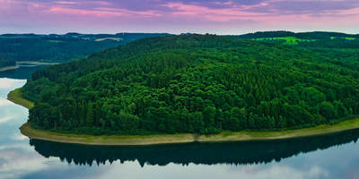
Around the 3 km (1.9 miles) mark, you’ll come across the Neye Reservoir, a significant landmark on this trail. This reservoir not only provides a stunning backdrop for photos but also serves as a habitat for various aquatic birds. Take a moment to enjoy the peaceful surroundings and perhaps have a snack by the water.
#### Historical Significance
As you continue, the trail will lead you past several historical markers and remnants of old settlements. This region has a rich history dating back to medieval times, and you may encounter old stone walls and foundations that tell the story of the area's past inhabitants. Around the 6 km (3.7 miles) point, you’ll find an information board detailing the history of the Heimatweg and its significance to the local community.
### Midway Point and Elevation Gain
The midway point of the trail is where you’ll experience the most elevation gain. Over the next 2 km (1.2 miles), you’ll ascend another 50 meters (164 feet). This section can be a bit challenging, but the well-maintained path and the surrounding natural beauty make it worthwhile.
### Open Meadows and Panoramic Views
Once you reach the highest point of the trail, you’ll be rewarded with open meadows and panoramic views of the surrounding countryside. This is an excellent spot for a rest and some photos. The landscape here is dotted with wildflowers in the spring and summer, adding a splash of color to your hike.
### Descent and Return Loop
The final 3 km (1.9 miles) of the trail take you on a gentle descent back towards the trailhead. This section is less forested and offers more open views, allowing you to see the rolling hills and farmlands that characterize this region of Germany.
### Practical Tips
- Footwear: Given the mixed terrain, sturdy hiking boots are recommended. - Weather: Check the weather forecast before you go, as the trail can become slippery in wet conditions. - Supplies: Bring enough water and snacks, as there are no facilities along the trail. - Wildlife: Be respectful of the local wildlife and maintain a safe distance.
This trail offers a perfect blend of natural beauty, moderate physical challenge, and historical interest, making it a rewarding experience for any hiker.
Reviews
User comments, reviews and discussions about the Neye via Heimatweg, Germany.
5.0
average rating out of 5
5 rating(s)


