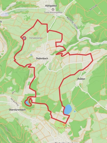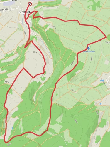
Steinerbueschelche, Schauinsland and Weiselstein via Osteifelweg
11.2 km
~2 hrs 47 min
329 m
“Explore Ahrweiler's 11 km trail for scenic views, historical sites, and a moderately challenging hike.”
Starting near the picturesque town of Ahrweiler in Germany, this 11 km (approximately 6.8 miles) loop trail offers a delightful mix of natural beauty, historical significance, and moderate physical challenge. With an elevation gain of around 300 meters (approximately 984 feet), hikers can expect a moderately challenging experience that rewards with stunning views and rich cultural heritage.
### Getting There To reach the trailhead, you can either drive or use public transport. If driving, set your GPS to Ahrweiler, a charming town known for its medieval architecture and vineyards. There is ample parking available near the trailhead. For those using public transport, Ahrweiler is well-connected by train. From the Ahrweiler train station, it's a short walk to the starting point of the trail.
### Trail Highlights #### Steinerbueschelche The trail begins with a gentle ascent through lush forests, leading you to the Steinerbueschelche. This section is characterized by dense woodland and a variety of native flora. Keep an eye out for local wildlife such as deer and various bird species. The forest canopy provides ample shade, making this part of the hike particularly pleasant during warmer months.
#### Schauinsland As you continue, you'll reach the Schauinsland area, which offers panoramic views of the surrounding Eifel region. This is a great spot to take a break and soak in the scenery. The elevation gain here is gradual but steady, so pace yourself and enjoy the journey. The open landscape is dotted with wildflowers in the spring and summer, adding a splash of color to your hike.
#### Weiselstein The trail then leads you to Weiselstein, a notable geological formation that stands as a testament to the region's volcanic history. The rocky outcrop provides a unique vantage point and is a popular spot for photography. The terrain here can be a bit rugged, so sturdy hiking boots are recommended.
### Historical Significance The Osteifelweg, part of which this trail follows, is steeped in history. The Eifel region has been inhabited since Roman times, and remnants of ancient settlements can still be found. Ahrweiler itself is a historical gem, with its well-preserved medieval walls and gates. As you hike, you'll pass by several markers and plaques that provide insights into the area's rich past.
### Navigation and Safety For navigation, the HiiKER app is highly recommended. It provides detailed maps and real-time updates, ensuring you stay on the right path. The trail is well-marked, but having a reliable navigation tool adds an extra layer of security.
### Flora and Fauna The trail traverses a variety of ecosystems, from dense forests to open meadows. In the spring, the forest floor is carpeted with wildflowers, while autumn brings a stunning display of fall foliage. Wildlife is abundant, with opportunities to spot deer, foxes, and a variety of bird species. Always respect the natural habitat and maintain a safe distance from any wildlife you encounter.
### Practical Tips - Wear sturdy hiking boots with good ankle support. - Bring plenty of water and snacks, as there are limited facilities along the trail. - Check the weather forecast before you go, as conditions can change rapidly. - A lightweight rain jacket is advisable, especially in the spring and fall.
This trail offers a perfect blend of natural beauty, moderate physical challenge, and historical intrigue, making it a rewarding experience for hikers of all levels.
Reviews
User comments, reviews and discussions about the Steinerbueschelche, Schauinsland and Weiselstein via Osteifelweg, Germany.
5.0
average rating out of 5
3 rating(s)


