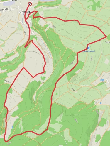
9.2 km
~2 hrs 9 min
187 m
“Explore Ahrweiler's scenic landscapes, historical sites, and diverse wildlife on this 9-km loop trail.”
Starting near the picturesque town of Ahrweiler in Germany, this loop trail spans approximately 9 kilometers (5.6 miles) with an elevation gain of around 100 meters (328 feet). The trailhead is conveniently located near Ahrweiler, which is accessible by both car and public transport. If you're driving, you can park near the Ahrweiler train station. For those using public transport, Ahrweiler is well-connected by regional trains and buses, making it an easy starting point for your hike.
### Initial Ascent and Graberfeld
The trail begins with a gentle ascent, leading you through lush forests and open fields. As you make your way up, you'll come across the Graberfeld, an ancient burial ground that offers a glimpse into the region's rich history. This area is particularly fascinating for history buffs, as it dates back to the Roman era. The terrain here is relatively easy, making it a good warm-up for the rest of the hike.
### Breitekopf Summit
Continuing on, you'll reach the Breitekopf, the highest point of the trail. The elevation gain here is gradual, making it accessible for hikers of all skill levels. At the summit, you'll be rewarded with panoramic views of the surrounding Eifel region. This is a great spot to take a break, enjoy a snack, and soak in the natural beauty. The Breitekopf is also a popular spot for birdwatching, so keep your eyes peeled for local species.
### Eifel Ardennen Straße
Descending from Breitekopf, the trail leads you to the Eifel Ardennen Straße, a historic road that has been used for centuries. This section of the trail is relatively flat and easy to navigate. Along the way, you'll pass through charming villages and scenic landscapes that are characteristic of the Eifel region. The road itself has historical significance, having been a crucial route for trade and travel in the past.
### Flora and Fauna
The trail is rich in biodiversity, offering a variety of flora and fauna. Depending on the season, you might encounter wildflowers, mushrooms, and a range of wildlife including deer, foxes, and various bird species. The forested areas are particularly dense, providing ample shade and a cool environment even during the warmer months.
### Navigation and Safety
For navigation, it's highly recommended to use the HiiKER app, which provides detailed maps and real-time updates. The trail is well-marked, but having a reliable navigation tool will ensure you stay on track. Make sure to wear sturdy hiking boots, as some sections can be muddy or slippery, especially after rain.
### Return to Ahrweiler
As you complete the loop and head back towards Ahrweiler, you'll pass through more open fields and vineyards, offering a different but equally beautiful landscape. The final stretch is relatively easy, allowing you to wind down and reflect on the hike. Once back in Ahrweiler, you can explore the town's historic sites, enjoy local cuisine, or simply relax and take in the charming atmosphere.
This trail offers a perfect blend of natural beauty, historical significance, and moderate physical challenge, making it an ideal choice for a day hike.
Reviews
User comments, reviews and discussions about the Graberfeld, Breitekopf and Eifel Ardennen Straße Loop, Germany.
5.0
average rating out of 5
3 rating(s)


