Seven Shires Way trail stages
stage 1
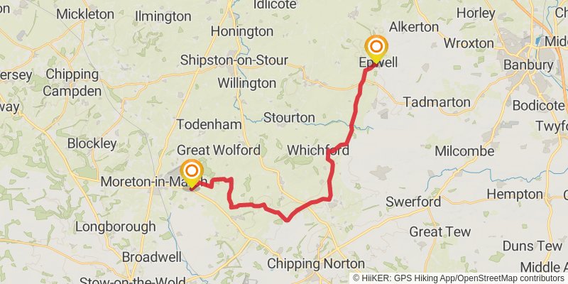
Ending at: Epwell, Cherwell, Oxfordshire, OX15 6LD
Distance: 24.4 km
Elevation gain: 390 m
Duration: 05:32:07
stage 2
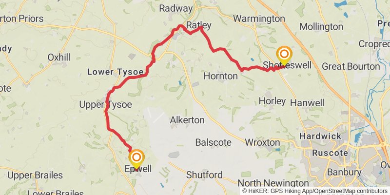
Starting at: Epwell, Cherwell, Oxfordshire, OX15 6LB
Ending at: Stratford-on-Avon, Warwickshire, OX17 1HS
Distance: 17.1 km
Elevation gain: 331 m
Duration: 03:58:50
stage 3
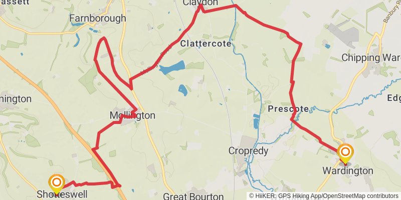
Ending at: Wardington, Cherwell, Oxfordshire, OX17 1RU
Distance: 17.4 km
Elevation gain: 226 m
Duration: 03:51:47
stage 4
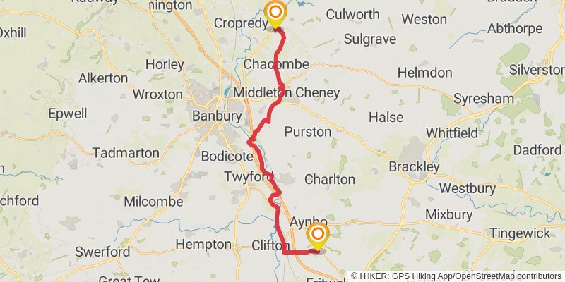
Starting at: Wardington, Cherwell, Oxfordshire, OX17 1RU
Ending at: Cherwell, Oxfordshire, OX27 7JJ
Distance: 21.9 km
Elevation gain: 173 m
Duration: 04:40:08
stage 5
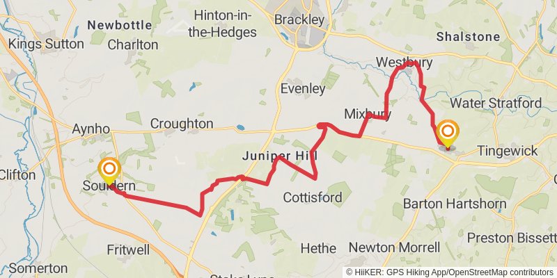
Starting at: Souldern, Cherwell, Oxfordshire, OX27 7JJ
Ending at: Crossroads, Cherwell, Oxfordshire, MK18 4BG
Distance: 20.3 km
Elevation gain: 158 m
Duration: 04:19:09
stage 6
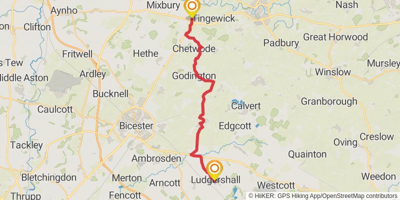
Starting at: Finmere, Cherwell, Oxfordshire, MK18 4BG
Ending at: Ludgershall, Buckinghamshire, HP18 9PE
Distance: 21.5 km
Elevation gain: 95 m
Duration: 04:27:14
stage 7
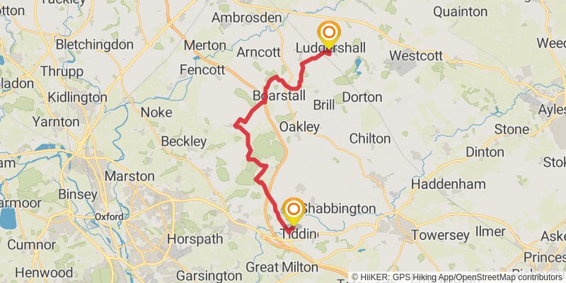
Starting at: Ludgershall, Buckinghamshire, HP18 9PE
Ending at: South Oxfordshire, Oxfordshire, OX33 1JT
Distance: 21.5 km
Elevation gain: 232 m
Duration: 04:41:16
stage 8
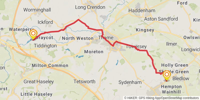
Starting at: Waterstock, South Oxfordshire, Oxfordshire, OX33 1JT
Distance: 17.7 km
Elevation gain: 116 m
Duration: 03:43:34
stage 9
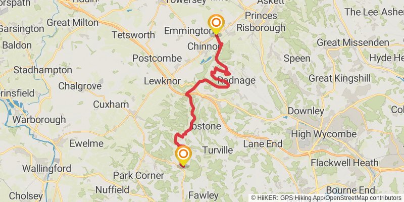
Starting at: Chinnor, South Oxfordshire, Oxfordshire, OX39 4AQ
Ending at: South Oxfordshire, Buckinghamshire, RG9 6HQ
Distance: 23.7 km
Elevation gain: 508 m
Duration: 05:35:36
stage 10
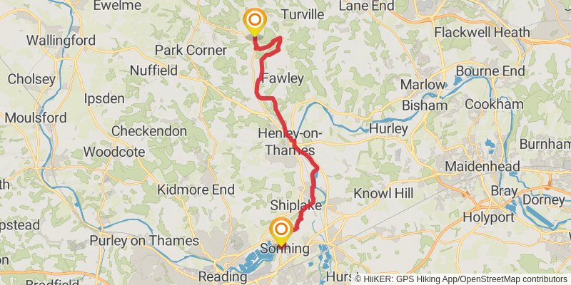
Ending at: Sonning, Borough of Wokingham, RG4 6UT
Distance: 21.4 km
Elevation gain: 251 m
Duration: 04:42:22
stage 11
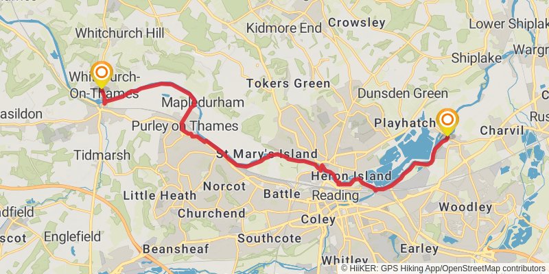
Starting at: Sonning, Borough of Wokingham, RG4 6UT
Ending at: South Oxfordshire, Oxfordshire, RG8 7EP
Distance: 17.3 km
Elevation gain: 113 m
Duration: 03:38:28
stage 12
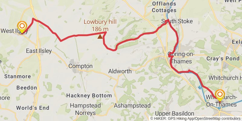
Ending at: West Ilsley, West Berkshire, RG20 7AL
Distance: 25.4 km
Elevation gain: 368 m
Duration: 05:41:48
stage 13
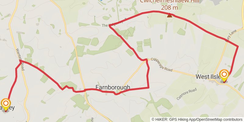
Starting at: West Ilsley, West Berkshire, RG20 7AL
Ending at: Fawley, West Berkshire, OX12 9YW
Distance: 18.0 km
Elevation gain: 245 m
Duration: 04:00:10
stage 14
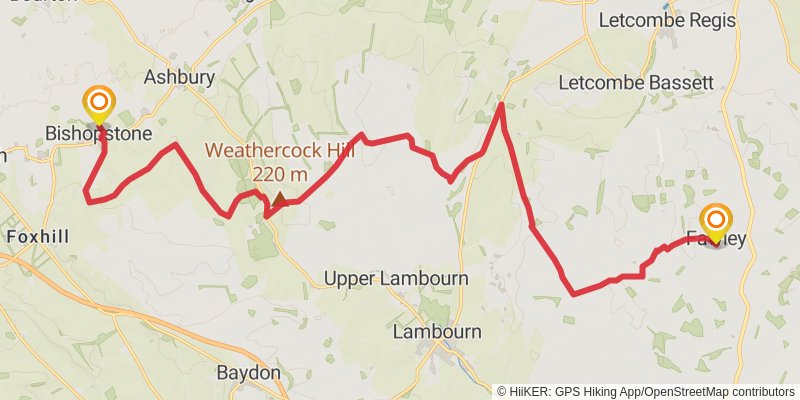
Starting at: Fawley, West Berkshire, OX12 9YW
Ending at: Bishopstone, Swindon, SN6 8PQ
Distance: 25.9 km
Elevation gain: 431 m
Duration: 05:53:54
stage 15
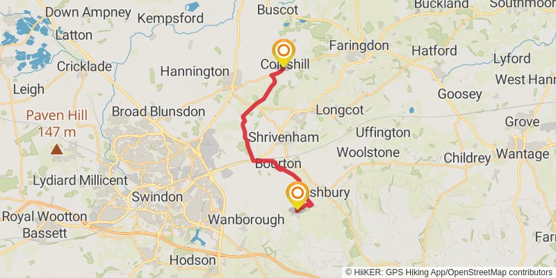
Starting at: Bishopstone, Swindon, SN6 8PQ
Ending at: Vale of White Horse, Oxfordshire, SN6 7PR
Distance: 15.8 km
Elevation gain: 124 m
Duration: 03:22:15
stage 16
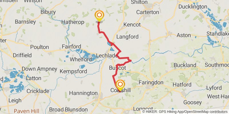
Starting at: Coleshill, Vale of White Horse, Oxfordshire, SN6 7PR
Distance: 19.5 km
Elevation gain: 106 m
Duration: 04:04:41
stage 17
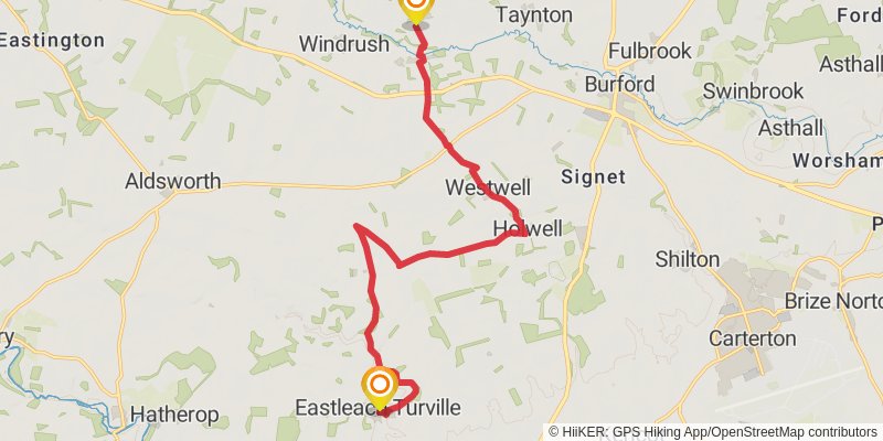
Ending at: Cotswold, Gloucestershire, OX18 4UR
Distance: 15.4 km
Elevation gain: 199 m
Duration: 03:25:04
stage 18
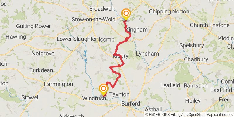
Ending at: Cotswold, Gloucestershire, GL56 0YQ
Distance: 22.2 km
Elevation gain: 302 m
Duration: 04:56:06
stage 19
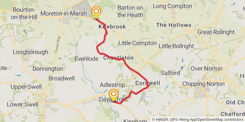
Starting at: Daylesford, Cotswold, Gloucestershire, GL56 0YQ
Ending at: Stratford-on-Avon, Warwickshire, GL56 0PF
Distance: 12.1 km
Elevation gain: 181 m
Duration: 02:43:02