End To End Trail trail stages
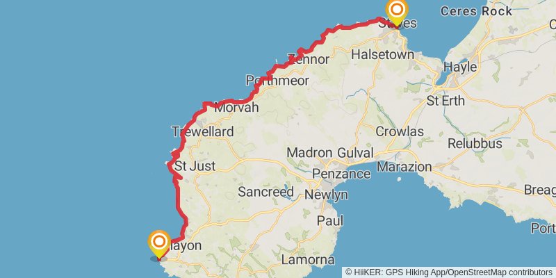
stage 1

Starting at: Sennen Cove, Cornwall, TR19 7AA
Distance: 35.2 km
Elevation gain: 1148 m
Duration: 08:56:37
stage 2

Starting at: Cornwall, TR26
Ending at: Portreath, Cornwall, TR16 4NL
Distance: 26.9 km
Elevation gain: 602 m
Duration: 06:23:03
stage 3

Starting at: Portreath, Cornwall, TR16 4NR
Distance: 12.7 km
Elevation gain: 433 m
Duration: 03:15:34
stage 4

Starting at: St. Agnes, Cornwall, TR5 0SA
Ending at: Newquay, Cornwall, TR7 1DJ
Distance: 24.4 km
Elevation gain: 623 m
Duration: 05:55:14
stage 5

stage 6

Starting at: Cornwall, PL28 8
Ending at: Port Isaac, Cornwall, PL29 3RZ
Distance: 19.9 km
Elevation gain: 282 m
Duration: 04:27:27
stage 7

Starting at: Port Isaac, Cornwall, PL29 3RZ
Ending at: Boscastle, Cornwall, PL35 0AQ
Distance: 20.4 km
Elevation gain: 1016 m
Duration: 05:46:58
stage 8

Starting at: Boscastle, Cornwall, PL35 0AD
Ending at: Bude Tennis Club, Bude, Cornwall, EX23 8LU
Distance: 26.2 km
Elevation gain: 1213 m
Duration: 07:15:52
stage 9

Starting at: Cornwall, EX23 8
Ending at: South Hole, Torridge, Devon, EX39 6HP
Distance: 18.3 km
Elevation gain: 1039 m
Duration: 05:23:59
stage 10

Starting at: Torridge, Devon, EX39 6HP
Ending at: Higher Clovelly, Torridge, Devon, EX39 5TL
Distance: 19.1 km
Elevation gain: 746 m
Duration: 05:03:29
stage 11

stage 12

Starting at: Torridge, Devon, EX39 2EZ
Ending at: North Devon, Devon, EX31 4TS
Distance: 36.2 km
Elevation gain: 699 m
Duration: 08:23:47
stage 13

Starting at: North Devon, Devon, EX31 4TT
Distance: 29.5 km
Elevation gain: 642 m
Duration: 06:58:38
stage 14

Distance: 18.9 km
Elevation gain: 460 m
Duration: 04:32:38
stage 15

Starting at: Somerset West and Taunton, Somerset, TA4 4JB
Distance: 30.1 km
Elevation gain: 599 m
Duration: 07:01:10
stage 16

Starting at: Eastover, Sedgemoor, Somerset, TA6 3BY
Ending at: Sedgemoor, Somerset, BS28 4NX
Distance: 21.4 km
Elevation gain: 91 m
Duration: 04:26:13
stage 17

Starting at: Sedgemoor, Somerset, BS28 4NL
Distance: 26.4 km
Elevation gain: 543 m
Duration: 06:11:37
stage 18

Starting at: Sandford, North Somerset, BS25 5RH
Ending at: Pill, North Somerset, BS20 0JB
Distance: 29.7 km
Elevation gain: 338 m
Duration: 06:29:48
stage 19

Starting at: Pill, North Somerset, BS20 0
Distance: 28.7 km
Elevation gain: 339 m
Duration: 06:18:33
stage 20

Starting at: Monmouthshire, NP16
Ending at: Ladbrokes, Monmouth, Monmouthshire, NP25 3EG
Distance: 28.4 km
Elevation gain: 898 m
Duration: 07:10:33
stage 21

Starting at: Monmouthshire, NP25
Ending at: Llanvetherine, Monmouthshire, NP7 8RD
Distance: 18.5 km
Elevation gain: 371 m
Duration: 04:18:49
stage 22

Starting at: Llanvetherine, Monmouthshire, NP7 8RD
Ending at: Herefordshire, HR2 0NF
Distance: 20.6 km
Elevation gain: 788 m
Duration: 05:25:48
stage 23

Starting at: Michaelchurch Escley, Herefordshire
Ending at: Gladestry, Powys, HR5 3PR
Distance: 28.8 km
Elevation gain: 567 m
Duration: 06:42:31
stage 24

Starting at: Gladestry, Powys, HR5 3NS
Ending at: LD7 233, Rhos-y-meirch, Powys, LD7 1NH
Distance: 25.5 km
Elevation gain: 878 m
Duration: 06:33:45
stage 25

stage 26

stage 27

Starting at: Shropshire, TF13 6LU
Ending at: Bell Inn, Tong, Shropshire, TF11 8PS
Distance: 24.6 km
Elevation gain: 301 m
Duration: 05:24:57
stage 28

stage 29

Starting at: South Staffordshire, Staffordshire, ST19 5DN
Ending at: East Staffordshire, Staffordshire, ST14 8XH
Distance: 36.6 km
Elevation gain: 395 m
Duration: 07:58:12
stage 30

Starting at: East Staffordshire, Staffordshire, ST14 8AQ
Distance: 22.4 km
Elevation gain: 456 m
Duration: 05:14:06