Download
3D Flyover
Add to list
More
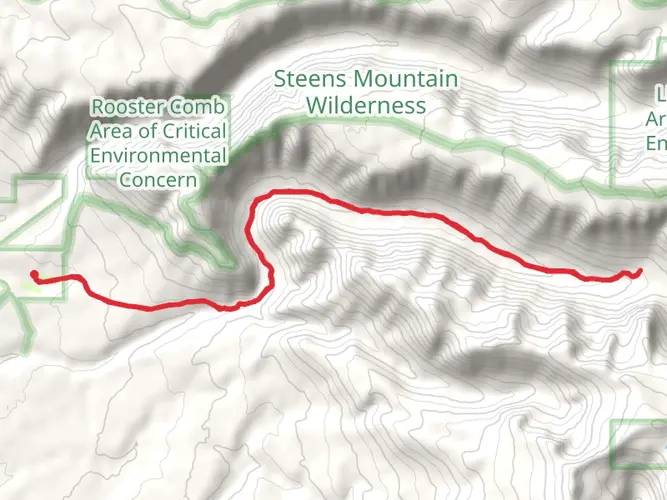
41.2 km
~2 days
1464 m
Multi-Day
“Trek the wild Pueblo Mountain Section for a rugged, solitary high-desert adventure.”
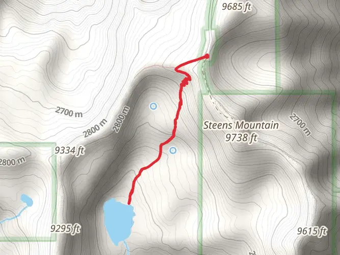
Embarking on the Oregon Desert Trail's Pueblo Mountain Section, hikers will traverse approximately 41 kilometers (25.5 miles) of rugged, high-desert landscape. This challenging point-to-point trail begins near Humboldt County, Oregon, and boasts an elevation gain of around 1400 meters (4593 feet), presenting a strenuous journey even for seasoned adventurers.
Getting to the Trailhead
To reach the starting point of the Pueblo Mountain Section, hikers can drive to the vicinity of Denio, Nevada, which is the nearest community to the trailhead. From Denio, travel north on Fields-Denio Road, which eventually turns into a gravel road leading towards the Oregon border. The trailhead is located just across the state line in Oregon, near the base of the Pueblo Mountains. Public transportation options are limited in this remote area, so a personal vehicle or a rented car is the most feasible way to access the trail.
Navigating the Trail
The Oregon Desert Trail is known for its remoteness and lack of established trail markers, so hikers should be well-versed in navigation. HiiKER is an invaluable tool for this purpose, offering detailed maps and GPS coordinates to help keep you on track. Be sure to download the necessary maps for offline use, as cell service is unreliable in this area.
Landmarks and Natural Features
As you begin your hike, the Pueblo Mountains will loom on the horizon, a stunning backdrop to the sagebrush and juniper-dotted landscape. The trail meanders through a variety of terrains, including rocky canyons, rolling hills, and flat basins. Around the 10-kilometer (6.2-mile) mark, you'll encounter a series of small creeks, which can be a welcome sight in the arid environment, though water flow can be seasonal and unreliable.
The halfway point of the trail offers a panoramic view of the surrounding desert, with opportunities to spot wildlife such as pronghorn antelope, mule deer, and various raptors soaring above. The flora and fauna here are well-adapted to the harsh conditions, and hikers will witness a unique ecosystem that thrives under extreme temperatures and limited water.
Historical Significance
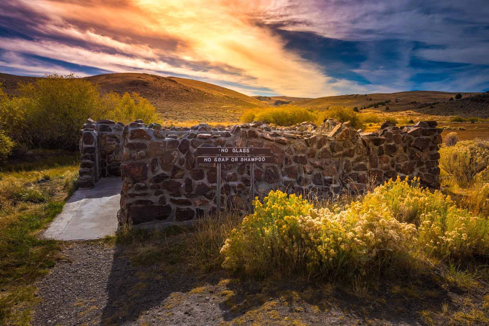
The region holds a rich tapestry of history, with evidence of Native American presence dating back thousands of years. The landscape has also seen its share of pioneers and settlers during the westward expansion. As you hike, you may come across old mining sites, remnants of homesteads, and other historical artifacts that tell the story of human perseverance in this challenging environment.
Preparation and Safety
Given the trail's difficulty and isolation, hikers should be self-sufficient and well-prepared. Carry plenty of water, as sources along the trail are scarce and often not potable without treatment. Be ready for rapid weather changes and pack appropriate gear for both hot days and cold nights. It's also wise to inform someone of your itinerary and expected return time due to the remote nature of the trail.
Remember, the Oregon Desert Trail's Pueblo Mountain Section is a test of endurance and self-reliance, offering a profound sense of solitude and connection with the wild. With careful planning and respect for the desert's harsh beauty, this trail can provide an unforgettable adventure.

What to expect?
Frequently asked questions
How long is the Oregon Desert Trail - Pueblo Mountain Section and how hard is it?
The Oregon Desert Trail - Pueblo Mountain Section is 41.24 km, or about 25.6 miles, with 1,464 meters of climbing. It is a difficult multi-day point-to-point route, and the combination of distance, elevation gain, high-desert exposure, and remote terrain makes it better suited to experienced backpackers.
Where do hikers usually start the Oregon Desert Trail - Pueblo Mountain Section near Denio?
Access to the Oregon Desert Trail - Pueblo Mountain Section is typically approached from the Denio and Fields corridor along the county road between Fields, Oregon, and Denio, Nevada. The Pueblo Mountains Wilderness Study Area lies west of that road, and common access points into the range include primitive roads near Denio Cemetery and routes on the north side near Sesena Creek.
Is the Oregon Desert Trail - Pueblo Mountain Section a marked trail or a navigation-heavy route?
The Oregon Desert Trail - Pueblo Mountain Section is a navigation-heavy route rather than a fully built, signed trail. In the Pueblo Mountains, there are no defined hiking trails through much of the range, though some large cairns can be found near the crest, so strong map, compass, and GPS skills are important on this section.
What is the best time of year to hike the Oregon Desert Trail - Pueblo Mountain Section?
Spring and fall are generally the best seasons for the Oregon Desert Trail - Pueblo Mountain Section. The Pueblo Mountains are high enough for lingering snow in colder months, while summer can be very hot with little shade, so shoulder-season conditions are usually more manageable for a 41.24 km difficult backpacking route.
What landmarks and high points are on the Oregon Desert Trail - Pueblo Mountain Section?
The standout landmark on the Oregon Desert Trail - Pueblo Mountain Section is Pueblo Mountain, which reaches 8,634 feet and is the second-highest peak in southeastern Oregon. The broader Pueblo Mountains ridgeline averages around 7,300 feet and gives this section its big elevation profile, wide basin views, and rugged fault-block terrain.
Is parking available for the Oregon Desert Trail - Pueblo Mountain Section?
Parking for the Oregon Desert Trail - Pueblo Mountain Section is informal rather than a developed trailhead lot. On the south side of the range, hikers commonly park at the entrance near Denio Cemetery, while other access points use primitive roads off the Fields-Denio corridor, so a high-clearance vehicle can be helpful depending on conditions.
Are there any tricky sections on the Oregon Desert Trail - Pueblo Mountain Section?
Yes. One of the known problem areas on the Oregon Desert Trail - Pueblo Mountain Section has been the Denio Canyon approach, where dense willow growth has made travel slow and frustrating. A commonly noted alternative is the unnamed canyon just north of Denio Canyon, which adds roughly 1,500 feet of climbing but offers easier passage into the range.
Comments and Reviews
User comments, reviews and discussions about the Oregon Desert Trail - Pueblo Mountain Section, Oregon.
4.67
average rating out of 5
9 rating(s)