Download
3D Flyover
Add to list
More
32.5 km
~6 hrs 48 min
186 m
Multi-Day
“Embark on Connecticut's historic Hop River State Park Trail, a scenic and moderately challenging 20-mile hiking adventure.”
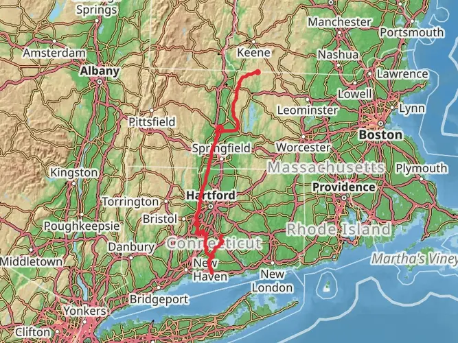
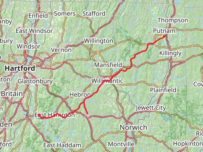
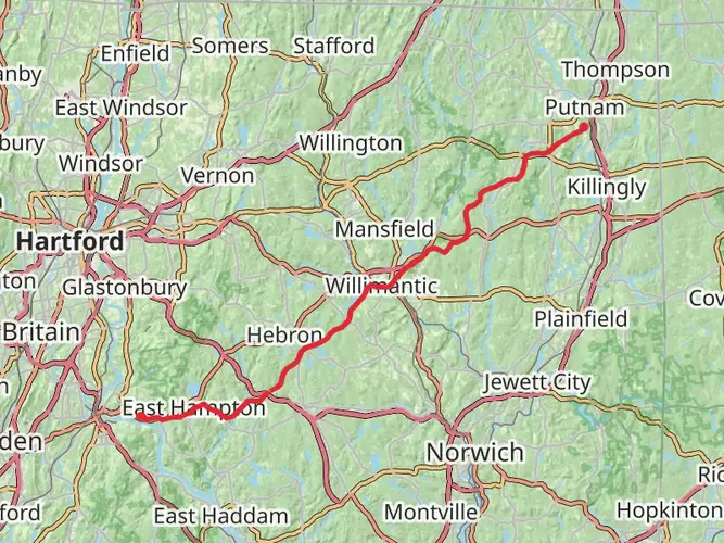
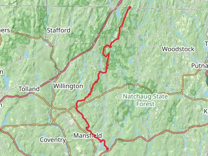
The Hop River State Park Trail, stretching approximately 20 miles (32 kilometers) with an elevation gain of around 328 feet (100 meters), offers an immersive experience through the scenic landscapes near Hartford County, Connecticut. This point-to-point trail is rated as medium difficulty, making it accessible to hikers with some experience looking for a day-long adventure.
Getting to the Trailhead
To reach the starting point of the trail, hikers can drive to Colonial Drive and Parker Street in Manchester, near Hartford, which is the nearest significant landmark to the trailhead coordinates. For those opting for public transportation, the area is serviced by local bus routes that get you close to the trailhead, where a short walk will lead you to the beginning of your journey.
Navigating the Trail
As you embark on the Hop River State Park Trail, you'll find that the path is well-maintained and marked, with HiiKER being an excellent tool for navigation and ensuring you stay on track. The trail is primarily crushed stone and dirt, making it suitable for both walking and biking.
Historical Significance and Landmarks
The trail itself is a converted rail trail, which once served as the Hartford, Providence, and Fishkill Railroad corridor. As you hike, you'll encounter remnants of Connecticut's industrial past, including old mill sites and railroad bridges that stand as historical landmarks along the route.
One of the most notable features is the 1373-foot-long (418-meter-long) Hop River State Park Trail Tunnel, which is an impressive structure hikers will pass through. The tunnel's cool, echoing passage offers a moment of reflection on the engineering feats of the past.
Natural Beauty and Wildlife
The trail meanders through dense forests, wetlands, and over streams, providing a habitat for a variety of wildlife. Keep an eye out for deer, beavers, and numerous bird species that call this area home. The changing seasons bring a dynamic backdrop to the trail, with vibrant autumn foliage and wildflowers in the spring and summer.
Preparation and Planning
Before setting out, ensure you have adequate water and snacks for the journey, as there are limited facilities along the trail. Dress in layers to adapt to changing weather conditions and wear sturdy footwear suitable for the mixed terrain. It's also wise to check the weather forecast and trail conditions, especially after heavy rains that may affect the trail's surface.
Conclusion
The Hop River State Park Trail offers a blend of historical intrigue, natural beauty, and a moderate challenge for hikers. With its convenient access and rich surroundings, it's a journey that invites exploration and appreciation of Connecticut's diverse landscapes.

What to expect?
Activity types
Frequently asked questions
How long is the Hop River State Park Trail and how hard is the full route?
The Hop River State Park Trail is about 32.49 km long, or roughly 20.2 miles, with around 186 m of total elevation gain. It is generally considered an easy rail-trail route because the grade stays gentle for most of the corridor, making the full point-to-point hike more about distance than steep climbing.
Where are the main parking areas for the Hop River State Park Trail?
Common access points for the Hop River State Park Trail include parking near Colonial Road in Manchester, Bolton Notch State Park at the junction of Route 44 and Route 6 in Bolton, and additional trail access farther east in Columbia. Connecticut state trail maps also show parking near Tunnel Road and Parker Bridge Road along the corridor.
Are dogs allowed on the Hop River State Park Trail?
Dogs are allowed on the Hop River State Park Trail, but they should be kept under control and, in places such as Columbia trail areas, on leash. That fits the trail’s shared-use character, since the route is also popular with walkers, runners, and cyclists across several towns.
What towns does the Hop River State Park Trail pass through in Connecticut?
The Hop River State Park Trail runs through Manchester, Vernon, Bolton, Coventry, Andover, and Columbia, following a former railroad corridor across eastern Connecticut. The route continues east toward the Willimantic area, where it connects into the broader regional trail network near the Willimantic River.
What is the surface like on the Hop River State Park Trail?
Most of the Hop River State Park Trail follows a former rail bed with a firm crushed-stone or stone-dust surface, plus some dirt sections. The easy grade and wide corridor make it one of the more approachable long trails in the Hartford County area for hiking, biking, and longer multi-use outings.
Does the Hop River State Park Trail go through the Bolton Notch tunnel?
Yes. One of the best-known features on the Hop River State Park Trail is the tunnel in Bolton Notch State Park, a roughly 400-foot railroad tunnel along the old line. Connecticut completed a lighting project there in late 2025, making this landmark section more accessible and easier to navigate.
What is the historic significance of the Hop River State Park Trail?
The Hop River State Park Trail follows the former Hartford, Providence and Fishkill Railroad corridor, a line completed in 1849. That rail history still shapes the hike today, with old railroad grades, bridge sites, and other remnants of Connecticut’s industrial era visible along the route.
Comments and Reviews
User comments, reviews and discussions about the Hop River State Park Trail, Connecticut.
4.5
average rating out of 5
1701 rating(s)