Download
3D Flyover
Add to list
More
349.1 km
~14 days
5770 m
Multi-Day
“Embark on the New England Trail, a historic and diverse trek through New England's picturesque wilderness.”
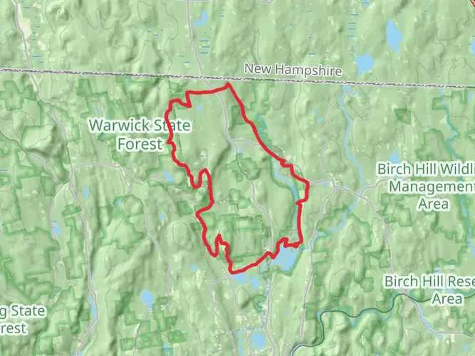
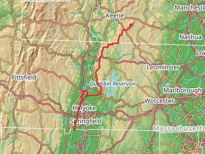
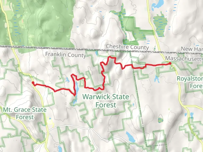
Spanning approximately 217 miles (349 km) and with an elevation gain of around 18,700 feet (5700 meters), the New England Trail offers a diverse hiking experience through the scenic landscapes of New England. The trail begins near the town of Guilford, Connecticut, close to the Long Island Sound, and traverses north through Connecticut and Massachusetts, culminating near the New Hampshire border.
Getting to the Trailhead
The southern terminus of the trail is accessible from the town of Guilford, Connecticut. If you're arriving by car, you can find parking near the trailhead at Chittenden Park, which is a short drive from the town center. For those relying on public transportation, Guilford can be reached by train from New Haven, where connections are available to New York City and other major cities. From the Guilford train station, the trailhead is a short taxi or bus ride away.
Trail Overview
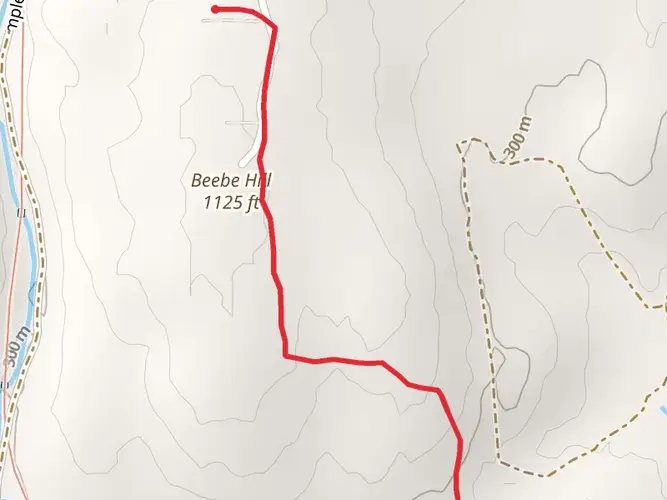
As you embark on your journey from the southern end, you'll be greeted by the coastal charm of Connecticut with its salt marshes and beach views. The trail quickly transitions into the wooded hills and ridges of the state. In the early miles, you'll ascend Bluff Head in Guilford, offering expansive views of the surrounding area.
Continuing north, the trail weaves through the Connecticut River Valley, where hikers can enjoy a mix of forested paths, streams, and occasional farmlands. The trail crosses notable peaks such as Mount Higby and Chauncey Peak, providing panoramic vistas.
Historical Significance and Landmarks
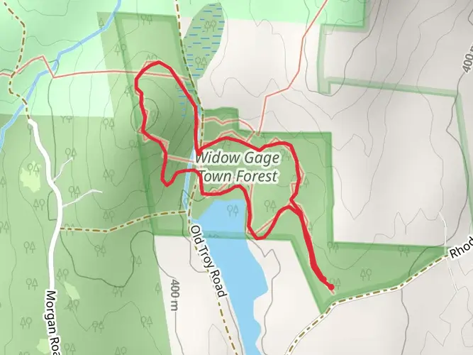
The New England Trail passes through a region rich in history. As you hike, you'll encounter colonial roads, historic landmarks, and Native American sites. The trail also intersects with the Metacomet-Monadnock Trail, which has been traveled for centuries and is steeped in the cultural heritage of the area.
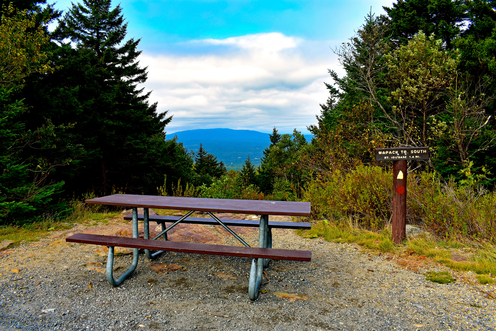
One of the historical highlights is the passage through the Holyoke Range, home to the famous Skinner State Park and the historic Prospect House. This area offers not only a glimpse into the past but also some of the most challenging and rewarding sections of the trail with steep ascents and descents.
Wildlife and Nature
The trail offers an opportunity to witness the diverse flora and fauna of New England. From hardwood forests to wetlands, the ecosystems along the trail support a variety of wildlife, including deer, beavers, and numerous bird species. During the fall, the trail is a popular destination for leaf-peeping as the foliage transforms into a vibrant display of autumn colors.
Navigation and Preparation
Hikers should prepare for a variety of terrain and weather conditions. The trail is well-marked, but carrying a detailed map or using a navigation app like HiiKER is recommended to stay on track. Be sure to pack sufficient water, food, and gear for the changing conditions, especially in the more remote sections where amenities are sparse.
Conclusion
The New England Trail is a journey through the heart of New England's natural beauty and historical tapestry. Whether you're seeking a multi-day adventure or a series of day hikes, this trail offers a unique experience for hikers of all levels. Remember to leave no trace and enjoy the rich landscapes and heritage that this trail embodies.

What to expect?
Activity types
Frequently asked questions
How long is the New England Trail and how many days does it usually take to hike?
The New England Trail is about 349.13 km, or roughly 217 miles, with around 5,770 m of climbing. Most hikers treat it as a multi-day route rather than a short backpacking trip, and a full end-to-end hike typically takes several weeks depending on pace, road-walk logistics, and overnight planning.
Where does the New England Trail start and finish?
The southern end of the New England Trail is at Chittenden Park in Guilford, Connecticut, on Long Island Sound. The route runs north through Connecticut and Massachusetts and ends at the Massachusetts–New Hampshire border near Royalston, so it does not continue as an official National Scenic Trail deep into New Hampshire.
Where can you park for the New England Trail in Guilford, Connecticut?
At the southern terminus, Chittenden Park in Guilford marks the start of the New England Trail. For longer parking tied to a thru-hike, trail guidance also notes parking near the Guilford Amtrak station, which is used by some hikers beginning at the Long Island Sound end of the route.
Is the New England Trail hard?
The New England Trail is generally rated medium difficulty, but the challenge adds up over its 349 km length and 5,770 m of elevation gain. The route includes rocky ridge walking, repeated climbs, and some road walks, with notable high-view sections on traprock ridges such as Bluff Head, Mount Higby, and Chauncey Peak.
Can you camp on the New England Trail?
Camping on the New England Trail is limited to designated overnight sites rather than open camping along the route. There are currently nine designated overnight sites, so end-to-end hikers usually need to plan each day carefully around legal camping options, town services, and road access.
Are dogs allowed on the New England Trail?
Dogs are allowed on much of the New England Trail, but they should be kept leashed because the route crosses many different public and private properties. There are also specific no-dog sections in Massachusetts, including Whiting Street Reservoir and Quabbin Reservoir, so pet access is not uniform across the full trail.
What is the best time of year to hike the New England Trail?
Spring and fall are usually the best seasons for the New England Trail because temperatures are more manageable and ridge sections are more comfortable than in peak summer heat. In spring, streams and waterfalls are often stronger, while fall brings clearer views and foliage across the traprock ridges and rural valleys of Connecticut and Massachusetts.
Comments and Reviews
User comments, reviews and discussions about the New England Trail, New Hampshire.
4.64
average rating out of 5
11 rating(s)