Ice Age National Scenic Trail trail stages
stage 61
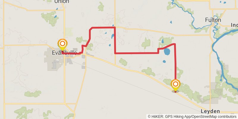
Starting at: Evansville, Rock County, 53536
Ending at: Center, Rock County, 53536
Distance: 20.4 km
Elevation gain: 83 m
Duration: 04:13:00
stage 62
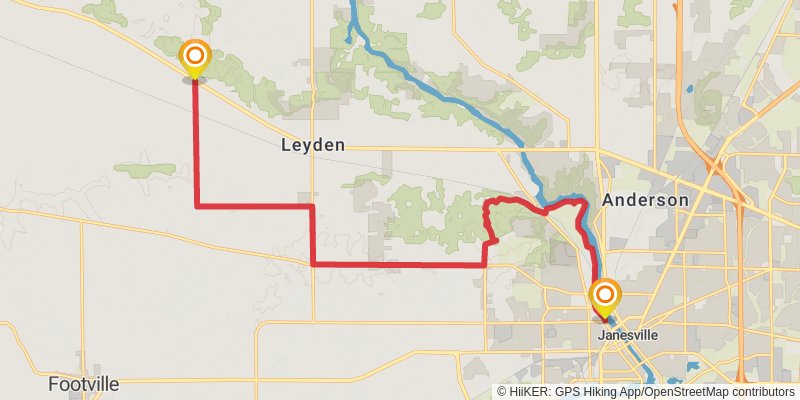
Starting at: Center, Rock County, 53536
Ending at: Janesville, Rock County, 53548
Distance: 22.5 km
Elevation gain: 209 m
Duration: 04:51:26
stage 63
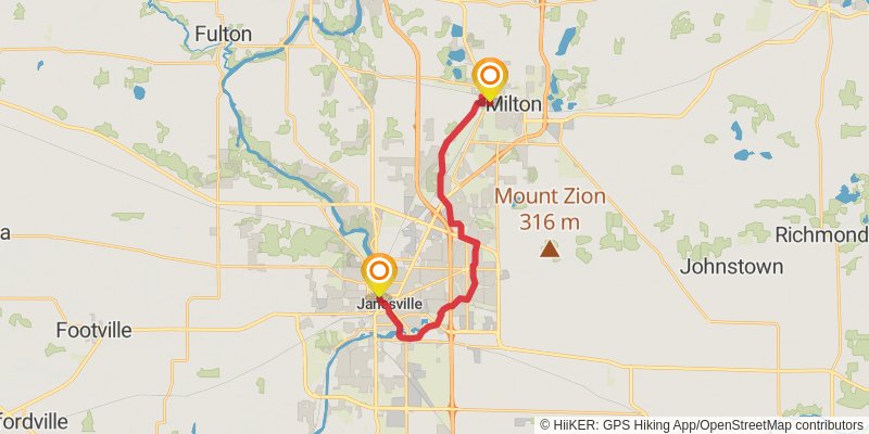
Starting at: Janesville, Rock County, 53548
Distance: 21.6 km
Elevation gain: 108 m
Duration: 04:30:23
stage 64
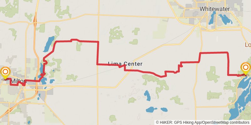
Starting at: Milton, Rock County, 53563
Ending at: Whitewater, Walworth County, 53190
Distance: 34.0 km
Elevation gain: 217 m
Duration: 07:10:15
stage 65
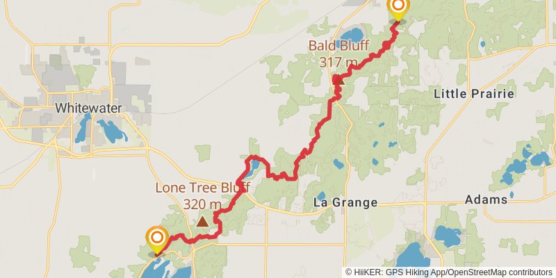
Starting at: Whitewater, Walworth County, 53190
Ending at: Palmyra, Jefferson County, 53156
Distance: 22.3 km
Elevation gain: 634 m
Duration: 05:31:08
stage 66

Starting at: Palmyra, Jefferson County, 53156
Ending at: Eagle, Waukesha County, 53119
Distance: 7.0 km
Elevation gain: 130 m
Duration: 01:37:35
stage 67
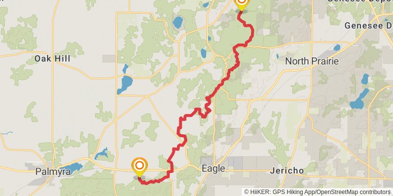
Starting at: Eagle, Waukesha County, 53119
Ending at: Dousman, Waukesha County, 53118
Distance: 18.8 km
Elevation gain: 315 m
Duration: 04:17:11
stage 68
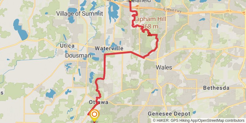
Starting at: Ottawa, Waukesha County, 53118
Ending at: Delafield, Waukesha County, 53018
Distance: 22.5 km
Elevation gain: 335 m
Duration: 05:03:07
stage 69
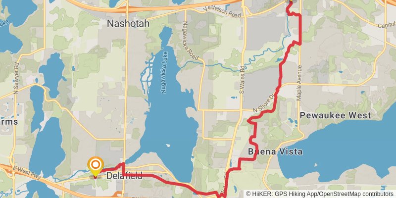
Starting at: Delafield, Waukesha County, 53018
Ending at: Hartland, Waukesha County, 53029
Distance: 12.8 km
Elevation gain: 154 m
Duration: 02:49:22
stage 70
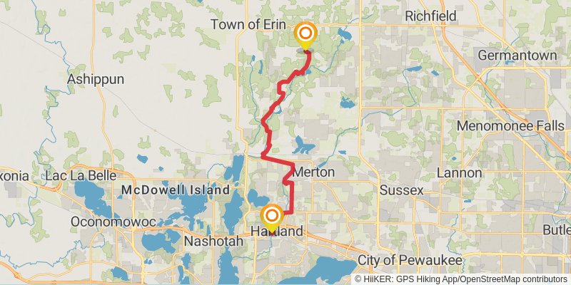
Starting at: Hartland, Waukesha County, 53029
Ending at: Erin, Washington County, 53027
Distance: 22.8 km
Elevation gain: 324 m
Duration: 05:05:41
stage 71
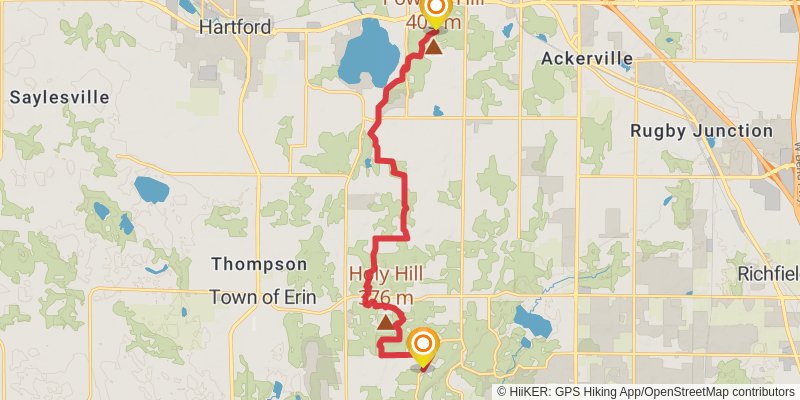
Starting at: Erin, Washington County, 53027
Ending at: Hartford, Washington County, 53027
Distance: 16.0 km
Elevation gain: 364 m
Duration: 03:48:59
stage 72
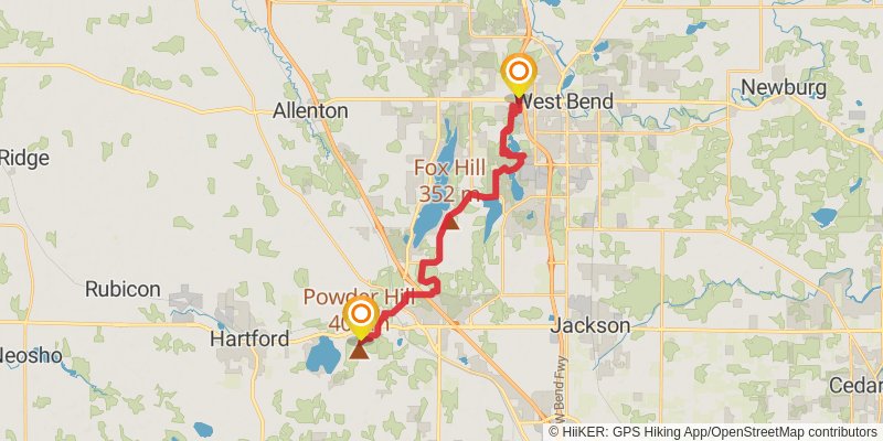
Starting at: Hartford, Washington County, 53027
Ending at: West Bend, Washington County, 53090
Distance: 23.4 km
Elevation gain: 322 m
Duration: 05:12:30
stage 73
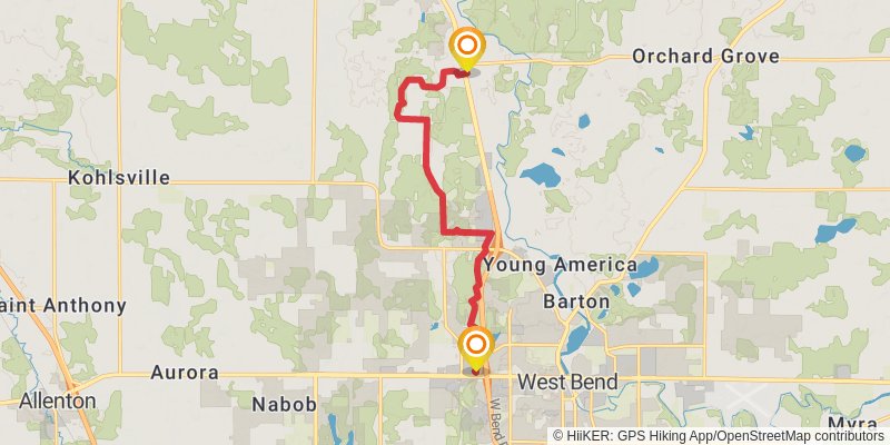
Starting at: West Bend, Washington County, 53090
Ending at: Kewaskum, Washington County, 53040
Distance: 12.2 km
Elevation gain: 207 m
Duration: 02:46:33
stage 74
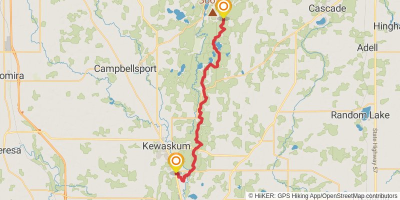
Starting at: Kewaskum, Washington County, 53040
Ending at: Mitchell, Sheboygan County, 53011
Distance: 26.9 km
Elevation gain: 593 m
Duration: 06:22:01
stage 75
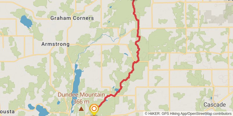
Starting at: Mitchell, Sheboygan County, 53011
Ending at: Town of Greenbush, Sheboygan County, 53023
Distance: 15.7 km
Elevation gain: 352 m
Duration: 03:43:02
stage 76
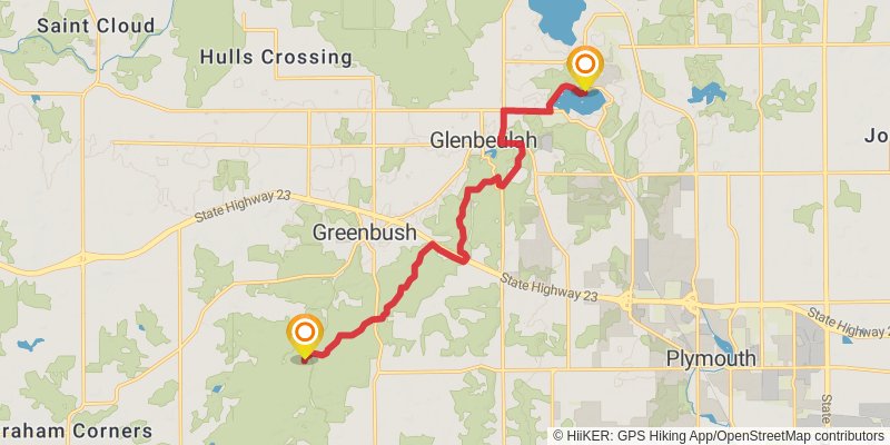
Starting at: Shelter, Greenbush, Sheboygan County, 53023
Ending at: Rhine, Sheboygan County, 53073
Distance: 14.2 km
Elevation gain: 278 m
Duration: 03:17:56
stage 77
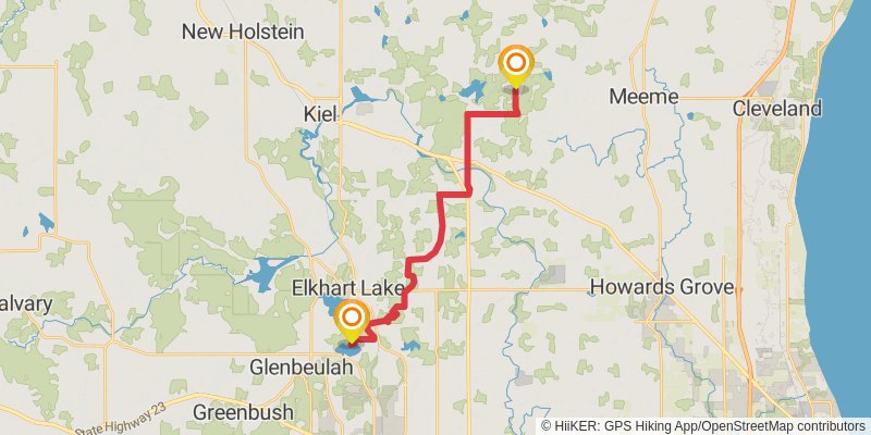
Starting at: Rhine, Sheboygan County, 53073
Ending at: Meeme, Manitowoc County, 53042
Distance: 23.7 km
Elevation gain: 282 m
Duration: 05:12:29
stage 78
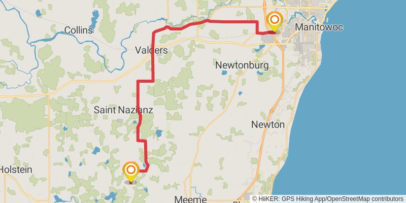
Starting at: Meeme, Manitowoc County, 53042
Ending at: Manitowoc Rapids, Manitowoc County, 54220
Distance: 36.1 km
Elevation gain: 159 m
Duration: 07:29:17
stage 79
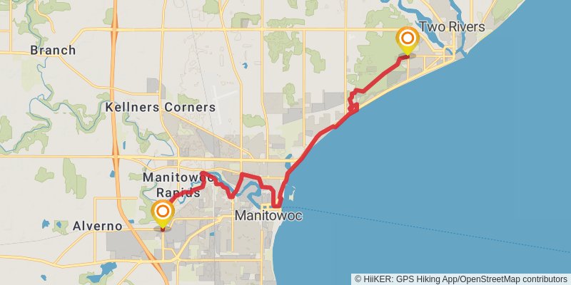
Starting at: Manitowoc, Manitowoc County, 54220
Ending at: Two Rivers, Manitowoc County, 54241
Distance: 17.6 km
Elevation gain: 94 m
Duration: 03:40:01
stage 80
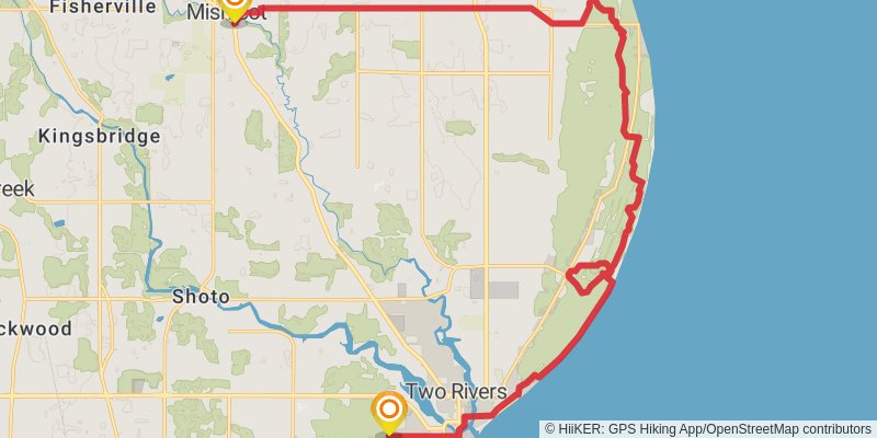
Starting at: Two Rivers, Manitowoc County, 54241
Ending at: Mishicot, Manitowoc County, 54228
Distance: 29.4 km
Elevation gain: 82 m
Duration: 06:00:54
stage 81
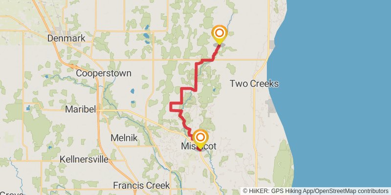
Starting at: Mishicot, Manitowoc County, 54228
Ending at: Carlton, Kewaunee County, 54216
Distance: 20.4 km
Elevation gain: 158 m
Duration: 04:20:56
stage 82
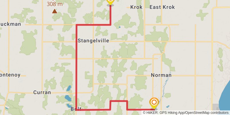
Starting at: Carlton, Kewaunee County, 54216
Ending at: Montpelier, Kewaunee County, 54216
Distance: 23.6 km
Elevation gain: 107 m
Duration: 04:53:22
stage 83
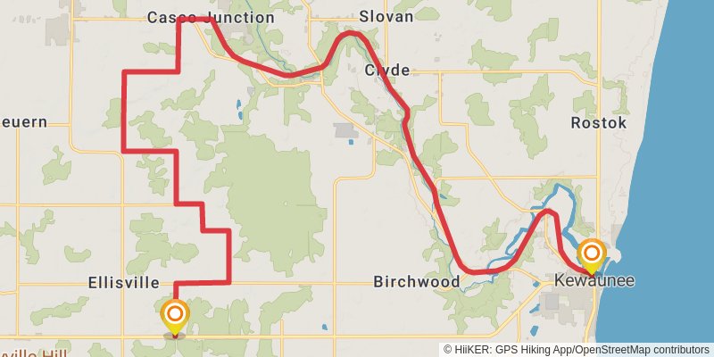
Starting at: Montpelier, Kewaunee County, 54216
Ending at: Kewaunee, Kewaunee County, 54216
Distance: 37.3 km
Elevation gain: 111 m
Duration: 07:38:33
stage 84
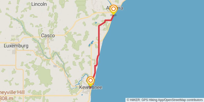
stage 85
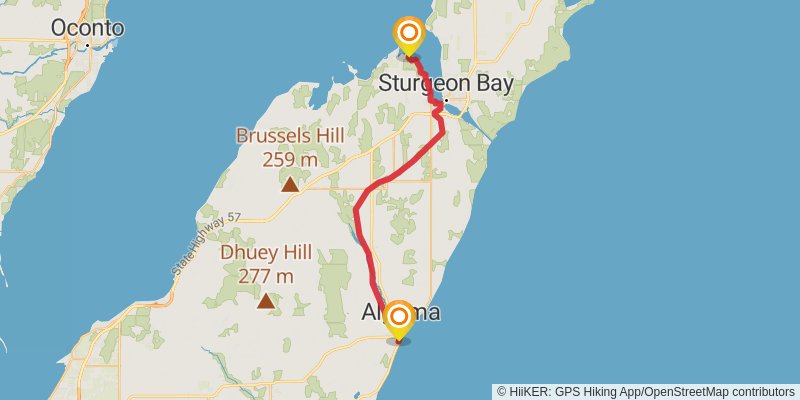
Starting at: Algoma, Kewaunee County, 54201
Ending at: Nasewaupee, Door County, 54235
Distance: 41.3 km
Elevation gain: 218 m
Duration: 08:37:38