South Climb, Burnt Rock Peak and Riley Camp Trail
24.7 km
~1 day 1 hrs
725 m
“Embark on a 25-kilometer journey through lush forests and stunning peaks, rich in beauty and history.”
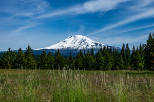
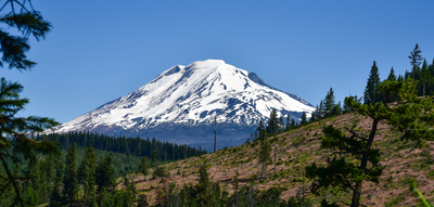
Starting near Yakima County, Washington, the South Climb, Burnt Rock Peak, and Riley Camp Trail is a point-to-point adventure spanning approximately 25 kilometers (15.5 miles) with an elevation gain of around 700 meters (2,300 feet). This medium-difficulty trail offers a diverse range of experiences, from lush forests to panoramic mountain views, making it a rewarding journey for prepared hikers.
### Getting There To reach the trailhead, you can drive or use public transportation. If driving, head towards Yakima County and look for the nearest significant landmark, which is the White Pass Ski Area. From there, follow the signs to the trailhead parking area. For those using public transport, buses from Yakima can take you to the White Pass Ski Area, where you can arrange a local shuttle or taxi to the trailhead.
### Trail Overview The trail begins with a gradual ascent through dense forest, offering a cool and shaded start. As you climb, you'll encounter a variety of flora, including Douglas firs and Western hemlocks. Keep an eye out for wildlife such as deer and the occasional black bear. The first 5 kilometers (3.1 miles) will see you gaining about 200 meters (656 feet) in elevation, making it a steady but manageable climb.
### Significant Landmarks Around the 8-kilometer (5-mile) mark, you'll reach Burnt Rock Peak. This section is more exposed, providing stunning views of the surrounding valleys and peaks. The terrain here becomes rockier, so sturdy hiking boots are recommended. The elevation gain to this point is approximately 400 meters (1,312 feet).
Continuing on, you'll descend slightly before the final push towards Riley Camp. This section of the trail is known for its historical significance, as it was once used by Native American tribes for hunting and gathering. Interpretive signs along the way provide insights into the rich cultural history of the area.
### Riley Camp At around 18 kilometers (11.2 miles), you'll arrive at Riley Camp, a great spot to rest and take in the serene environment. The camp is situated near a small creek, offering a reliable water source. From here, the trail continues with a moderate ascent, gaining another 300 meters (984 feet) over the next 7 kilometers (4.3 miles).
### Final Stretch The last section of the trail takes you through alpine meadows, where wildflowers bloom in abundance during the summer months. The trail eventually descends towards the endpoint, offering a gentle finish to your hike.
### Navigation and Safety For navigation, it's highly recommended to use the HiiKER app, which provides detailed maps and real-time updates. Always check weather conditions before setting out, as the higher elevations can experience sudden changes. Carry sufficient water, snacks, and a first-aid kit, and be prepared for a full day of hiking.
This trail offers a mix of natural beauty, historical significance, and physical challenge, making it a memorable experience for those who are well-prepared.
Reviews
User comments, reviews and discussions about the South Climb, Burnt Rock Peak and Riley Camp Trail, Washington.
5.0
average rating out of 5
3 rating(s)


