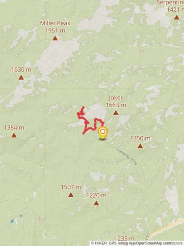
15.4 km
~4 hrs 39 min
951 m
“Embark on the Iron Bear via Teanaway Ridge Trail for a scenic, wildflower-strewn ascent through Washington's Cascades.”
The Iron Bear via Teanaway Ridge Trail is a moderately challenging hike that offers a rewarding journey through the central Cascades with expansive views and vibrant wildflowers during the right season. The trailhead is located near Kittitas County, Washington, and can be accessed by car. To reach the starting point, take Highway 97 from Cle Elum and turn onto the Teanaway Road, following it to the West Fork Teanaway Road, then to the North Fork Teanaway Road, and finally onto Forest Road 9714. The trailhead is at the end of this road.
Starting the Ascent
As you begin your hike, the trail will take you through a forested area, gradually ascending along the Teanaway Ridge. The initial few miles will introduce you to a mix of ponderosa pines and Douglas firs, with the underbrush providing a habitat for local wildlife. Keep an eye out for deer, elk, and various bird species that call this area home.
Gaining Elevation
After about 2.5 miles (4 km), you'll start to notice the elevation gain becoming more pronounced. The trail zigzags up the ridge, offering increasingly impressive views of the surrounding peaks and valleys. At this point, you've ascended roughly 1,500 feet (457 meters), and the landscape begins to open up, allowing for panoramic vistas.
Reaching the Ridge
Upon reaching the ridge, the trail flattens out somewhat, providing a respite from the steady climb. Here, at around 4,000 feet (1,219 meters) above sea level, the environment changes, with subalpine firs and mountain hemlocks dotting the landscape. The ridge walk is a highlight, with wildflowers such as lupines and Indian paintbrush adding splashes of color in the late spring and early summer.
The Final Push to Iron Bear
The last section of the trail involves a push to the summit of Iron Bear at around 5,500 feet (1,676 meters). This final ascent covers approximately 1.5 miles (2.4 km) and takes you through open meadows before reaching the peak. From the top, you'll be rewarded with a 360-degree view that includes Mount Rainier, Mount Stuart, and the Enchantments.
Historical Significance
The region holds historical significance, with the Teanaway area being a traditional gathering and hunting ground for the Native American tribes of the Yakama Nation. The name "Teanaway" itself is derived from a Native American word. As you hike, consider the long history of the land and its importance to the indigenous people.
Navigating the Trail
For navigation, HiiKER is a reliable tool to use on this trail. It will help you stay on track and provide real-time updates on your location. Remember that cell service can be spotty in the mountains, so downloading the trail map beforehand is advisable.
Return Journey
The return journey follows the same path back down to the trailhead. The descent will be quicker, but be mindful of your footing, as the loose rocks and dirt on the trail can be slippery.
Distance and Elevation
The round trip distance of the Iron Bear via Teanaway Ridge Trail is approximately 15 km (9.3 miles), with an elevation gain of around 900 meters (2,953 feet). The trail is rated as medium difficulty, making it accessible to hikers with a reasonable level of fitness.
Getting There
Public transport options are limited in this area, so arriving by car is the most feasible option. There is parking available at the trailhead, but it can fill up quickly during peak hiking season, so an early start is recommended.
Preparation
Before setting out, ensure you have adequate water, food, and layers for changing weather conditions. The trail can be exposed, so sun protection is also essential. Always leave a trip plan with someone and check the weather forecast before your hike.
Reviews
User comments, reviews and discussions about the Iron Bear via Teanaway Ridge Trail, Washington.
0.0
average rating out of 5
0 rating(s)


