Download
Preview
Add to list
More
23.0 km
~2 days
1034 m
Multi-Day
“Embark on the Teanaway Ridge Trail for a rewarding, panoramic hike through Washington's diverse wilderness.”
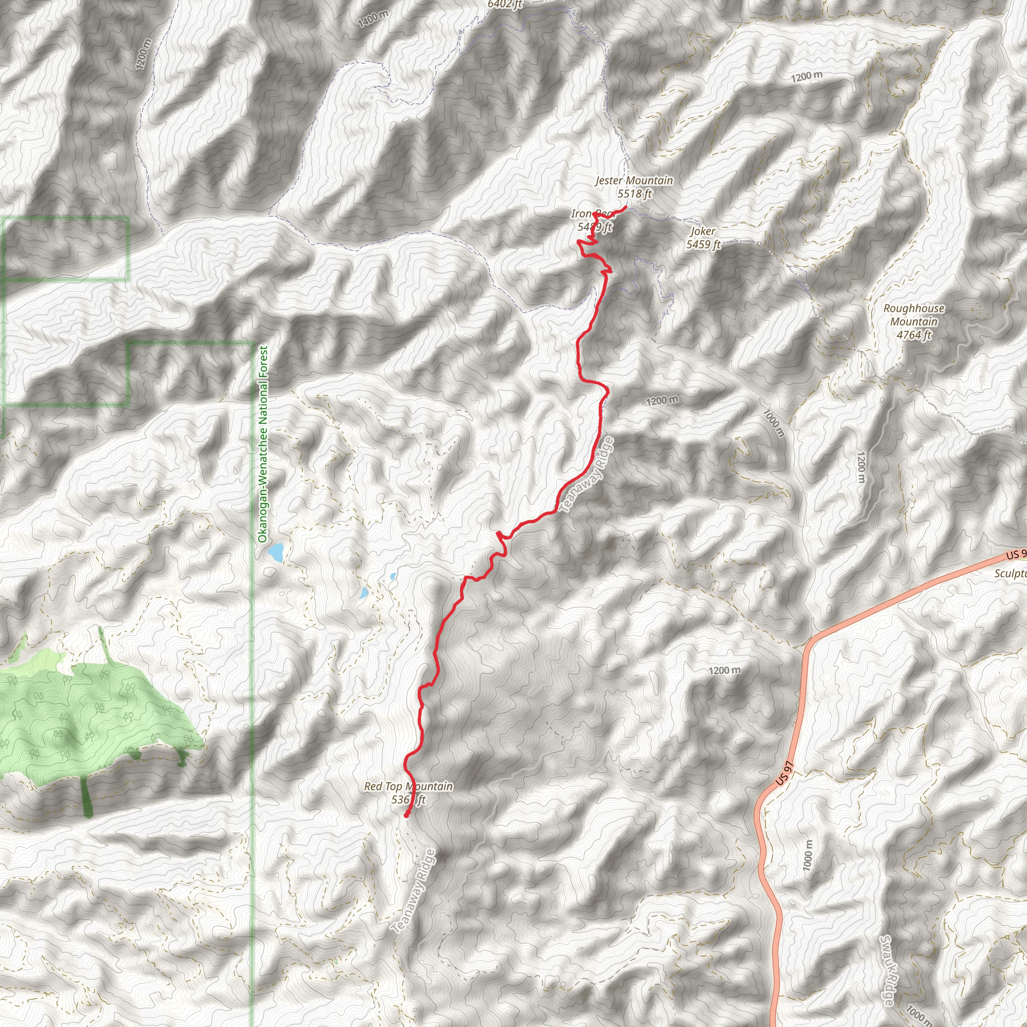
The Teanaway Ridge Trail, nestled in the heart of Kittitas County, Washington, offers hikers a moderately challenging experience with its approximately 23 kilometers (around 14 miles) out-and-back journey. The trail boasts an elevation gain of roughly 1000 meters (about 3280 feet), providing sweeping views and a satisfying workout for those who traverse its path.
Getting to the Trailhead
To reach the starting point of the Teanaway Ridge Trail, hikers can drive to the vicinity of Cle Elum, a town located just off Interstate 90. The trailhead is accessible via a network of forest roads that branch off from Highway 970. For those relying on public transportation, options are limited, and it's advisable to rent a car from nearby cities to get to the trail.
The Hike
As you embark on the Teanaway Ridge Trail, the initial stretch will lead you through a dense forest of pine and fir trees, with the soft forest floor cushioning your steps. The ascent begins gently, allowing your legs to warm up before the steeper sections ahead. Approximately 3 kilometers (nearly 2 miles) in, you'll encounter the first of several switchbacks, which will become a recurring theme as you gain elevation.
Flora and Fauna
The trail is a haven for wildlife enthusiasts, with the possibility of spotting deer, elk, and even black bears, so be sure to hike with caution and respect for the local inhabitants. Birdwatchers can also delight in the variety of species that call this area home, including woodpeckers, hawks, and the occasional eagle soaring overhead.
As you ascend, the forest canopy will occasionally open up to reveal stunning vistas of the surrounding peaks and valleys. The flora transitions as you climb, with subalpine species making their appearance. Wildflowers, including lupines and Indian paintbrush, add splashes of color to the landscape in the warmer months.
Historical Significance
The region holds historical significance, with the Teanaway area being a part of the traditional lands of the Yakama Nation. The surrounding forests and valleys have a rich logging history, and remnants of past logging operations can sometimes be found along the trail.
Navigation and Preparation
When planning your hike, it's essential to be well-prepared with adequate supplies, including water, food, and layers to accommodate changing weather conditions. For navigation, HiiKER is an excellent tool to keep you on track, offering detailed maps and trail information.
Landmarks and Points of Interest
Around the halfway mark, at approximately 11.5 kilometers (7 miles), you'll reach the ridge's high point. Here, you'll be rewarded with panoramic views that are particularly breathtaking during sunrise or sunset. This is an ideal spot for a rest or a meal before you begin your descent or turn back if you're not completing the full out-and-back route.
The descent will retrace your steps, offering a different perspective on the scenery you encountered on the way up. The gradual decline in elevation will be a welcome change after the rigorous climb, allowing for a leisurely pace to take in the natural beauty one last time.
Conclusion
Remember, the Teanaway Ridge Trail is at its best from late spring to early fall, when the snow has melted, and the trail is most accessible. Always check current trail conditions and weather forecasts before setting out, as mountain weather can be unpredictable. With the right preparation and a spirit of adventure, the Teanaway Ridge Trail is sure to offer a memorable hiking experience.
What to expect?
Activity types
Comments and Reviews
User comments, reviews and discussions about the Teanaway Ridge Trail, Washington.
4.8
average rating out of 5
5 rating(s)

