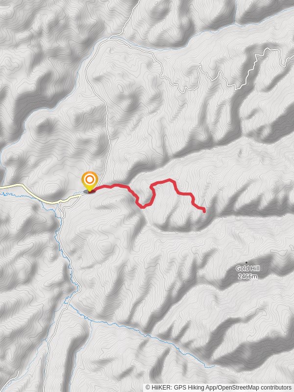
10.1 km
~2 hrs 46 min
453 m
“Experience lush forests, stunning views, and rich history on the moderately challenging Curtis Creek and Spring Creek trail.”
Starting near Cache County, Utah, the Curtis Creek and Spring Creek trail offers a rewarding out-and-back hike that spans approximately 10 kilometers (6.2 miles) with an elevation gain of around 400 meters (1,312 feet). This trail is rated as medium difficulty, making it suitable for moderately experienced hikers.
### Getting There To reach the trailhead, you can drive or use public transportation. If driving, head towards the nearest known landmark, the Logan Canyon Scenic Byway. From there, follow signs to the trailhead parking area. For those using public transport, the Cache Valley Transit District (CVTD) offers bus services that can get you close to the trailhead. Check the latest schedules and routes on their website to plan your trip.
### Trail Overview The trail begins with a gentle ascent through a lush forest of aspen and pine trees. Early on, you'll cross Curtis Creek, a serene waterway that adds a soothing soundtrack to your hike. The first kilometer (0.6 miles) is relatively easy, with a gradual elevation gain of about 50 meters (164 feet).
### Significant Landmarks At approximately 2 kilometers (1.2 miles) in, you'll encounter a small, picturesque waterfall. This is a great spot to take a break and enjoy the natural beauty. Continuing on, the trail becomes steeper, gaining another 100 meters (328 feet) in elevation over the next kilometer (0.6 miles).
### Wildlife and Flora The area is rich in wildlife, including deer, elk, and various bird species. Keep an eye out for wildflowers such as lupine and Indian paintbrush, especially in the spring and early summer months. The dense forest provides ample shade, making it a pleasant hike even during warmer days.
### Historical Significance The region around Curtis Creek and Spring Creek has a rich history. It was originally inhabited by the Shoshone people, who utilized the abundant natural resources for sustenance. In the late 19th century, European settlers arrived, drawn by the fertile land and plentiful water sources. Remnants of old homesteads and logging operations can still be found along the trail, offering a glimpse into the area's past.
### Navigation For navigation, it's highly recommended to use the HiiKER app, which provides detailed maps and real-time updates. This will help you stay on track and ensure you don't miss any key points of interest.
### Final Stretch As you approach the 5-kilometer (3.1 miles) mark, you'll reach the highest point of the trail, with an elevation gain of around 400 meters (1,312 feet). From here, you'll have stunning views of the surrounding valleys and mountains. The trail then descends back the way you came, offering a different perspective on the landscape.
### Preparation Tips Given the moderate difficulty of the trail, it's advisable to bring plenty of water, snacks, and a first-aid kit. Wear sturdy hiking boots and dress in layers, as the weather can change rapidly. Always check the weather forecast before heading out and let someone know your plans.
This trail offers a perfect blend of natural beauty, historical significance, and moderate physical challenge, making it a must-visit for any hiking enthusiast.
Reviews
User comments, reviews and discussions about the Curtis Creek and Spring Creek, Utah.
0.0
average rating out of 5
0 rating(s)


