Download
Preview
Add to list
More
25.0 km
~6 hrs 34 min
953 m
Multi-Day
“Embark on the challenging Lost Cabin Loop, a historical trek through South Dakota's stunning, rugged wilderness.”
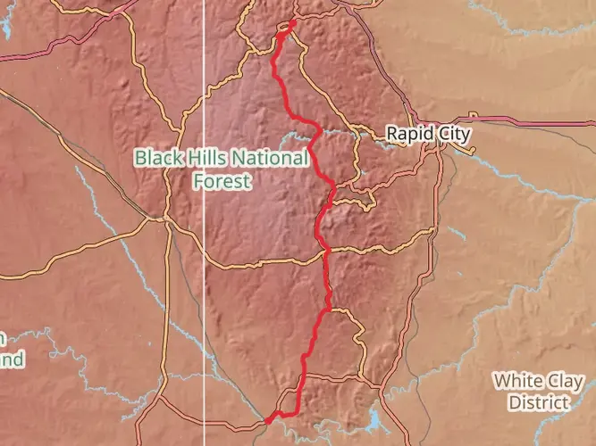
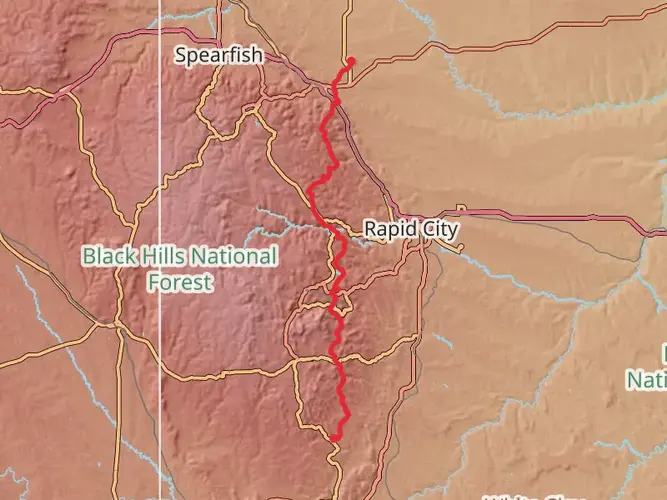
The Lost Cabin Loop, nestled in the scenic Black Hills of South Dakota, offers an immersive experience into the rugged wilderness. With a total distance of approximately 25 kilometers (15.5 miles) and an elevation gain of around 900 meters (2950 feet), this trail is not for the faint-hearted and is best suited for seasoned hikers seeking a challenge.
Getting to the Trailhead To reach the trailhead, which is situated near Pennington County, hikers can drive to the nearest significant landmark, the Mount Rushmore National Memorial. From there, it's a short journey west into the Black Hills National Forest, where the loop begins. Public transportation options are limited in this region, so arriving by car is recommended.
Navigating the Trail As you embark on the Lost Cabin Loop, you'll find that the path is well-marked, but due to its complexity and remote nature, it's advisable to use a reliable navigation tool like HiiKER to keep track of your progress and ensure you stay on the correct path.
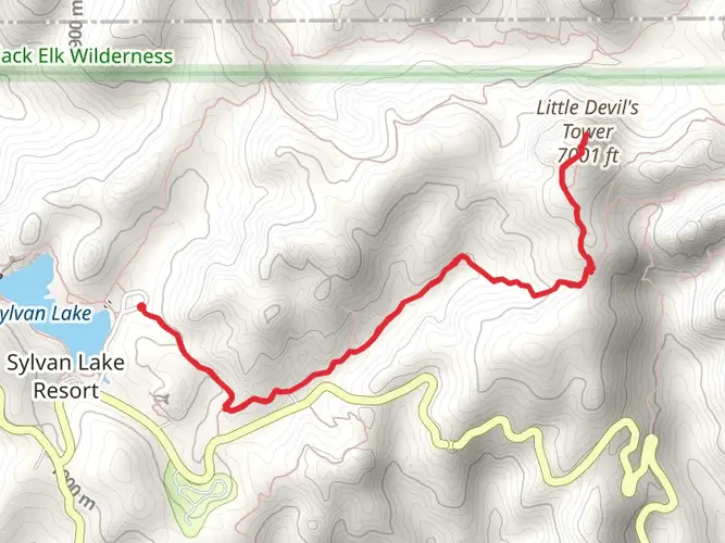
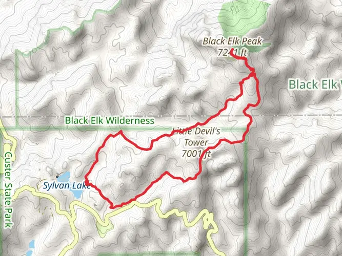
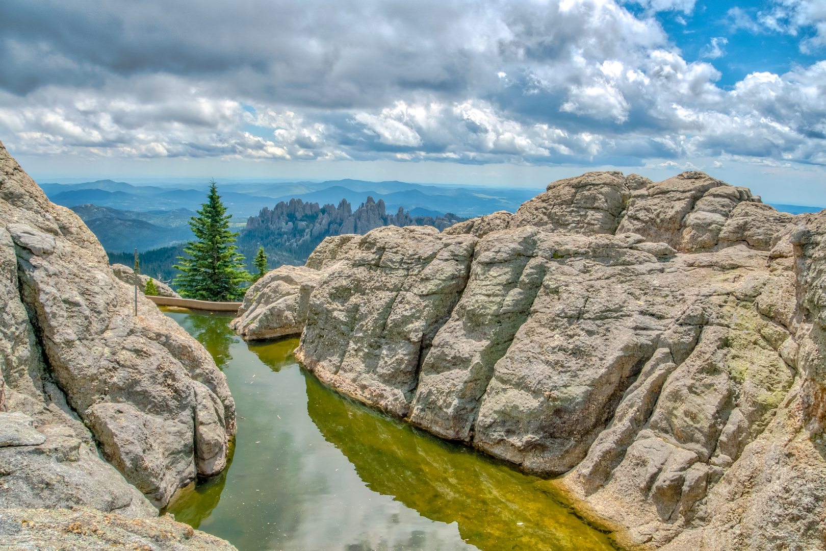
Landmarks and Natural Features The trail will lead you through a diverse landscape, featuring ponderosa pine forests, rugged canyons, and high mountain meadows. Early in the hike, you'll encounter the first significant elevation gain as you ascend toward Harney Peak, the highest point in South Dakota. This area offers breathtaking views of the surrounding Black Hills.
As you continue, you'll pass by remnants of the area's mining history, including the namesake Lost Cabin Mine, which dates back to the late 19th century. The mine is a testament to the Black Hills Gold Rush era, and while it's no longer in operation, it provides a glimpse into the region's rich historical tapestry.
Wildlife and Flora The Black Hills are home to a variety of wildlife, including elk, mountain goats, and the occasional mountain lion. Birdwatchers may also spot species such as the American goldfinch and the red-tailed hawk. The trail is abundant with wildflowers in the spring and summer, adding a splash of color to the landscape.
Preparation and Safety Given the trail's difficulty rating and remote nature, hikers should come prepared with adequate supplies, including water, food, and layers to accommodate changing weather conditions. It's also wise to inform someone of your hiking plans and expected return time.
Seasonal Considerations The Lost Cabin Loop is best hiked from late spring to early fall to avoid snow and cold temperatures. However, even in these seasons, weather can be unpredictable, so always check the forecast before heading out.
Remember, the Lost Cabin Loop is a demanding hike that will test your endurance and reward you with its natural beauty and historical intrigue. Plan accordingly, stay safe, and enjoy the journey through one of South Dakota's most captivating landscapes.

What to expect?
Activity types
Frequently asked questions
How long is the Lost Cabin Loop in Pennington County, South Dakota?
The Lost Cabin Loop is 24.97 km, or about 15.5 miles, making it a substantial outing in the Black Hills. With 953 m of elevation gain, it is better suited to a full-day push for strong hikers or a shorter multi-day itinerary with an overnight camp where regulations allow.
How difficult is the Lost Cabin Loop and how much climbing does the Lost Cabin Loop have?
The Lost Cabin Loop is rated difficult and packs 953 m, roughly 3,127 feet, of ascent into just under 25 km. That combination means sustained climbing, a long day on foot, and a route that is best matched to experienced hikers comfortable with steep grades and backcountry navigation.
Where do you park for the Lost Cabin Loop trailhead?
A common access point for the Lost Cabin Loop is the Palmer Creek Trailhead on Palmer Creek Road in the Black Hills National Forest. From Hill City, the Forest Service directs travelers south on Highway 16 for about 3 miles, east on Highway 244 for 2.7 miles, then south on Palmer Creek Road for about 1 mile; the trailhead is on the left. There are no restrooms or potable water at the site.
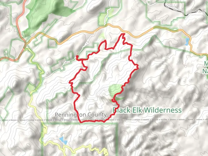
Does the Lost Cabin Loop go into the Black Elk Wilderness or near Black Elk Peak?
Lost Cabin routes in this part of the Black Hills are commonly linked with Palmer Creek Trail, also called Lost Cabin Trail #2, which climbs to the Black Elk Wilderness boundary and is often combined with Trail #9 North and Trail #9 South for a longer loop near Black Elk Peak. That places the route in rugged terrain with big elevation change and limited rescue access if problems arise.
Are dogs allowed on the Lost Cabin Loop?
Dogs are allowed on trails in the Black Elk Wilderness area, but they cannot roam freely. Forest Service rules prohibit having a dog that is not on a leash or under strict voice control, so the Lost Cabin Loop is only suitable for dogs that can be managed closely on a long, difficult mountain route.
What is the best time of year to hike the Lost Cabin Loop?
The most reliable season for the Lost Cabin Loop is typically summer into early fall, when Black Hills trails are more likely to be cleared and snow-free. The Forest Service notes that many Black Elk Wilderness trails are cleared in early summer, but storms can bring down trees at any time, so conditions can change quickly even in peak season.
Can you camp on the Lost Cabin Loop?
The Lost Cabin Loop is listed as a multi-day hike, so it can be done as an overnight route, but camping rules in the Black Elk Wilderness are strict. Camping is prohibited within a quarter mile of the Black Elk Peak summit and within 100 feet of water sources, and open fires are only allowed in designated sites.
Comments and Reviews
User comments, reviews and discussions about the Lost Cabin Loop, South Dakota.
4.47
average rating out of 5
55 rating(s)