Download
Preview
Add to list
More
194.8 km
~8 days
4510 m
Multi-Day
“The Centennial Trail is a scenic and historic 121-mile South Dakota hike, dotted with landmarks and diverse wildlife.”
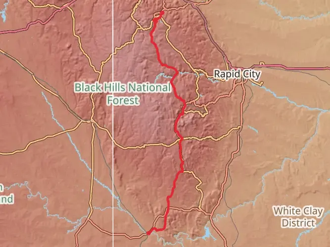
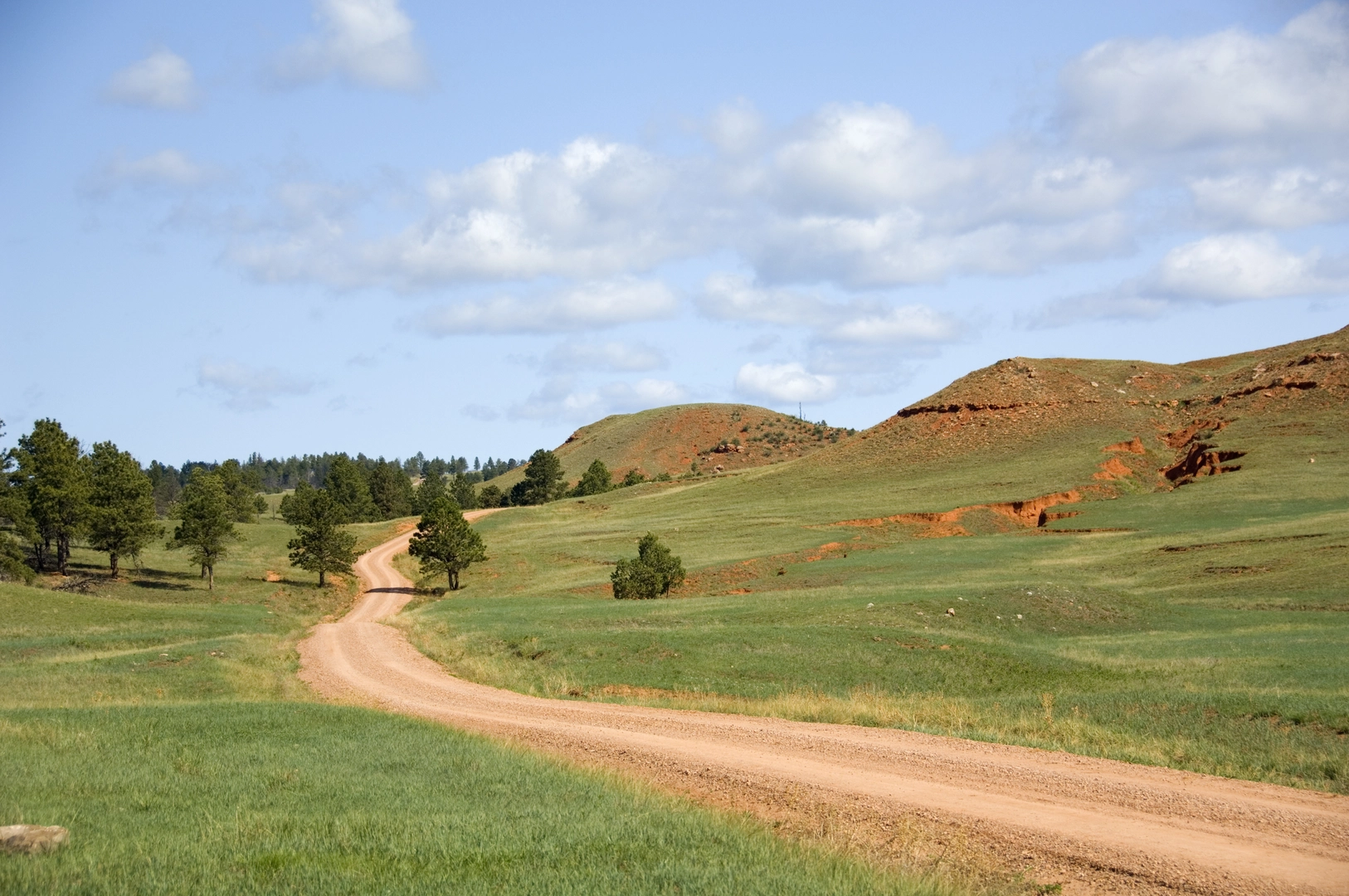
The Centennial Trail carves a scenic path through the diverse landscapes of South Dakota, stretching approximately 195 kilometers (121 miles) from Bear Butte State Park in the north to Wind Cave National Park in the southern end. With an elevation gain of around 4500 meters (14,764 feet), the trail offers a medium difficulty rating, making it accessible to hikers with a reasonable level of fitness.
Getting to the Trailhead
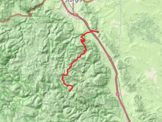
The northern trailhead is located near Meade County, just outside of Sturgis. To reach the starting point by car, hikers can drive to Bear Butte State Park, which is situated off SD Highway 79. This is a convenient spot to begin the trek, with the trailhead being well-marked and easy to locate.
For those relying on public transportation, options are limited, and it's often necessary to arrange a taxi or shuttle service from the nearest towns or cities, such as Rapid City, which has the closest airport.
Navigating the Trail
Hikers can utilize the HiiKER app for detailed maps and navigation assistance throughout their journey on the Centennial Trail. The app provides valuable information on waypoints, water sources, and camping spots, ensuring a well-informed adventure.
Landmarks and Scenery
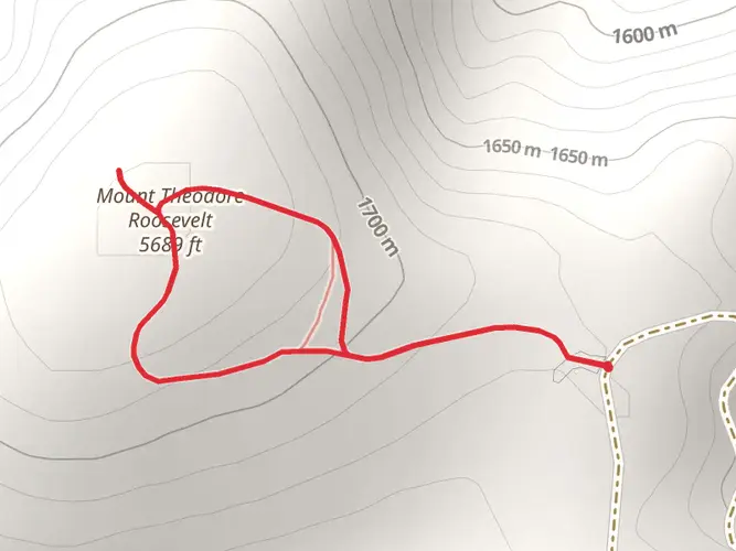
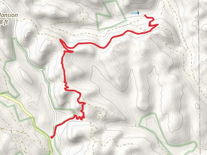
The trail offers a rich tapestry of South Dakota's natural beauty, including prairie grasslands, dense forests, and rugged badlands. Notable landmarks along the route include Bear Butte, an important religious site for many Native American tribes, and the Black Elk Wilderness, named after the famous Lakota spiritual leader.
As hikers progress southward, they'll encounter the impressive Norbeck Wildlife Preserve and the iconic Mount Rushmore National Memorial, which lies just off the trail. The journey continues through Custer State Park, known for its roaming bison herds, before culminating in the subterranean wonders of Wind Cave National Park.
Wildlife and Nature
The Centennial Trail traverses habitats teeming with wildlife. Hikers may spot bison, elk, pronghorn antelope, and mule deer. Birdwatchers will delight in the variety of species, from raptors to songbirds. Caution is advised in areas inhabited by rattlesnakes and mountain lions.
Historical Significance
The trail's name commemorates South Dakota's 100th anniversary of statehood in 1989. The region is steeped in history, from the sacred significance of Bear Butte to the gold rush era that brought prospectors and settlers to the Black Hills.
Trail Preparation
Hikers should prepare for variable weather conditions and pack accordingly. Water sources can be scarce in certain sections, so carrying an adequate supply and a filtration system is essential. It's also advisable to plan for food resupply points along the route.
The trail is well-marked with numbered posts, but carrying a map or using HiiKER for digital navigation is recommended. Campsites are available throughout the trail, with backcountry camping allowed in designated areas.
Distance and Elevation
The trail's 195 kilometers (121 miles) can be tackled in sections or as a through-hike, which typically takes 10 to 14 days. The elevation gain of 4500 meters (14,764 feet) is spread across the length of the trail, with some steep ascents and descents, particularly in the Black Hills region.
Conclusion
The Centennial Trail offers a remarkable cross-section of South Dakota's natural and historical heritage. With careful planning and respect for the trail's environment and wildlife, hikers can enjoy a memorable experience traversing this diverse and storied landscape.

What to expect?
Activity types
Comments and Reviews
User comments, reviews and discussions about the Centennial Trail - South Dakota, South Dakota.
4.59
average rating out of 5
32 rating(s)