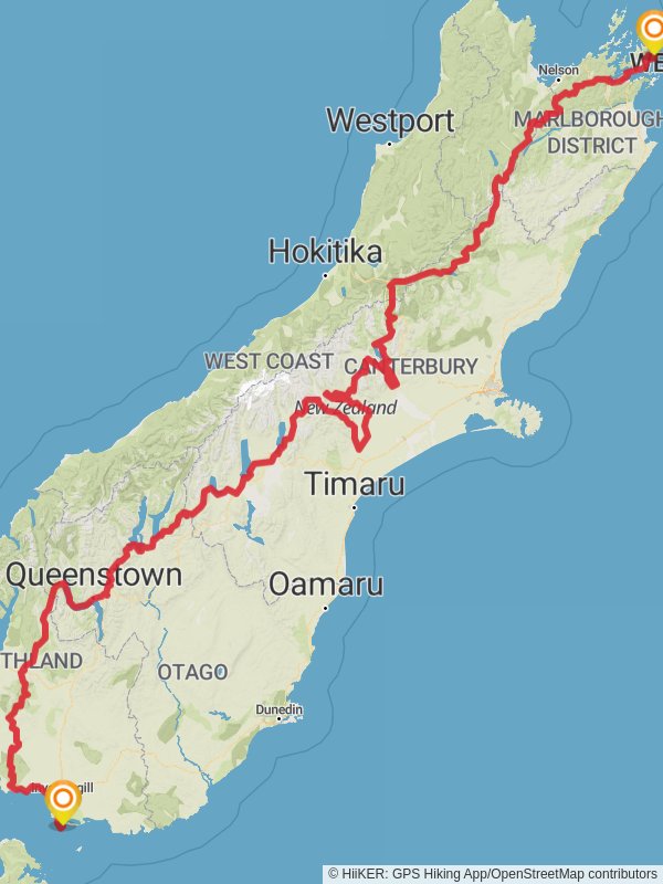
1530.9 km
~2 mth 15 day
43299 m
“Embark on an epic Te Araroa trek, immersing in New Zealand's diverse terrain and rich heritage.”
Embarking on the Te Araroa South Island trail is a journey through the heart of New Zealand's stunning landscapes, encompassing a variety of terrains from serene beaches to rugged mountains. Spanning approximately 1531 kilometers (951 miles) with an elevation gain of around 43,200 meters (141,732 feet), this trail is a formidable challenge that requires thorough preparation and a high level of fitness.
Getting to the Trailhead
The trailhead is located near the Marlborough Region, at the top of the South Island. To reach the starting point, hikers can fly into Wellington and take a ferry across the Cook Strait to Picton, which is the nearest town to the trailhead. From Picton, you can drive or take a local bus to Ship Cove, which marks the beginning of the adventure.
Navigating the Trail
Hikers can rely on HiiKER for detailed maps and navigation tools to guide them along the trail. It's essential to plan each section carefully, as the trail traverses remote areas where cell service may be limited.
Trail Highlights and Landmarks
The trail kicks off at the historic Ship Cove, where Captain James Cook made his base in the 1770s. This area is not only significant for its European history but also for its importance to the Māori as a place of rest and replenishment.
As you progress, you'll encounter the rich biodiversity of the Richmond Alpine Range, where the trail reaches its highest point at Travers Saddle, offering panoramic views. The elevation here is a staggering 1,789 meters (5,869 feet), and it's approximately 300 kilometers (186 miles) into the journey.
Further along, the trail winds through the enchanting beech forests of the Nelson Lakes National Park, home to native birds such as the kea and the bellbird. The park is roughly 424 kilometers (263 miles) from the trailhead.
Crossing the Harper Pass, you'll experience a sense of isolation reminiscent of the early pioneers. This section is historically significant as a route used by Māori for greenstone (pounamu) trading and later by European settlers.
The trail also takes you through the heart of the Southern Alps, including the challenging but breathtakingly beautiful Two Thumb Range. This segment is approximately 1,000 kilometers (621 miles) from the start and offers an elevation gain that will test your endurance.
As you approach the end of the trail, you'll traverse the tussock grasslands and discover the serene beauty of Lake Tekapo, with its turquoise waters and the iconic Church of the Good Shepherd.
Wildlife and Nature
The Te Araroa South Island trail is a haven for wildlife enthusiasts. The diverse habitats along the trail support an array of flora and fauna, including the elusive kiwi, the New Zealand falcon, and the endemic South Island robin. Plant life varies from coastal forests to alpine herbs, providing a constantly changing backdrop.
Preparation and Safety
Given the trail's difficulty rating and the diverse weather conditions, hikers must be well-prepared with appropriate gear, including sturdy hiking boots, weather-resistant clothing, and reliable shelter. It's also crucial to have a detailed plan for resupply points and to be aware of the locations of huts and campsites along the route.
Conclusion
The Te Araroa South Island trail is a journey that offers a profound connection with New Zealand's natural beauty and cultural heritage. With careful planning and respect for the land, hikers can embark on an unforgettable adventure across some of the most dramatic and varied landscapes on the planet.
Te Araroa South Island passes through these parks:
Reviews
User comments, reviews and discussions about the Te Araroa South Island, New Zealand.
5.0
average rating out of 5
5 rating(s)


