Appalachian Trail Section Hike - Hanover to Wentworth
White Mountain National Forest · Grafton County, New Hampshire
48.4 km
~2 day
2516 m
“Trek the historic Appalachian Trail from Hanover to Wentworth, braving steep climbs and rugged beauty.”
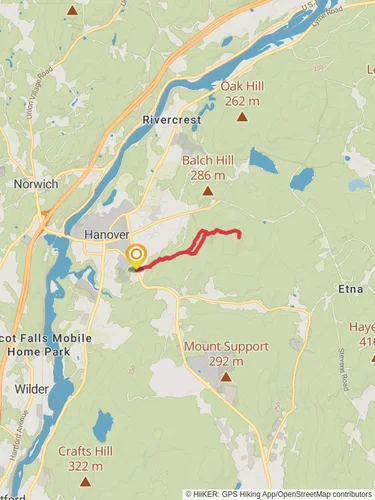
Embarking on the Appalachian Trail Section Hike from Hanover to Wentworth, you'll traverse approximately 48 kilometers (30 miles) of New Hampshire's rugged terrain, with an elevation gain of around 2500 meters (8200 feet). This point-to-point hike is considered difficult due to its challenging elevation changes and the technical nature of the trail.
Getting to the Trailhead
The trailhead is located near Grafton County, New Hampshire, just outside the town of Hanover. For those arriving by car, parking is available in the vicinity of Dartmouth College. If you're using public transportation, the Dartmouth Coach provides service to Hanover from various locations, including Boston and New York City. From the drop-off point, the trailhead is accessible by a short walk.
Navigating the Trail
As you set out from Hanover, the trail takes you through a mix of hardwood forests and over rolling hills. The use of a navigation tool like HiiKER can be invaluable for staying on track and being aware of upcoming changes in terrain or elevation.
Landmarks and Scenery
One of the first significant landmarks you'll encounter is Velvet Rocks, offering a scenic overlook that's especially beautiful during the fall foliage season. As you continue, you'll cross the Connecticut River, marking the boundary between New Hampshire and Vermont.
The trail meanders through a series of small mountains and hills, including Moose Mountain, which provides a moderate climb and descent. Further along, you'll ascend Smarts Mountain, a more strenuous section with an elevation of 987 meters (3238 feet). The Lambert Ridge Trail offers an alternative, less steep route up Smarts Mountain for those looking for a less challenging option.
Wildlife and Nature
The region is rich in wildlife, and it's not uncommon to spot deer, moose, and a variety of bird species. Black bears are also present in the area, so proper food storage and bear safety precautions are essential.
Historical Significance
The Appalachian Trail itself is steeped in history, having been completed in 1937. The trail crosses numerous historical sites and regions that played a role in early American settlement and development. The section between Hanover and Wentworth is no exception, with remnants of old farms and stone walls hinting at the area's past.
Preparation and Planning
Given the trail's difficulty, it's important to be well-prepared with the appropriate gear, including sturdy hiking boots, weather-appropriate clothing, and sufficient water and food. The trail offers limited resupply points, so plan accordingly. It's also wise to check the weather forecast and trail conditions before setting out, as New England weather can be unpredictable.
Conclusion
This section of the Appalachian Trail offers a challenging yet rewarding experience for seasoned hikers. With its mix of natural beauty, wildlife, and historical significance, the Hanover to Wentworth hike is a memorable journey through the heart of New Hampshire's wilderness.

Reviews
User comments, reviews and discussions about the Appalachian Trail Section Hike - Hanover to Wentworth, New Hampshire.
4.0
average rating out of 5
7 rating(s)