Download
3D Flyover
Add to list
More
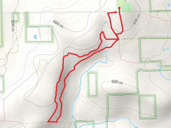
1817.4 km
~80 days
67543 m
Multi-Day
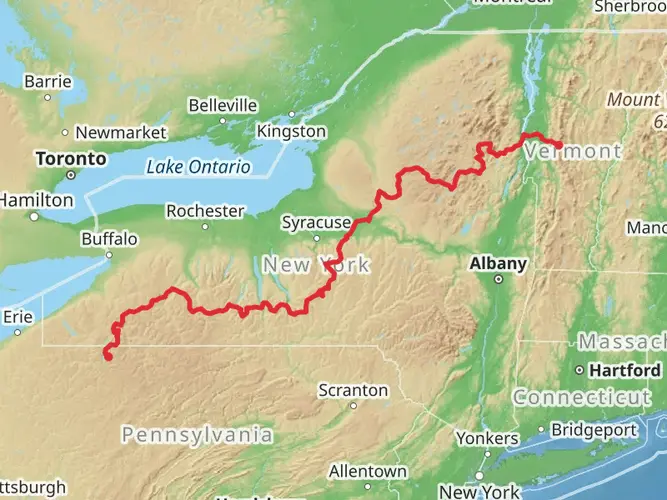
Embarking on the American Perimeter Trail from New York to Maine is a monumental journey that spans approximately 1817 kilometers (about 1129 miles), with an elevation gain of around 67500 meters (approximately 221,457 feet). This point-to-point trail begins near Steuben County, New York, and traverses a diverse array of landscapes before reaching its terminus in the rugged wilderness of Maine.
The trailhead can be accessed near Steuben County, which is reachable by car or potentially by public transportation options that serve the area. Hikers should plan their arrival to the starting point, which may involve a combination of buses or trains from larger cities and a taxi or rideshare service to the trailhead itself.
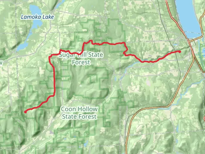
As you set out from the southern terminus, you'll be greeted by the rolling hills and lush forests of upstate New York. The trail meanders through a mix of state parks, wildlife reserves, and public lands. Early on, you'll encounter the Finger Lakes region, known for its picturesque vineyards and serene water bodies. The trail does not shy away from elevation changes, and you'll find yourself ascending and descending numerous hills and small mountains.
Continuing northeast, the trail crosses into Vermont, where the Green Mountains offer a new set of challenges and rewards. The Long Trail, which coincides with the Appalachian Trail for a portion, will be a companion during this segment. Expect steep climbs, rocky paths, and the potential for rapidly changing weather conditions.
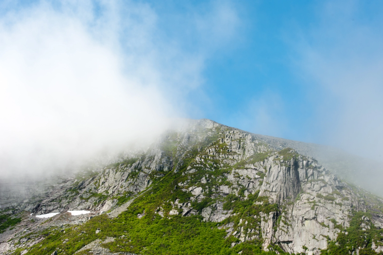
As you progress into New Hampshire, the White Mountains await with some of the most demanding and awe-inspiring sections of the hike. The Presidential Range, including the formidable Mount Washington, presents significant elevation gains and the potential for severe weather, even in summer months.
Crossing into Maine, the trail's character shifts once again. The vast forests and remote stretches of the Appalachian Trail in Maine will test your wilderness skills. This section is known for its rugged terrain, expansive lakes, and the famed Hundred-Mile Wilderness, one of the most isolated sections of the Appalachian Trail.
Throughout your journey, you'll encounter a rich tapestry of wildlife, from white-tailed deer and black bears to a variety of bird species. The trail also winds through areas of historical significance, including Revolutionary War sites, indigenous lands, and regions that played pivotal roles in America's industrial past.
Given the trail's difficulty rating and the extensive distance covered, hikers should be well-prepared with proper gear, navigation tools, and supplies. HiiKER can be an invaluable resource for planning your route, identifying key waypoints, and ensuring you have the most up-to-date trail information.
The American Perimeter Trail from New York to Maine is not just a physical challenge; it's a journey through the heart of the northeastern United States' natural beauty and historical heritage. Whether you're a seasoned thru-hiker or looking to tackle a section at a time, this trail offers an unforgettable adventure for those who are prepared to take it on.

Frequently asked questions
How long does the American Perimeter Trail - New York to Maine take to hike?
The American Perimeter Trail - New York to Maine is 1,817.37 km, or about 1,129 miles, so it is a true long-distance expedition rather than a short thru-hike. Completion time depends on pace, resupply strategy, and weather, but most hikers should expect a multi-month trip across New York, Vermont, New Hampshire, and Maine.
How difficult is the American Perimeter Trail - New York to Maine?
The American Perimeter Trail - New York to Maine is rated difficult and packs in about 67,543 m of total elevation gain, which is roughly 221,600 feet of climbing over the full route. That combination of distance and ascent points to a demanding multi-day trail with repeated steep sections, long stretches between major towns, and sustained physical effort over many weeks.
What states does the American Perimeter Trail - New York to Maine pass through?
The American Perimeter Trail - New York to Maine begins in New York and continues northeast through Vermont, New Hampshire, and into Maine. The broader Northern Appalachian section follows the Appalachian backbone toward the Canadian border, and the route uses a mix of existing long-distance trails and developing connections rather than a single continuous footpath.
Does the American Perimeter Trail - New York to Maine use the Long Trail in Vermont?
Yes. In Vermont, the American Perimeter Trail - New York to Maine is proposed to connect with the Long Trail, which follows the main ridge of the Green Mountains from the Massachusetts-Vermont line to the Canadian border. That means the Vermont section is tied to one of the oldest and most rugged long-distance hiking corridors in the Northeast.
Is the American Perimeter Trail - New York to Maine fully established and waymarked?
Not end to end. The American Perimeter Trail system is still being developed and combines existing trails, road links, cross-country sections, and some undefined or proposed routes. In the Northern Appalachian region, parts of the route are established on known trails, but some connections are still being scouted, especially outside the major long-distance trail corridors.
Where does the American Perimeter Trail - New York to Maine start in New York?
The New York segment is described as a proposed route that travels from the northern terminus of Pennsylvania’s Mid State Trail to connect with the North Country Trail in New York. On this HiiKER listing, the route is associated with Steuben County, placing the southern end of this section in the Southern Tier region near the Pennsylvania border.
What is the best season to hike the American Perimeter Trail - New York to Maine?
The usual hiking window for the American Perimeter Trail - New York to Maine is late spring through early fall, when higher sections in Vermont, New Hampshire, and Maine are more reliably snow-free. Early spring can bring mud and runoff in the Northeast, while late fall raises the chance of cold weather and early snow at elevation, especially in the Green Mountains and White Mountains.
Comments and Reviews
User comments, reviews and discussions about the American Perimeter Trail - New York to Maine, New York.
4.0
average rating out of 5
1 rating(s)