Sheltowee Trace Trail trail stages
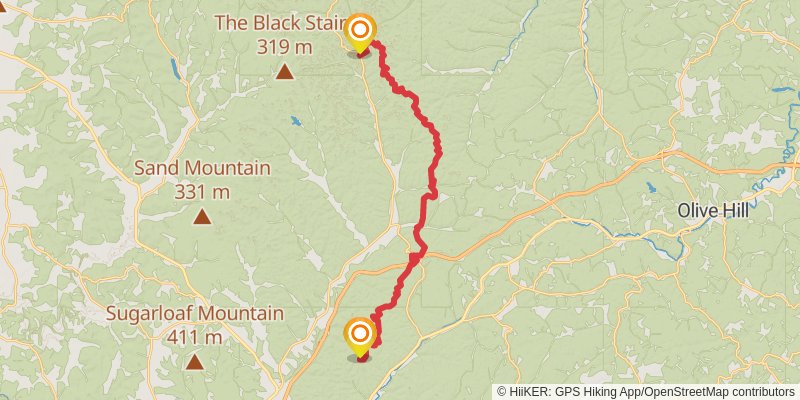
stage 1

Starting at: Henderson Cemetery, Morehead, Rowan County, 40351
Ending at: Rowan County, 40351
Distance: 31.0 km
Elevation gain: 1315 m
Duration: 08:23:32
View on mapstage 2

Starting at: Rowan County, 40351
Ending at: Morehead, Rowan County, 40313
Distance: 15.9 km
Elevation gain: 451 m
Duration: 03:55:50
View on mapstage 3

Starting at: Clearfield, Rowan County, 40313
Ending at: Farmers, Rowan County, 40313
Distance: 12.3 km
Elevation gain: 375 m
Duration: 03:05:07
View on mapstage 4

Starting at: Farmers, Rowan County, 40313
Ending at: Frenchburg, Menifee County, 40322
Distance: 26.3 km
Elevation gain: 1086 m
Duration: 07:04:18
View on mapstage 5

Starting at: Ratliff, Frenchburg, Menifee County, 40322
Ending at: Frenchburg, Menifee County, 40322
Distance: 35.9 km
Elevation gain: 1281 m
Duration: 09:19:29
View on mapstage 6

Starting at: Frenchburg, Wolfe County, 40322
Ending at: Slade, Powell County, 40376
Distance: 11.7 km
Elevation gain: 447 m
Duration: 03:04:43
View on mapstage 7

Starting at: Slade, Powell County, 40376
Ending at: Beattyville, Lee County, 41311
Distance: 28.0 km
Elevation gain: 908 m
Duration: 07:06:35
View on mapstage 8

Starting at: Beattyville, Lee County, 41311
Ending at: McKee, Jackson County, 40447
Distance: 58.0 km
Elevation gain: 1524 m
Duration: 14:08:24
View on mapstage 9

Starting at: Rocky Hill Heights, Jackson County, 40447
Ending at: Livingston, Jackson County, 40445
Distance: 22.8 km
Elevation gain: 768 m
Duration: 05:49:59
View on mapspur 1

Starting at: Mc Kee, Jackson County, 40447
Ending at: Mc Kee, Jackson County, 40447
Distance: 7.5 km
Elevation gain: 289 m
Duration: 01:59:10
View on mapstage 10

Starting at: Livingston, Jackson County, 40445
Ending at: East Bernstadt, Laurel County, 40729
Distance: 57.8 km
Elevation gain: 682 m
Duration: 12:41:16
View on mapstage 11

Starting at: East Bernstadt, Jackson County, 40729
Ending at: East Bernstadt, Laurel County, 40729
Distance: 16.6 km
Elevation gain: 539 m
Duration: 04:12:33
View on mapstage 12

Starting at: Hare, East Bernstadt, Laurel County, 40729
Ending at: Bernstadt, Laurel County, 40741
Distance: 86.2 km
Elevation gain: 2805 m
Duration: 21:55:07
View on mapstage 13

Starting at: Whitley County, 40701
Ending at: London, Laurel County, 40741
Distance: 15.3 km
Elevation gain: 561 m
Duration: 04:00:09
View on mapstage 14

Starting at: Flat Rock, McCreary County, 42653
Ending at: London, Laurel County, 40741
Distance: 0 m
Elevation gain: 0 m
Duration: 00:00:00
View on mapstage 15

Starting at: Bernstadt, London, Laurel County, 40741
Ending at: London, Laurel County, 40741
Distance: 15.4 km
Elevation gain: 596 m
Duration: 04:04:28
View on mapstage 16

Starting at: Baldrock, Laurel County, 40741
Ending at: London, Laurel County, 40744
Distance: 6.3 km
Elevation gain: 202 m
Duration: 01:35:13
View on mapstage 17

Starting at: London, Laurel County, 40741
Ending at: Corbin, Whitley County, 40701
Distance: 7.2 km
Elevation gain: 242 m
Duration: 01:49:59
View on mapstage 18

Starting at: Hightop, London, Laurel County, 40741
Distance: 5.2 km
Elevation gain: 170 m
Duration: 01:19:37
View on mapalt 1

Starting at: Corbin, Whitley County, 40701
Ending at: Corbin, Whitley County, 40701
Distance: 4.6 km
Elevation gain: 183 m
Duration: 01:13:28
View on mapspur 2

Starting at: Corbin, Whitley County, 40701
Ending at: Corbin, Whitley County, 40701
Distance: 3.7 km
Elevation gain: 117 m
Duration: 00:56:23
View on mapstage 19

Starting at: Baldrock, Laurel County, 40744
Ending at: Whitley City, McCreary County, 42653
Distance: 12.7 km
Elevation gain: 432 m
Duration: 03:15:06
View on mapstage 20

Starting at: Honeybee, McCreary County, 40701
Ending at: Whitley City, McCreary County, 42653
Distance: 42.8 km
Elevation gain: 1302 m
Duration: 10:44:21
View on mapstage 21

Starting at: Flat Rock, McCreary County, 42653
Ending at: McCreary County, 42653
Distance: 16.0 km
Elevation gain: 489 m
Duration: 04:00:53
View on mapalt 2

Starting at: Whitley City, McCreary County, 42653
Ending at: Whitley City, McCreary County, 42653
Distance: 6.9 km
Elevation gain: 354 m
Duration: 01:58:01
View on mapstage 22

Ending at: Whitley City, McCreary County, 42647
Distance: 9.5 km
Elevation gain: 204 m
Duration: 02:14:12
View on mapstage 23

Starting at: Whitley City, McCreary County, 42647
Ending at: Stearns, McCreary County, 42647
Distance: 20.6 km
Elevation gain: 877 m
Duration: 05:35:09
View on mapalt 3

Starting at: Stearns, McCreary County, 42647
Ending at: Oneida, Scott County, 37841
Distance: 17.3 km
Elevation gain: 636 m
Duration: 04:31:15
View on mapstage 24

Starting at: Stearns, McCreary County, 42647
Ending at: Stearns, McCreary County, 42647
Distance: 11.0 km
Elevation gain: 284 m
Duration: 02:40:57
View on mapstage 25

Ending at: Oneida, Scott County, 37841
Distance: 30.2 km
Elevation gain: 983 m
Duration: 07:40:31
View on map